Irishtown Township, Clinton County, Illinois
| Irishtown Township | |
|---|---|
| Township | |
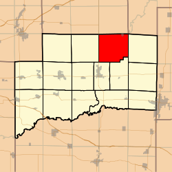 Location in Clinton County | |
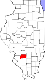 Clinton County's location in Illinois | |
| Coordinates: 38°41′24″N 89°18′37″W / 38.69000°N 89.31028°WCoordinates: 38°41′24″N 89°18′37″W / 38.69000°N 89.31028°W | |
| Country | United States |
| State | Illinois |
| County | Clinton |
| Established | November 4, 1873 |
| Area | |
| • Total | 37.13 sq mi (96.2 km2) |
| • Land | 24.94 sq mi (64.6 km2) |
| • Water | 12.19 sq mi (31.6 km2) 32.83% |
| Elevation | 472 ft (144 m) |
| Population (2010) | |
| • Total | 1,167 |
| • Density | 46.8/sq mi (18.1/km2) |
| Time zone | CST (UTC-6) |
| • Summer (DST) | CDT (UTC-5) |
| ZIP codes | 62231, 62246, 62253, 62283 |
| GNIS feature ID | 0429171 |
Irishtown Township is one of fifteen townships in Clinton County, Illinois, USA. As of the 2010 census, its population was 1,167 and it contained 832 housing units.[1]
Geography
According to the 2010 census, the township has a total area of 37.13 square miles (96.2 km2), of which 24.94 square miles (64.6 km2) (or 67.17%) is land and 12.19 square miles (31.6 km2) (or 32.83%) is water.[1]
Cities, towns, villages
- Keyesport (southwest half)
Unincorporated towns
(This list is based on USGS data and may include former settlements.)
Cemeteries
The township contains these three cemeteries: Gillespie, Keyesport and McNeill.
Major highways
Airports and landing strips
- Carrillon Airport
Landmarks
- Eldon Hazlet State Recreation Area (north three-quarters)
School districts
- Carlyle Community Unit School District 1
Political districts
- Illinois' 19th congressional district
- State House District 107
- State Senate District 54
References
- "Irishtown Township, Clinton County, Illinois". Geographic Names Information System. United States Geological Survey. Retrieved 2010-01-10.
- United States Census Bureau 2007 TIGER/Line Shapefiles
- United States National Atlas
- 1 2 "Population, Housing Units, Area, and Density: 2010 - County -- County Subdivision and Place -- 2010 Census Summary File 1". United States Census. Retrieved 2013-05-28.
External links
 |
Mills Township, Bond County | Tamalco Township, Bond County | Pope Township, Fayette County | |
| Wheatfield Township | |
East Fork Township | ||
| ||||
| | ||||
| Carlyle Township | Clement Township |
Municipalities and communities of Clinton County, Illinois, United States | ||
|---|---|---|
| Cities | ||
| Villages | ||
| Townships | ||
| Unincorporated communities | ||
| Ghost town | ||
| Footnotes | ‡This populated place also has portions in an adjacent county or counties | |
This article is issued from Wikipedia - version of the 11/29/2013. The text is available under the Creative Commons Attribution/Share Alike but additional terms may apply for the media files.