Brookston, Minnesota
| Brookston, Minnesota | |
|---|---|
| City | |
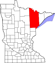
 Location of the city of Brookston within Saint Louis County, Minnesota | |
| Coordinates: 46°51′57″N 92°36′12″W / 46.86583°N 92.60333°W | |
| Country | United States |
| State | Minnesota |
| County | Saint Louis |
| Area[1] | |
| • Total | 0.55 sq mi (1.42 km2) |
| • Land | 0.55 sq mi (1.42 km2) |
| • Water | 0 sq mi (0 km2) |
| Elevation | 1,227 ft (374 m) |
| Population (2010)[2] | |
| • Total | 141 |
| • Estimate (2012[3]) | 141 |
| • Density | 256.4/sq mi (99.0/km2) |
| Time zone | Central (CST) (UTC-6) |
| • Summer (DST) | CDT (UTC-5) |
| Area code(s) | 218 |
| FIPS code | 27-08056[4] |
| GNIS feature ID | 0660884[5] |
Brookston is a city in Saint Louis County, Minnesota, United States; located along the Saint Louis River, opposite the mouth of the Artichoke River. The population was 141 at the 2010 census.[6]
Brookston is located 27 miles west of the city of Duluth and 17 miles northwest of the city of Cloquet.
U.S. Highway 2 and Saint Louis County Road 31 (CR 31) are two of the main routes in Brookston.
The city of Brookston is located within Culver Township geographically but is a separate entity. Brookston is politically independent of the township.
Brookston is located on the northern edge of the Fond du Lac Indian Reservation. It is one of three administrative centers of the reservation.
Geography
According to the United States Census Bureau, the city has a total area of 0.55 square miles (1.42 km2), all of it land.[1]
Demographics
| Historical population | |||
|---|---|---|---|
| Census | Pop. | %± | |
| 1910 | 160 | — | |
| 1920 | 135 | −15.6% | |
| 1930 | 144 | 6.7% | |
| 1940 | 135 | −6.2% | |
| 1950 | 180 | 33.3% | |
| 1960 | 144 | −20.0% | |
| 1970 | 137 | −4.9% | |
| 1980 | 124 | −9.5% | |
| 1990 | 107 | −13.7% | |
| 2000 | 98 | −8.4% | |
| 2010 | 141 | 43.9% | |
| Est. 2015 | 139 | [7] | −1.4% |
2010 census
At the 2010 census,[2] there were 141 people, 38 households and 27 families residing in the city. The population density was 256.4 inhabitants per square mile (99.0/km2). There were 39 housing units at an average density of 70.9 per square mile (27.4/km2). The racial makeup of the city was 74.5% White, 7.1% African American, 14.9% Native American and 3.5% from two or more races.
There were 38 households of which 39.5% had children under the age of 18 living with them, 47.4% were married couples living together, 18.4% had a female householder with no husband present, 5.3% had a male householder with no wife present, and 28.9% were non-families. 28.9% of all households were made up of individuals and 10.5% had someone living alone who was 65 years of age or older. The average household size was 2.63 and the average family size was 3.19.
The median age was 40.3 years. 21.3% of residents were under the age of 18; 10.7% were between the ages of 18 and 24; 27% were from 25 to 44; 20.7% were from 45 to 64; and 20.6% were 65 years of age or older. The gender makeup was 63.1% male and 36.9% female.
2000 census
At the 2000 census,[4] there were 98 people, 38 households and 28 families residing in the city. The population density was 175.9 per square mile (67.6/km²). There were 38 housing units at an average density of 68.2 per square mile (26.2/km²). The racial makeup of the city was 82.65% White, 1.02% African American, 8.16% Native American, and 8.16% from two or more races. Hispanic or Latino of any race were 1.02% of the population. 68.2% were of Finnish, 12.1% Danish and 10.6% Swedish ancestry.
There were 38 households of which 31.6% had children under the age of 18 living with them, 52.6% were married couples living together, 10.5% had a female householder with no husband present, and 23.7% were non-families. 18.4% of all households were made up of individuals and 7.9% had someone living alone who was 65 years of age or older. The average household size was 2.58 and the average family size was 2.93.
29.6% of the population were under the age of 18, 7.1% from 18 to 24, 32.7% from 25 to 44, 12.2% from 45 to 64, and 18.4% who were 65 years of age or older. The median age was 33 years. For every 100 females there were 117.8 males. For every 100 females age 18 and over, there were 86.5 males.
The median household income was $32,917 and the median family income was $40,625. Males had a median income of $40,625 compared with $18,750 for females. The per capita income was $14,009. There were no families and 5.3% of the population living below the poverty line, including no under eighteens and 23.5% of those over 64.
Coordinates: 46°52′04″N 92°36′14″W / 46.86778°N 92.60389°W
References
- 1 2 "US Gazetteer files 2010". United States Census Bureau. Archived from the original on July 14, 2012. Retrieved November 13, 2012.
- 1 2 "American FactFinder". United States Census Bureau. Retrieved November 13, 2012.
- ↑ "Population Estimates". United States Census Bureau. Archived from the original on June 17, 2013. Retrieved May 28, 2013.
- 1 2 "American FactFinder". United States Census Bureau. Archived from the original on 2013-09-11. Retrieved 2008-01-31.
- ↑ "US Board on Geographic Names". United States Geological Survey. October 25, 2007. Retrieved January 31, 2008.
- ↑ "2010 Census Redistricting Data (Public Law 94-171) Summary File". American FactFinder. U.S. Census Bureau, 2010 Census. Archived from the original on 21 July 2011. Retrieved 23 April 2011.
- ↑ "Annual Estimates of the Resident Population for Incorporated Places: April 1, 2010 to July 1, 2015". Retrieved July 2, 2016.
- ↑ "Census of Population and Housing". Census.gov. Archived from the original on May 11, 2015. Retrieved June 4, 2015.