Brushy Creek, Williamson County, Texas
| Brushy Creek, Texas | |
|---|---|
| CDP | |
 Location of Brushy Creek, Texas | |
 | |
| Coordinates: 30°30′39″N 97°44′5″W / 30.51083°N 97.73472°WCoordinates: 30°30′39″N 97°44′5″W / 30.51083°N 97.73472°W | |
| Country | United States |
| State | Texas |
| County | Williamson |
| Area | |
| • Total | 8.7 sq mi (22.6 km2) |
| • Land | 8.7 sq mi (22.6 km2) |
| • Water | 0.0 sq mi (0.0 km2) |
| Elevation | 827 ft (252 m) |
| Population (2000) | |
| • Total | 15,371 |
| • Density | 1,764.8/sq mi (681.4/km2) |
| Time zone | Central (CST) (UTC-6) |
| • Summer (DST) | CDT (UTC-5) |
| ZIP code | 78717 |
| Area code(s) | 512 |
| FIPS code | 48-10897[1] |
| GNIS feature ID | 1867542[2] |
Brushy Creek is a census-designated place (CDP) in Williamson County, Texas, United States. The population was 21,764 at the 2010 census.
Geography
Brushy Creek is located at 30°30′39″N 97°44′05″W / 30.510970°N 97.734697°W (30.510970, -97.734697),[3] just west of Round Rock along the shore of Brushy Creek.
According to the United States Census Bureau, the CDP has a total area of 8.7 square miles (22.6 km2), all of it land.
Demographics
| Historical population | |||
|---|---|---|---|
| Census | Pop. | %± | |
| 1990 | 5,833 | — | |
| 2000 | 15,371 | 163.5% | |
| 2010 | 21,764 | 41.6% | |
| source:[4] | |||
As of the census[1] of 2000, there were 15,371 people, 4,805 households, and 4,252 families residing in the CDP. The population density was 1,764.8 people per square mile (681.4/km2). There were 4,919 housing units at an average density of 564.8/sq mi (218.1/km2). The racial makeup of the CDP was 82.95% White, 4.08% African American, 0.27% Native American, 6.81% Asian, 0.08% Pacific Islander, 3.71% from other races, and 2.09% from two or more races. Hispanic or Latino of any race were 10.23% of the population.
There were 4,805 households out of which 57.9% had children under the age of 18 living with them, 80.2% were married couples living together, 6.8% had a female householder with no husband present, and 11.5% were non-families. 8.6% of all households were made up of individuals and 1.4% had someone living alone who was 65 years of age or older. The average household size was 3.18 and the average family size was 3.39.
In the CDP the population was spread out with 35.0% under the age of 18, 4.7% from 18 to 24, 39.1% from 25 to 44, 17.2% from 45 to 64, and 4.0% who were 65 years of age or older. The median age was 32 years. For every 100 females there were 96.3 males. For every 100 females age 18 and over, there were 93.7 males.
The median income for a household in the CDP was $84,472, and the median income for a family was $85,370 (these figures had risen to $107,465 and $113,523 respectively as of a 2007 estimate[5]). Males had a median income of $60,409 versus $39,542 for females. The per capita income for the CDP was $28,129. About 1.2% of families and 1.7% of the population were below the poverty line, including 2.0% of those under age 18 and 1.3% of those age 65 or over.
Nearby localities
The following diagram represents localities within a 12 kilometres (7.5 mi) radius of Brushy Creek.
References
- 1 2 "American FactFinder". United States Census Bureau. Archived from the original on 2013-09-11. Retrieved 2008-01-31.
- ↑ "US Board on Geographic Names". United States Geological Survey. 2007-10-25. Retrieved 2008-01-31.
- ↑ "US Gazetteer files: 2010, 2000, and 1990". United States Census Bureau. 2011-02-12. Retrieved 2011-04-23.
- ↑ "CENSUS OF POPULATION AND HOUSING (1790-2000)". U.S. Census Bureau. Retrieved 2010-07-17.
- ↑ Brushy Creek Income Estimates
External links
Municipalities and communities of Williamson County, Texas, United States | ||
|---|---|---|
| Cities | 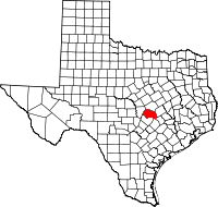 | |
| CDPs | ||
| Unincorporated communities | ||
| Ghost town | ||
| Footnotes | ‡This populated place also has portions in an adjacent county or counties | |