Burnham-on-Sea Round Tower
 Burnham-on-Sea Round Tower | |
 Somerset | |
| Location |
Burnham-on-Sea Somerset England |
|---|---|
| Coordinates | 51°14′24″N 2°59′55″W / 51.239978°N 2.998627°WCoordinates: 51°14′24″N 2°59′55″W / 51.239978°N 2.998627°W |
| Year first constructed | 1801 |
| Deactivated | 1832 |
| Construction | masonry tower |
| Tower shape | cylindrical tower with battlement top |
| Markings / pattern | white tower |
| ARLHS number | ENG-323 |
| Managing agent | private |
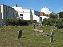
The Round Tower was a lighthouse in Burnham-on-Sea, Somerset, England. It is now a private dwelling.
Burnham-on-Sea is notable for its beach and mudflats, which are characteristic of Bridgwater Bay and the rest of the Bristol Channel where the tide can recede for over 1.5 miles (2.4 km). Burnham is close to the estuary of the River Parrett where it flows into the Bristol Channel, which has the second highest tidal range in the world of 15 metres (49 ft),[1] second only to Bay of Fundy in Eastern Canada.[2][3] The constantly shifting sands have always been a significant risk to shipping in the area.
History
During the 18th century a light was placed on the top of St Andrews Church tower to guide fishing boats into the harbour. A local vicar, either John Goulden in 1764 or Walter Harris in 1799, raised a subscription amongst the local population to replace the light on the church. This was built in 1800 to 1801,[4][5] when the curate David Davies paid the verger £20 to build the round tower attached to his house. Some funds were raised from local merchants and ship owners; however by 1813 funds were insufficient and Davies was given permission to levy dues to supplement the £135 annual income as this wasn't enough for the lights maintenance. A 100 years lease was attached to the permission to levy fees; however the outstanding 85 years of the lease was sold to Trinity House around 1829.[6] Funds from the sale were used by the vicar, Rev David Davies, to improve the area in an attempt to create a spa town.[4]
Trinity House operated the lighthouse until 1832 when it became inactive, and was replaced by the High and Low lighthouses.
The tower was later shortened to two storeys, to prevent any confusion with the High Lighthouse,[7][8] and battlements were added.
See also
References
- ↑ "Severn Estuary Barrage" (PDF). UK Environment Agency. 7 May 2008. Archived from the original (PDF) on 30 September 2007. Retrieved 3 September 2007.
- ↑ Chan, Marjorie A.; Archer, Allen William (2003). Extreme Depositional Environments: Mega End Members in Geologic Time. Boulder, Colorado: Geological Society of America. p. 151. ISBN 0-8137-2370-1.
- ↑ "Coast: Bristol Channel". BBC. Retrieved 27 August 2007.
- 1 2 "Burnham on Sea Conservation Area Character Appraisal" (PDF). Sedgemoor Council. p. 12. Retrieved 26 April 2010.
- ↑ Farr, Grahame (1954). Somerset Harbours. London: Christopher Johnson. p. 91.
- ↑ Taylor, Alan. "The lighthouse on legs". UK Lighthouses. Alan Taylor. Retrieved 28 April 2010.
- ↑ "Lighthouses". Burnham on Sea.com. Retrieved 5 April 2010.
- ↑ Rowlett, Russ. "Lighthouses of Western England". University of North Carolina at Chapel Hill. Retrieved 6 October 2015.