Byrdstown, Tennessee
| Byrdstown, Tennessee | |
|---|---|
| Town | |
|
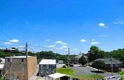
Town square in Byrdstown | |
 Location of Byrdstown, Tennessee | |
| Coordinates: 36°34′21″N 85°8′14″W / 36.57250°N 85.13722°W | |
| Country | United States |
| State | Tennessee |
| County | Pickett |
| Founded | 1879 |
| Incorporated | 1917[1] |
| Named for | Col. Robert K. Byrd |
| Area | |
| • Total | 1.5 sq mi (4.0 km2) |
| • Land | 1.5 sq mi (4.0 km2) |
| • Water | 0.0 sq mi (0.0 km2) |
| Elevation | 1,027 ft (313 m) |
| Population (2010) | |
| • Total | 803 |
| • Density | 587.5/sq mi (226.8/km2) |
| Time zone | Central (CST) (UTC-6) |
| • Summer (DST) | CDT (UTC-5) |
| ZIP code | 38549 |
| Area code(s) | 931 |
| FIPS code | 47-10180[2] |
| GNIS feature ID | 1279260[3] |
| Website |
www |
Byrdstown is a town in Pickett County, Tennessee, United States. The population was 803 at the 2010 census.[4] It is the county seat of Pickett County.[5]
History
Byrdstown was established in 1879 as a county seat for the newly-formed Pickett County. The town, where several families already lived, was named for Colonel Robert K. Byrd, a state senator whose district included the new county. Byrdstown was officially incorporated in 1917.
Former Secretary of State Cordell Hull (1871–1955)— who played a pivotal role in the creation of the United Nations— was born just west of Byrdstown. The Pickett County Courthouse, built in 1935, and the Cordell Hull Birthplace are both listed on the National Register of Historic Places. Other historical sites include the Amonett House at the junction of TN-325 and TN-111.[6][7]
Geography
Byrdstown is located at 36°34′21″N 85°8′14″W / 36.57250°N 85.13722°W (36.572585, -85.137088).[8] The town is situated in a hilly area on the Highland Rim, a few miles south of the Kentucky state line. Byrdstown lies south of the Wolf River, north of the Obey River, and east of Dale Hollow Lake, where the two rivers converge.

Tennessee State Route 325 traverses Byrdstown from west to east, mostly following West Main Street and East Main Street. This highway connects Byrdstown with the Dale Hollow Lake and Cordell Hull Birthplace State Park areas to the west, and the rural parts of central Pickett County to the east. Tennessee State Route 111, which intersects SR 325 in western Byrdstown, connects the town with Livingston to the southwest, and Static at the state line to the north. At Static, the highway terminates at an intersection with U.S. Route 127, with the latter continuing northward to Albany, Kentucky.
According to the United States Census Bureau, the town has a total area of 1.5 square miles (3.9 km2), all of it land.
Demographics
| Historical population | |||
|---|---|---|---|
| Census | Pop. | %± | |
| 1920 | 125 | — | |
| 1930 | 135 | 8.0% | |
| 1940 | 215 | 59.3% | |
| 1950 | 379 | 76.3% | |
| 1960 | 613 | 61.7% | |
| 1970 | 582 | −5.1% | |
| 1980 | 884 | 51.9% | |
| 1990 | 998 | 12.9% | |
| 2000 | 903 | −9.5% | |
| 2010 | 803 | −11.1% | |
| Est. 2015 | 814 | [9] | 1.4% |
| Sources:[10][11] | |||
As of the census[2] of 2000, there were 903 people, 395 households, and 233 families residing in the town. The population density was 587.5 people per square mile (226.4/km²). There were 460 housing units at an average density of 299.3 per square mile (115.3/km²). The racial makeup of the town was 98.12% White, 0.22% African American, 0.44% Native American, and 1.22% from two or more races. Hispanic or Latino of any race were 0.55% of the population.

There were 395 households out of which 24.1% had children under the age of 18 living with them, 39.7% were married couples living together, 14.9% had a female householder with no husband present, and 41.0% were non-families. 37.7% of all households were made up of individuals and 18.7% had someone living alone who was 65 years of age or older. The average household size was 2.11 and the average family size was 2.80.
In the town the population was spread out with 19.8% under the age of 18, 9.7% from 18 to 24, 22.4% from 25 to 44, 23.9% from 45 to 64, and 24.1% who were 65 years of age or older. The median age was 43 years. For every 100 females there were 81.0 males. For every 100 females age 18 and over, there were 75.7 males.
The median income for a household in the town was $19,375, and the median income for a family was $25,938. Males had a median income of $23,281 versus $16,389 for females. The per capita income for the town was $14,462. About 19.2% of families and 28.1% of the population were below the poverty line, including 40.4% of those under age 18 and 32.5% of those age 65 or over.
Notable residents
- Cordell Hull (1871–1955), U.S. Secretary of State and Nobel Peace Prize winner
- Sierra Hull (b. 1991), musician
References
- ↑ Tennessee Blue Book, 2005-2006, pp. 618-625.
- 1 2 "American FactFinder". United States Census Bureau. Archived from the original on 2013-09-11. Retrieved 2008-01-31.
- ↑ "US Board on Geographic Names". United States Geological Survey. 2007-10-25. Retrieved 2008-01-31.
- ↑ Tennessee Department of Economic and Community Development, Certified Population of Tennessee Incorporated Municipalities and Counties, State of Tennessee official website, 14 July 2011. Retrieved: 6 December 2013.
- ↑ "Find a County". National Association of Counties. Archived from the original on 2011-05-31. Retrieved 2011-06-07.
- ↑ "History of Pickett County, Tennessee." Overton County/Pickett County E-911. Retrieved: 19 December 2007.
- ↑ The Federal Writers' Project, The WPA Guide to Tennessee (Knoxville, Tenn.: University of Tennessee Press, 1986), 507.
- ↑ "US Gazetteer files: 2010, 2000, and 1990". United States Census Bureau. 2011-02-12. Retrieved 2011-04-23.
- ↑ "Annual Estimates of the Resident Population for Incorporated Places: April 1, 2010 to July 1, 2015". Retrieved July 2, 2016.
- ↑ "Census of Population and Housing: Decennial Censuses". United States Census Bureau. Retrieved 2012-03-04.
- ↑ "Incorporated Places and Minor Civil Divisions Datasets: Subcounty Resident Population Estimates: April 1, 2010 to July 1, 2012". Population Estimates. U.S. Census Bureau. Archived from the original on 17 June 2013. Retrieved 11 December 2013.
External links
| Wikimedia Commons has media related to Byrdstown, Tennessee. |
- Official site
- Municipal Technical Advisory Service entry for Byrdstown — information on local government, elections, and link to charter
Coordinates: 36°34′21″N 85°08′14″W / 36.572585°N 85.137088°W
Municipalities and communities of Pickett County, Tennessee, United States | ||
|---|---|---|
| Town | ||
| Unincorporated communities | ||
| Ghost town | ||
| Footnotes | ‡This populated place also has portions in an adjacent county or counties | |