Caernarvon Township, Berks County, Pennsylvania
| Caernarvon Township, Berks County, Pennsylvania | |
| Township | |
| Municipal offices and police department in Morgantown | |
| Country | United States |
|---|---|
| State | Pennsylvania |
| County | Berks |
| Elevation | 620 ft (189.0 m) |
| Coordinates | 40°10′02″N 75°52′42″W / 40.16722°N 75.87833°WCoordinates: 40°10′02″N 75°52′42″W / 40.16722°N 75.87833°W |
| Area | 8.9 sq mi (23.1 km2) |
| - land | 8.9 sq mi (23 km2) |
| - water | 0.0 sq mi (0 km2), 0% |
| Population | 4,006 (2010) |
| Density | 260.3/sq mi (100.5/km2) |
| Founded | 1752 |
| Timezone | EST (UTC-5) |
| - summer (DST) | EDT (UTC-4) |
| Area code | 610 |
|
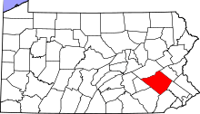
Location of Caernarvon Township in Pennsylvania
| |
 Location of Pennsylvania in the United States
| |
| Website: http://www.caernarvon.org | |
Caernarvon Township is a township in Berks County, Pennsylvania, United States. The population was 4,006 at the 2010 census. It is often referred to as Morgantown, the township's largest village.
History
Caernarvon was so named by Welsh settlers[1] after the town of Caernarfon in North Wales.
Caernarvon Township officially dates back to 1752, the same year Berks County was established. There is some confusion as to the origin of the two separate Caernarvon Townships, the other being in adjacent Lancaster County. Possibly the Townships existed as one before the county lines were drawn up, and were divided to accommodate county delineation. In that case, Township origins can be traced back to 1729, the year Lancaster County was established.
Morgantown Historic District was listed on the National Register of Historic Places in 1995.[2]
Geography
According to the United States Census Bureau, the township has a total area of 8.9 square miles (23 km2), of which, 8.9 square miles (23 km2) of it is land and 0.11% is water. The township is partially located in the Hopewell Big Woods.
Adjacent townships
- Brecknock Township, Berks County (NW)
- Robeson Township, Berks County (N)
- West Nantmeal Township, Chester County (SE)
- Honey Brook Township, Chester County (S)
- Caernarvon Township, Lancaster County (SW)
- Brecknock Township, Lancaster County (W)
Adjacent boroughs
- New Morgan (N)
- Elverson (SE)
Demographics
| Historical population | |||
|---|---|---|---|
| Census | Pop. | %± | |
| 1980 | 1,710 | — | |
| 1990 | 1,933 | 13.0% | |
| 2000 | 2,312 | 19.6% | |
| 2010 | 4,006 | 73.3% | |
| Source: US Census Bureau | |||
As of the census[3] of 2000, there were 2,312 people, 888 households, and 658 families residing in the township. The population density was 260.3 people per square mile (100.5/km²). There were 925 housing units at an average density of 104.1/sq mi (40.2/km²). The racial makeup of the township was 97.79% White, 0.30% African American, 0.78% Asian, 0.22% from other races, and 0.91% from two or more races. Hispanic or Latino of any race were 0.87% of the population.
There were 888 households, out of which 32.4% had children under the age of 18 living with them, 64.1% were married couples living together, 6.6% had a female householder with no husband present, and 25.9% were non-families. 21.5% of all households were made up of individuals, and 8.4% had someone living alone who was 65 years of age or older. The average household size was 2.60 and the average family size was 3.05.
In the township the population was spread out, with 26.1% under the age of 18, 6.5% from 18 to 24, 29.2% from 25 to 44, 24.1% from 45 to 64, and 14.2% who were 65 years of age or older. The median age was 38 years. For every 100 females there were 98.1 males. For every 100 females age 18 and over, there were 95.1 males.
The median income for a household in the township was $49,041, and the median income for a family was $57,574. Males had a median income of $37,639 versus $27,273 for females. The per capita income for the township was $21,250. About 2.9% of families and 6.1% of the population were below the poverty line, including 12.1% of those under age 18 and none of those age 65 or over.
References
- ↑ "Local school children to hear history of Berks and deeds of noted citizens". Reading Eagle. Mar 6, 1927. p. 5. Retrieved 2 December 2015.
- ↑ National Park Service (2010-07-09). "National Register Information System". National Register of Historic Places. National Park Service.
- ↑ "American FactFinder". United States Census Bureau. Archived from the original on 2013-09-11. Retrieved 2008-01-31.
