Fleetwood, Pennsylvania
| Fleetwood, Pennsylvania | |
|---|---|
| Borough | |
|
Main Street in Fleetwood | |
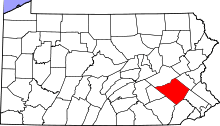
 Fleetwood Location of Fleetwood in Pennsylvania | |
| Coordinates: 40°27′17″N 75°49′08″W / 40.45472°N 75.81889°WCoordinates: 40°27′17″N 75°49′08″W / 40.45472°N 75.81889°W | |
| Country | United States |
| State | Pennsylvania |
| County | Berks |
| Area | |
| • Total | 2.68 sq mi (6.9 km2) |
| • Land | 2.67 sq mi (6.9 km2) |
| • Water | 0.01 sq mi (0.03 km2) |
| Elevation | 433 ft (132 m) |
| Population (2010) | |
| • Total | 4,085 |
| • Density | 1,500/sq mi (590/km2) |
| Time zone | EST (UTC-5) |
| • Summer (DST) | EDT (UTC-4) |
| ZIP code | 19522 |
| Area code(s) | 610 Exchange: 944 |
| Website |
www |

Fleetwood, also called Schlegelschteddel in Deitsch, is a borough in Berks County, Pennsylvania, United States. The population was 4,085 at the 2010 census.[1] It was home to the Fleetwood Metal Body company, an automobile coachbuilder purchased by Fisher Body and integrated into General Motors in 1931. The name lived on in the Cadillac Fleetwood automobile.
History
The First National Bank in Fleetwood was listed on the National Register of Historic Places in 2005.[2]
Geography
Fleetwood is located northeast of the center of Berks County at 40°27′17″N 75°49′8″W / 40.45472°N 75.81889°W (40.454793, -75.818821).[3] It is bordered on the east, west, and north by Richmond Township and on its short southern edge by Ruscombmanor Township.
Pennsylvania Route 662 passes through the borough, leading north toward U.S. Route 222 and south to Oley and Douglassville. By Park Road it is 12 miles (19 km) southwest to Reading.
According to the United States Census Bureau, the borough has a total area of 1.0 square mile (2.7 km2), of which 0.004 square miles (0.01 km2), or 0.47%, is water.[1]
Demographics
| Historical population | |||
|---|---|---|---|
| Census | Pop. | %± | |
| 1880 | 802 | — | |
| 1890 | 878 | 9.5% | |
| 1900 | 978 | 11.4% | |
| 1910 | 1,394 | 42.5% | |
| 1920 | 1,652 | 18.5% | |
| 1930 | 2,150 | 30.1% | |
| 1940 | 2,254 | 4.8% | |
| 1950 | 2,338 | 3.7% | |
| 1960 | 2,647 | 13.2% | |
| 1970 | 3,064 | 15.8% | |
| 1980 | 3,422 | 11.7% | |
| 1990 | 3,478 | 1.6% | |
| 2000 | 4,018 | 15.5% | |
| 2010 | 4,085 | 1.7% | |
| Est. 2015 | 4,085 | [4] | 0.0% |
| Sources:[5][6][7] | |||
As of the census of 2010,[8] there were 4,085 people, 1,662 households, and 1,134 families residing in the borough. There were 1,720 housing units of which 96.6% were occupied. The racial makeup of the borough was 95.81% White, 0.93% African American, 0.83% Asian, 0.73% from other races, and 1.69% from two or more races.
There were 1,662 households, out of which 30.7% had children under the age of 18 living with them, 54.3% were married couples living together, 9.3% had a female householder with no husband present, and 31.8% were non-families. 25.3% of all households were made up of individuals living alone. The average household size was 2.44 and the average family size was 2.92.
In the borough the population was spread out, with 22.1% under the age of 18, 8.8% from 18 to 24, 26.3% from 25 to 44, 26.5% from 45 to 64, and 16.3% who were 65 years of age or older. The median age was 39.9 years. For every 100 females there were 95.5 males. For every 100 females age 18 and over, there were 112.5 males.
The following statistics are from the 2000 census.census[6] The median income for a household in the borough was $48,621, and the median income for a family was $60,051. Males had a median income of $39,559 versus $26,321 for females. The per capita income for the borough was $21,600. About 2.5% of families and 2.8% of the population were below the poverty line, including 3.5% of those under age 18 and 8.1% of those age 65 or over.
Education
The community is served by the Fleetwood Area School District, which operates Fleetwood Area High School, Fleetwood Area Middle School, and three elementary schools: Andrew Maier Elementary School, Richmond Elementary School, and Willow Creek Elementary School.
Town twinnings
Fleetwood is twinned with the town of Fleetwood in Lancashire, in the United Kingdom.
References
- 1 2 "Geographic Identifiers: 2010 Demographic Profile Data (G001): Fleetwood borough, Pennsylvania". U.S. Census Bureau, American Factfinder. Retrieved March 6, 2014.
- ↑ National Park Service (2010-07-09). "National Register Information System". National Register of Historic Places. National Park Service.
- ↑ "US Gazetteer files: 2010, 2000, and 1990". United States Census Bureau. 2011-02-12. Retrieved 2011-04-23.
- ↑ "Annual Estimates of the Resident Population for Incorporated Places: April 1, 2010 to July 1, 2015". Retrieved July 2, 2016.
- ↑ "Census of Population and Housing". U.S. Census Bureau. Retrieved 11 December 2013.
- 1 2 "American FactFinder". United States Census Bureau. Retrieved 2008-01-31.
- ↑ "Incorporated Places and Minor Civil Divisions Datasets: Subcounty Resident Population Estimates: April 1, 2010 to July 1, 2012". Population Estimates. U.S. Census Bureau. Retrieved 11 December 2013.
- ↑ "American FactFinder". Retrieved August 2, 2011.
External links
- Borough of Fleetwood official website
- Fleetwood Area School District
- Fleetwood Area Historical Society
- Fleetwood Volunteer Fire Company
| Wikimedia Commons has media related to Fleetwood, Pennsylvania. |