Mohnton, Pennsylvania
| Mohnton, Pennsylvania | |
| Borough | |
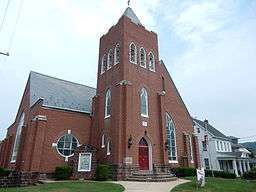 Zion Evangelical Church (1894). | |
| Country | United States |
|---|---|
| State | Pennsylvania |
| County | Berks |
| Elevation | 489 ft (149.0 m) |
| Coordinates | 40°17′10″N 75°59′09″W / 40.28611°N 75.98583°WCoordinates: 40°17′10″N 75°59′09″W / 40.28611°N 75.98583°W |
| Area | 1.99 km2 (0.8 sq mi) |
| - land | 1.98 km2 (1 sq mi) |
| - water | 0.01 km2 (0 sq mi) |
| Population | 3,043 (2010) |
| Density | 1,537.3/km2 (3,981.6/sq mi) |
| Timezone | EST (UTC-5) |
| - summer (DST) | EDT (UTC-4) |
| ZIP Code | 19540 |
| Area code | 610 and 484 |
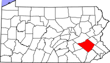
 Location of Mohnton in Pennsylvania | |
 Location of Pennsylvania in the United States | |
| Website: www | |
Mohnton is a borough in Berks County, Pennsylvania, United States. It had a population of 3,043 in the 2010 census.[1]
History
The earliest post office in Mohnton was called Mohn's Store.[2] A post office was established at Mohn's Store in 1857, the post office was renamed Mohnton in 1906, and it remains in operation.[3]
Geography
Mohnton is located in southern Berks County at 40°17′10″N 75°59′9″W / 40.28611°N 75.98583°W (40.286242, -75.985936),[4] part of the contiguous urban area surrounding the city of Reading. It is bordered on all sides by Cumru Township, including the unincorporated community of Pennwyn on the borough's eastern border. The borough of Shillington is 1 mile (1.6 km) to the northeast. Wyomissing Creek flows through the center of Mohnton.
According to the United States Census Bureau, Mohnton has a total area of 0.77 square miles (2.0 km2), of which 0.004 square miles (0.01 km2), or 0.63%, is water.[1]
Demographics
| Historical population | |||
|---|---|---|---|
| Census | Pop. | %± | |
| 1910 | 1,536 | — | |
| 1920 | 1,640 | 6.8% | |
| 1930 | 1,824 | 11.2% | |
| 1940 | 1,853 | 1.6% | |
| 1950 | 2,004 | 8.1% | |
| 1960 | 2,223 | 10.9% | |
| 1970 | 2,153 | −3.1% | |
| 1980 | 2,156 | 0.1% | |
| 1990 | 2,484 | 15.2% | |
| 2000 | 2,963 | 19.3% | |
| 2010 | 3,043 | 2.7% | |
| Est. 2015 | 3,036 | [5] | −0.2% |
| Sources:[6][7][8] | |||
As of the census[7] of 2000, there were 2,963 people, 1,211 households, and 842 families residing in the borough. The population density was 3,396.0 people per square mile (1,315.0/km²). There were 1,259 housing units at an average density of 1,443.0 per square mile (558.7/km²). The racial makeup of the borough was 96.79% White, 1.11% African American, 0.07% Native American, 0.44% Asian, 0.88% from other races, and 0.71% from two or more races. Hispanic or Latino of any race were 1.69% of the population.
There were 1,211 households, out of which 35.2% had children under the age of 18 living with them, 54.8% were married couples living together, 11.9% had a female householder with no husband present, and 30.4% were non-families. 26.3% of all households were made up of individuals, and 8.8% had someone living alone who was 65 years of age or older. The average household size was 2.44 and the average family size was 2.95.
In the borough the population was spread out, with 25.6% under the age of 18, 6.5% from 18 to 24, 32.5% from 25 to 44, 22.5% from 45 to 64, and 12.9% who were 65 years of age or older. The median age was 37 years. For every 100 females there were 89.8 males. For every 100 females age 18 and over, there were 83.7 males.
The median income for a household in the borough was $41,429, and the median income for a family was $56,174. Males had a median income of $40,037 versus $25,266 for females. The per capita income for the borough was $21,268. About 3.2% of families and 4.9% of the population were below the poverty line, including 6.8% of those under age 18 and 3.2% of those age 65 or over.
Sports
Maple Grove Raceway, which hosts the NHRA Nationals every year for the NHRA Mello Yellow series drivers, is located 8 miles (13 km) south of Mohnton in Brecknock Township. The drag strip's mailing address is Mohnton, as is much of southwest Berks County.
References
- 1 2 "Geographic Identifiers: 2010 Demographic Profile Data (G001): Mohnton borough, Pennsylvania". U.S. Census Bureau, American Factfinder. Retrieved March 7, 2014.
- ↑ "Some peculiar post office names in Berks". Reading Eagle. Nov 27, 1910. p. 11. Retrieved 2 December 2015.
- ↑ "Berks County". Jim Forte Postal History. Retrieved 1 December 2015.
- ↑ "US Gazetteer files: 2010, 2000, and 1990". United States Census Bureau. 2011-02-12. Retrieved 2011-04-23.
- ↑ "Annual Estimates of the Resident Population for Incorporated Places: April 1, 2010 to July 1, 2015". Retrieved July 2, 2016.
- ↑ "Census of Population and Housing". U.S. Census Bureau. Retrieved 11 December 2013.
- 1 2 "American FactFinder". United States Census Bureau. Retrieved 2008-01-31.
- ↑ "Incorporated Places and Minor Civil Divisions Datasets: Subcounty Resident Population Estimates: April 1, 2010 to July 1, 2012". Population Estimates. U.S. Census Bureau. Retrieved 11 December 2013.
External links
| Wikimedia Commons has media related to Mohnton, Pennsylvania. |