Campbell, New York
| Campbell, New York | |
|---|---|
| Town | |
 Campbell, New York Location within the state of New York | |
| Coordinates: 42°14′5″N 77°10′7″W / 42.23472°N 77.16861°WCoordinates: 42°14′5″N 77°10′7″W / 42.23472°N 77.16861°W | |
| Country | United States |
| State | New York |
| County | Steuben |
| Area | |
| • Total | 40.8 sq mi (105.6 km2) |
| • Land | 40.7 sq mi (105.5 km2) |
| • Water | 0.0 sq mi (0.1 km2) |
| Elevation | 1,657 ft (505 m) |
| Population (2000) | |
| • Total | 3,691 |
| • Density | 90.6/sq mi (35.0/km2) |
| Time zone | Eastern (EST) (UTC-5) |
| • Summer (DST) | EDT (UTC-4) |
| ZIP code | 14821 |
| Area code(s) | 607 |
| FIPS code | 36-11946 |
| GNIS feature ID | 0978780 |
Campbell is a town in Steuben County, New York, United States. The population was 3,691 at the 2000 census. The name is from Robert Campbell, an early landowner.
The Town of Campbell is centrally located in the county and is northwest of Corning.
History
Campbell was first settled around 1801. The town was formed in 1831 from the Town of Hornby.
The District School Number Five and Wood Road Metal Truss Bridge are listed on the National Register of Historic Places.[1]
Past residents of note
It was the birthplace, in 1869, of Illinois Attorney General Edward J. Brundage and, in 1874, of IBM founder Thomas J. Watson, Sr.
Geography
According to the United States Census Bureau, the town has a total area of 40.8 square miles (106 km2), of which, 40.8 square miles (106 km2) of it is land and 0.04 square miles (0.10 km2) of it (0.07%) is water.
Interstate 86 (including New York State Route 17), New York State Route 415 and the Conhocton River pass through the town.
Former New York State Route 333, now County Road 333, enters the town from the west.
Campbell is on the Gang Mills (Painted Post) Line of the B&H Rail Corporation. This portion of track was built opened in 1882 as the New York (Hoboken) to Buffalo line of the Delaware, Lackawanna & Western Railroad. In 1963 the route to Buffalo was severed between Wayland and Groveland, N.Y., by order of the U. S. Interstate Commerce Commission in order to promote highway transportation.
Campbell was also served (c. 1853-1963) by the Corning-Rochester line of the Erie Railroad. This line was removed in 1963 by the U. S. Interstate Commerce Commission, also in order to promote highway transportation.
Demographics
| Historical population | |||
|---|---|---|---|
| Census | Pop. | %± | |
| 1840 | 852 | — | |
| 1850 | 1,175 | 37.9% | |
| 1860 | 1,622 | 38.0% | |
| 1870 | 1,989 | 22.6% | |
| 1880 | 1,881 | −5.4% | |
| 1890 | 1,533 | −18.5% | |
| 1900 | 1,467 | −4.3% | |
| 1910 | 1,204 | −17.9% | |
| 1920 | 1,032 | −14.3% | |
| 1930 | 1,263 | 22.4% | |
| 1940 | 1,472 | 16.5% | |
| 1950 | 1,814 | 23.2% | |
| 1960 | 2,471 | 36.2% | |
| 1970 | 3,180 | 28.7% | |
| 1980 | 3,801 | 19.5% | |
| 1990 | 3,658 | −3.8% | |
| 2000 | 3,691 | 0.9% | |
| 2010 | 3,406 | −7.7% | |
| Est. 2014 | 3,347 | [2] | −1.7% |
As of the census[4] of 2000, there were 3,691 people, 1,418 households, and 1,036 families residing in the town. The population density was 90.6 people per square mile (35.0/km²). There were 1,515 housing units at an average density of 37.2 per square mile (14.4/km²). The racial makeup of the town was 98.54% White, 0.43% African American, 0.08% Native American, 0.27% Asian, 0.03% Pacific Islander, 0.16% from other races, and 0.49% from two or more races. Hispanic or Latino of any race were 0.35% of the population.
There were 1,418 households out of which 33.7% had children under the age of 18 living with them, 58.8% were married couples living together, 9.0% had a female householder with no husband present, and 26.9% were non-families. 21.4% of all households were made up of individuals and 8.0% had someone living alone who was 65 years of age or older. The average household size was 2.59 and the average family size was 2.99.
In the town the population was spread out with 26.0% under the age of 18, 7.2% from 18 to 24, 27.7% from 25 to 44, 26.3% from 45 to 64, and 12.8% who were 65 years of age or older. The median age was 38 years. For every 100 females there were 96.9 males. For every 100 females age 18 and over, there were 95.0 males.
The median income for a household in the town was $39,375, and the median income for a family was $46,220. Males had a median income of $30,820 versus $24,427 for females. The per capita income for the town was $18,819. About 6.1% of families and 8.2% of the population were below the poverty line, including 13.4% of those under age 18 and 4.0% of those age 65 or over.
Politics
Like most of Steuben County, it is a Republican stronghold, with few Democrats on the Town Board.
Communities and locations in the Town of Campbell
- Campbell – The hamlet of Campbell, located on the west side of Interstate 86 by the Cohocton River. County Road 125 is Main Street. It is also at the eastern terminus of County Road 333.
- Curtis – A hamlet south of Campbell village on Interstate 86.
- East Campbell – A hamlet east of Campbell Hamlet, located on County Road 26.
- Meads Creek – A stream passing by East Campbell and the name of a hamlet in the northeast corner of the town, located on the stream.
- Michigan Creek – A stream entering the Cohocton River by Campbell hamlet.
References
- ↑ National Park Service (2009-03-13). "National Register Information System". National Register of Historic Places. National Park Service.
- ↑ "Annual Estimates of the Resident Population for Incorporated Places: April 1, 2010 to July 1, 2014". Retrieved June 4, 2015.
- ↑ "Census of Population and Housing". Census.gov. Archived from the original on May 11, 2015. Retrieved June 4, 2015.
- ↑ "American FactFinder". United States Census Bureau. Archived from the original on 2013-09-11. Retrieved 2008-01-31.
External links
Municipalities and communities of Steuben County, New York, United States | ||
|---|---|---|
| Cities | 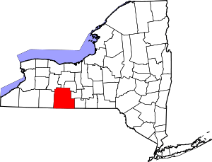 | |
| Towns | ||
| Villages | ||
| CDPs |
| |
| Hamlets | ||
| Footnotes | ‡This populated place also has portions in an adjacent county or counties | |