Campbell Township, Jennings County, Indiana
| Campbell Township | |
|---|---|
| Township | |
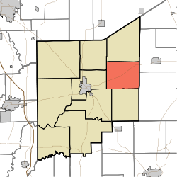 Location in Jennings County | |
| Coordinates: 39°02′14″N 85°30′01″W / 39.03722°N 85.50028°WCoordinates: 39°02′14″N 85°30′01″W / 39.03722°N 85.50028°W | |
| Country | United States |
| State | Indiana |
| County | Jennings |
| Government | |
| • Type | Indiana township |
| Area | |
| • Total | 32.35 sq mi (83.8 km2) |
| • Land | 32.06 sq mi (83.0 km2) |
| • Water | 0.28 sq mi (0.7 km2) 0.87% |
| Elevation | 791 ft (241 m) |
| Population (2010) | |
| • Total | 1,191 |
| • Density | 37.1/sq mi (14.3/km2) |
| GNIS feature ID | 0453155 |
Campbell Township is one of eleven townships in Jennings County, Indiana, United States. As of the 2010 census, its population was 1,191 and it contained 498 housing units.[1]
Campbell Township was established in 1825.[2]
History
Edward's Ford Bridge was listed on the National Register of Historic Places in 1996.[3]
Geography
According to the 2010 census, the township has a total area of 32.35 square miles (83.8 km2), of which 32.06 square miles (83.0 km2) (or 99.10%) is land and 0.28 square miles (0.73 km2) (or 0.87%) is water.[1]
Unincorporated towns
Adjacent townships
- Columbia Township (north)
- Otter Creek Township, Ripley County (northeast)
- Shelby Township, Ripley County (southeast)
- Bigger Township (south)
- Vernon Township (southwest)
- Center Township (west)
- Sand Creek Township (northwest)
Cemeteries
The township contains five cemeteries: Butlerville, Hopewell, Otter Creek, Saint Bridget and State School.
Major highways
References
- "Campbell Township, Jennings County, Indiana". Geographic Names Information System. United States Geological Survey. Retrieved 2009-09-24.
- United States Census Bureau cartographic boundary files
- 1 2 "Population, Housing Units, Area, and Density: 2010 - County -- County Subdivision and Place -- 2010 Census Summary File 1". United States Census. Retrieved 2013-05-10.
- ↑ Jennings Co. Historical Society (1999). Jennings Co., Indiana - Pictorial. Turner Publishing Company. p. 36.
- ↑ National Park Service (2010-07-09). "National Register Information System". National Register of Historic Places. National Park Service.
External links
Municipalities and communities of Jennings County, Indiana, United States | ||
|---|---|---|
| City | ||
| Town | ||
| Townships | ||
| CDPs | ||
| Other unincorporated communities | ||
| Footnotes | ‡This populated place also has portions in an adjacent county or counties | |
This article is issued from Wikipedia - version of the 11/13/2016. The text is available under the Creative Commons Attribution/Share Alike but additional terms may apply for the media files.