Center Township, Jennings County, Indiana
| Center Township | |
|---|---|
| Township | |
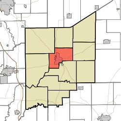 Location in Jennings County | |
| Coordinates: 39°00′51″N 85°37′11″W / 39.01417°N 85.61972°WCoordinates: 39°00′51″N 85°37′11″W / 39.01417°N 85.61972°W | |
| Country | United States |
| State | Indiana |
| County | Jennings |
| Government | |
| • Type | Indiana township |
| Area | |
| • Total | 25.21 sq mi (65.3 km2) |
| • Land | 25.2 sq mi (65 km2) |
| • Water | 0.01 sq mi (0.03 km2) 0.04% |
| Elevation | 669 ft (204 m) |
| Population (2010) | |
| • Total | 8,894 |
| • Density | 353/sq mi (136/km2) |
| GNIS feature ID | 0453183 |
Center Township is one of eleven townships in Jennings County, Indiana, United States. As of the 2010 census, its population was 8,894 and it contained 3,795 housing units.[1]
History
Center Township was established in 1855, and was so named from its position at the geographical center of Jennings County.[2]
Geography
According to the 2010 census, the township has a total area of 25.21 square miles (65.3 km2), of which 25.2 square miles (65 km2) (or 99.96%) is land and 0.01 square miles (0.026 km2) (or 0.04%) is water.[1] The streams of Deer Creek, Long Branch, Pleasant Run and Woods Branch run through this township.
Cities and towns
- North Vernon (vast majority)
Unincorporated towns
- Oakdale
Adjacent townships
- Sand Creek Township (north)
- Campbell Township (east)
- Vernon Township (south)
- Spencer Township (west)
- Geneva Township (northwest)
Cemeteries
The township contains three cemeteries: Hill Crest, Saint Marys and Summerfield.
Major highways
Airports and landing strips
- North Vernon Airport
References
- "Center Township, Jennings County, Indiana". Geographic Names Information System. United States Geological Survey. Retrieved 2009-09-24.
- United States Census Bureau cartographic boundary files
- 1 2 "Population, Housing Units, Area, and Density: 2010 - County -- County Subdivision and Place -- 2010 Census Summary File 1". United States Census. Retrieved 2013-05-10.
- ↑ Jennings Co. Historical Society (1999). Jennings Co., Indiana - Pictorial. Turner Publishing Company. p. 45.
External links
Municipalities and communities of Jennings County, Indiana, United States | ||
|---|---|---|
| City | ||
| Town | ||
| Townships | ||
| CDPs | ||
| Other unincorporated communities | ||
| Footnotes | ‡This populated place also has portions in an adjacent county or counties | |
This article is issued from Wikipedia - version of the 11/18/2016. The text is available under the Creative Commons Attribution/Share Alike but additional terms may apply for the media files.