Spencer Township, Jennings County, Indiana
| Spencer Township | |
|---|---|
| Township | |
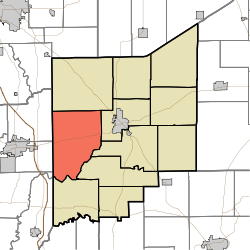 Location in Jennings County | |
| Coordinates: 38°58′24″N 85°44′41″W / 38.97333°N 85.74472°WCoordinates: 38°58′24″N 85°44′41″W / 38.97333°N 85.74472°W | |
| Country | United States |
| State | Indiana |
| County | Jennings |
| Government | |
| • Type | Indiana township |
| Area | |
| • Total | 49.23 sq mi (127.5 km2) |
| • Land | 48.91 sq mi (126.7 km2) |
| • Water | 0.32 sq mi (0.8 km2) 0.65% |
| Elevation | 646 ft (197 m) |
| Population (2010) | |
| • Total | 2,326 |
| • Density | 47.6/sq mi (18.4/km2) |
| GNIS feature ID | 0453861 |
Spencer Township is one of eleven townships in Jennings County, Indiana, United States. As of the 2010 census, its population was 2,326 and it contained 911 housing units.[1]
Geography
According to the 2010 census, the township has a total area of 49.23 square miles (127.5 km2), of which 48.91 square miles (126.7 km2) (or 99.35%) is land and 0.32 square miles (0.83 km2) (or 0.65%) is water.[1] The streams of Indian Creek, Little Mutton Creek, Powder Creek, Storm Creek, Tea Creek and Twomile Creek run through this township.
Unincorporated towns
- Four Corners
- Hayden
Adjacent townships
- Geneva Township (north)
- Center Township (east)
- Vernon Township (east)
- Lovett Township (southeast)
- Marion Township (south)
- Vernon Township, Jackson County (southwest)
- Washington Township, Jackson County (southwest)
- Jackson Township, Jackson County (west)
- Redding Township, Jackson County (west)
Cemeteries
The township contains eight cemeteries: Barkman, Hunt, Myers, Saint Catherines, Saint James, Sixmile, Whitcomb and Wohrer.
Major highways
References
- 1 2 "Population, Housing Units, Area, and Density: 2010 - County -- County Subdivision and Place -- 2010 Census Summary File 1". United States Census. Retrieved 2013-05-10.
External links
Municipalities and communities of Jennings County, Indiana, United States | ||
|---|---|---|
| City | ||
| Town | ||
| Townships | ||
| CDPs | ||
| Other unincorporated communities | ||
| Footnotes | ‡This populated place also has portions in an adjacent county or counties | |
This article is issued from Wikipedia - version of the 6/29/2014. The text is available under the Creative Commons Attribution/Share Alike but additional terms may apply for the media files.