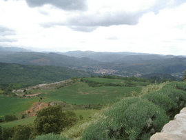
Camps-sur-l'Agly
| Camps-sur-l'Agly | ||
|---|---|---|
 | ||
| ||
 Camps-sur-l'Agly | ||
|
Location within Occitanie region  Camps-sur-l'Agly | ||
| Coordinates: 42°51′38″N 2°26′04″E / 42.8606°N 2.4344°ECoordinates: 42°51′38″N 2°26′04″E / 42.8606°N 2.4344°E | ||
| Country | France | |
| Region | Occitanie | |
| Department | Aude | |
| Arrondissement | Limoux | |
| Canton | Couiza | |
| Intercommunality | Pays de Couiza | |
| Government | ||
| • Mayor (2008–2014) | Rolande Alibert | |
| Area1 | 26.35 km2 (10.17 sq mi) | |
| Population (2008)2 | 84 | |
| • Density | 3.2/km2 (8.3/sq mi) | |
| Time zone | CET (UTC+1) | |
| • Summer (DST) | CEST (UTC+2) | |
| INSEE/Postal code | 11065 / 11190 | |
| Elevation |
445–1,227 m (1,460–4,026 ft) (avg. 540 m or 1,770 ft) | |
|
1 French Land Register data, which excludes lakes, ponds, glaciers > 1 km² (0.386 sq mi or 247 acres) and river estuaries. 2 Population without double counting: residents of multiple communes (e.g., students and military personnel) only counted once. | ||
.svg.png)
Camps-sur-l'Agly is a commune in the Aude department in southern France.
Population
| Historical population | ||
|---|---|---|
| Year | Pop. | ±% |
| 1962 | 16 | — |
| 1968 | 38 | +137.5% |
| 1975 | 37 | −2.6% |
| 1982 | 46 | +24.3% |
| 1990 | 56 | +21.7% |
| 1999 | 60 | +7.1% |
| 2008 | 84 | +40.0% |
See also
References
| Wikimedia Commons has media related to Camps-sur-l'Agly. |
This article is issued from Wikipedia - version of the 3/18/2013. The text is available under the Creative Commons Attribution/Share Alike but additional terms may apply for the media files.