Campti, Louisiana
| Campti, Louisiana | |
| Town | |
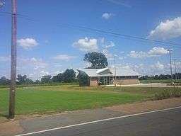 Natchitoches Parish Library off Hwy 71/84 | |
| Country | United States |
|---|---|
| State | Louisiana |
| Parish | Natchitoches |
| Elevation | 128 ft (39.0 m) |
| Coordinates | 31°53′44″N 93°06′50″W / 31.89556°N 93.11389°WCoordinates: 31°53′44″N 93°06′50″W / 31.89556°N 93.11389°W |
| Area | 1.0 sq mi (2.6 km2) |
| - land | 1.0 sq mi (3 km2) |
| - water | 0.0 sq mi (0 km2), 0% |
| Population | 1,057 (2000) |
| Density | 1,080.2/sq mi (417.1/km2) |
| Timezone | CST (UTC-6) |
| - summer (DST) | CDT (UTC-5) |
| ZIP Code | 71411 |
| Area code | 318 |
 Location of Campti in Louisiana
| |
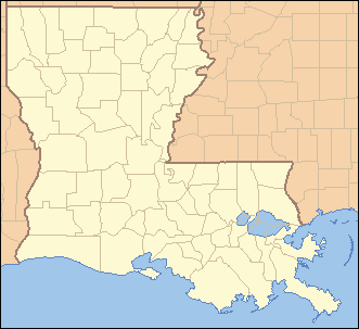
 Location of Louisiana in the United States
| |
Campti is a small town in Natchitoches Parish, Louisiana, United States. The population was 1,057 at the 2000 census. It is part of the Natchitoches Micropolitan Statistical Area. Campti is a flat area of mostly farmland. It sets on the eastern bank of the Red River. Considerable cattle are also raised in the general area.
Lakeview Junior and Senior High School, a modern consolidated school structure housing pre-kindergarten and grades nine through twelve, is located east of Campti on Louisiana Highway 9. The school is 55 percent white in enrollment,[1] but Campti itself is some 75 percent African American in population. Students from as far north as Ashland attend Lakeview.
During the American Civil War, Union General A.J. Smith, with two brigades, reached Campti to assist Admiral David Dixon Porter's trapped gunboats on the Red River there. Smith and his men burned Campti, which then contained only a few buildings and houses. The gunboats were returned safely upriver to Grand Ecore in Natchitoches Parish.[2]
History
Tradition maintains that the name "Campti" was derived from the name of a Caddo Indian Chief "Le Roi Campti" (The King Campti).[3] Church records in Natchitoches show that Father Valentin visited the community of Campti around 1745, and this was the first written record of Campti's existence during the French Louisiana.
Geography
Campti is located at 31°53′44″N 93°6′50″W / 31.89556°N 93.11389°W (31.895511, -93.113966).[4]
According to the United States Census Bureau, the town has a total area of 1.0 square mile (2.6 km2), all land.
Demographics
| Historical population | |||
|---|---|---|---|
| Census | Pop. | %± | |
| 1880 | 101 | — | |
| 1890 | 310 | 206.9% | |
| 1910 | 664 | — | |
| 1920 | 670 | 0.9% | |
| 1930 | 999 | 49.1% | |
| 1940 | 1,004 | 0.5% | |
| 1950 | 1,014 | 1.0% | |
| 1960 | 1,045 | 3.1% | |
| 1970 | 1,078 | 3.2% | |
| 1980 | 1,069 | −0.8% | |
| 1990 | 929 | −13.1% | |
| 2000 | 1,057 | 13.8% | |
| 2010 | 1,056 | −0.1% | |
| Est. 2015 | 1,044 | [5] | −1.1% |
As of the census[7] of 2000, there were 1,057 people, 385 households, and 269 families residing in the town. The population density was 1,080.2 people per square mile (416.4/km²). There were 462 housing units at an average density of 472.1 per square mile (182.0/km²). The racial makeup of the town was 24.88% White, 74.46% African American, 0.09% Native American, 0.28% from other races, and 0.28% from two or more races. Hispanic or Latino of any race were 0.85% of the population.
There were 385 households out of which 42.9% had children under the age of 18 living with them, 30.4% were married couples living together, 35.3% had a female householder with no husband present, and 29.9% were non-families. 26.0% of all households were made up of individuals and 6.2% had someone living alone who was 65 years of age or older. The average household size was 2.74 and the average family size was 3.36.
In the town the population was spread out with 38.5% under the age of 18, 8.5% from 18 to 24, 25.8% from 25 to 44, 18.0% from 45 to 64, and 9.2% who were 65 years of age or older. The median age was 27 years. For every 100 females there were 81.9 males. For every 100 females age 18 and over, there were 75.2 males.
The median income for a household in the town was $14,844, and the median income for a family was $15,781. Males had a median income of $25,750 versus $14,000 for females. The per capita income for the town was $7,219. About 47.3% of families and 45.4% of the population were below the poverty line, including 55.9% of those under age 18 and 33.0% of those age 65 or over.
In 2010, Campti had the eighth-lowest median household income of all places in the United States with a population over 1,000.[8]
See also
| Wikimedia Commons has media related to Category:Campti, Louisiana. |
References
| Wikivoyage has a travel guide for Campti. |
- ↑ "Lakeview Jr.-Sr. High School". muninetguide.com. Archived from the original on April 17, 2010. Retrieved August 17, 2009.
- ↑ John D. Winters, The Civil War in Louisiana, Baton Rouge: Louisiana State University Press, 1963, ISBN 0-8071-0834-0, p. 359
- ↑ History of Campti
- ↑ "US Gazetteer files: 2010, 2000, and 1990". United States Census Bureau. 2011-02-12. Retrieved 2011-04-23.
- ↑ "Annual Estimates of the Resident Population for Incorporated Places: April 1, 2010 to July 1, 2015". Retrieved July 2, 2016.
- ↑ "Census of Population and Housing". Census.gov. Archived from the original on May 11, 2015. Retrieved June 4, 2015.
- ↑ "American FactFinder". United States Census Bureau. Archived from the original on 2013-09-11. Retrieved 2008-01-31.
- ↑ "US Census". Retrieved 18 January 2014.
Municipalities and communities of Natchitoches Parish, Louisiana, United States | ||
|---|---|---|
| City | 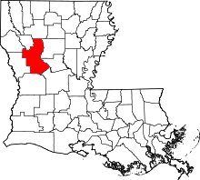 | |
| Town | ||
| Villages | ||
| CDPs | ||
| Other unincorporated communities |
| |
| Footnotes | ‡This populated place also has portions in an adjacent county or counties | |