Canfield, Ohio
| Canfield, Ohio | |
|---|---|
| City | |
 | |
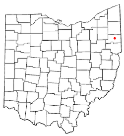 Location of Canfield, Ohio | |
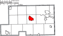 Location of Canfield in Mahoning County | |
| Coordinates: 41°1′47″N 80°45′56″W / 41.02972°N 80.76556°WCoordinates: 41°1′47″N 80°45′56″W / 41.02972°N 80.76556°W | |
| Country | United States |
| State | Ohio |
| County | Mahoning |
| Government | |
| • Mayor | Bernie Kosar Sr. |
| Area[1] | |
| • Total | 4.61 sq mi (11.94 km2) |
| • Land | 4.58 sq mi (11.86 km2) |
| • Water | 0.03 sq mi (0.08 km2) |
| Elevation[2] | 1,145 ft (349 m) |
| Population (2010)[3] | |
| • Total | 7,515 |
| • Estimate (2012[4]) | 7,434 |
| • Density | 1,640.8/sq mi (633.5/km2) |
| Time zone | Eastern (EST) (UTC-5) |
| • Summer (DST) | EDT (UTC-4) |
| ZIP code | 44406 |
| Area code(s) | 330 |
| FIPS code | 39-11360[5] |
| GNIS feature ID | 1038796[2] |
| Website | http://www.ci.canfield.oh.us/ |
Canfield is a suburban city located in Mahoning County, Ohio, United States, at the intersection of U.S. Route 224 and State Route 46/U.S. Route 62, about ten miles southwest of Youngstown. The population was 7,515 at the 2010 census. It is part of the Youngstown-Warren-Boardman, OH-PA Metropolitan Statistical Area. In 2005 Canfield was rated the 82nd best place to live in the United States by Money magazine.[6]
History
The village was named after Judson Canfield, a land agent.[7] Canfield was incorporated as a village in 1849.[8]
In 1992, Canfield city residents, although surrounded completely by Canfield Township, voted to secede from the township. This motion created two separate governmental entities — one a municipality, the other a township, which continue to operate together in many respects. An example of this is mutual fire protection service, communications with each other with respect to roads and highways, and the physical assets of both (schools, parks, etc.).
Geography
According to the United States Census Bureau, the city has a total area of 4.61 square miles (11.94 km2), of which 4.58 square miles (11.86 km2) is land and 0.03 square miles (0.08 km2) is water.[1]
Demographics
| Historical population | |||
|---|---|---|---|
| Census | Pop. | %± | |
| 1850 | 527 | — | |
| 1860 | 649 | 23.1% | |
| 1870 | 640 | −1.4% | |
| 1880 | 650 | 1.6% | |
| 1890 | 675 | 3.8% | |
| 1900 | 672 | −0.4% | |
| 1910 | 685 | 1.9% | |
| 1920 | 806 | 17.7% | |
| 1930 | 1,015 | 25.9% | |
| 1940 | 1,141 | 12.4% | |
| 1950 | 1,465 | 28.4% | |
| 1960 | 3,252 | 122.0% | |
| 1970 | 4,997 | 53.7% | |
| 1980 | 5,535 | 10.8% | |
| 1990 | 5,409 | −2.3% | |
| 2000 | 7,374 | 36.3% | |
| 2010 | 7,515 | 1.9% | |
| Est. 2015 | 7,355 | [9] | −2.1% |
| Sources:[10][11][12][13][14][15][5][16] | |||
2010 census
As of the census[3] of 2010, there were 7,515 people, 3,073 households, and 2,196 families residing in the city. The population density was 1,640.8 inhabitants per square mile (633.5/km2). There were 3,306 housing units at an average density of 721.8 per square mile (278.7/km2). The racial makeup of the city was 96.4% White, 0.4% African American, 0.1% Native American, 1.8% Asian, 0.5% from other races, and 0.7% from two or more races. Hispanic or Latino of any race were 1.5% of the population.
There were 3,073 households of which 30.8% had children under the age of 18 living with them, 59.7% were married couples living together, 8.7% had a female householder with no husband present, 3.0% had a male householder with no wife present, and 28.5% were non-families. 26.8% of all households were made up of individuals and 13.6% had someone living alone who was 65 years of age or older. The average household size was 2.44 and the average family size was 2.96.
The median age in the city was 45.8 years. 23.6% of residents were under the age of 18; 5.8% were between the ages of 18 and 24; 19.4% were from 25 to 44; 32.1% were from 45 to 64; and 19% were 65 years of age or older. The gender makeup of the city was 48.0% male and 52.0% female.
2000 census
As of the census[5] of 2000, there were 7,374 people, 2,917 households, and 2,143 families residing in the city. The population density was 1,588.1 people per square mile (613.6/km²). There were 3,043 housing units at an average density of 655.4 per square mile (253.2/km²). The racial makeup of the city was 97.27% White, 1.29% Asian, 0.45% African American, 0.04% Native American, 0.04% Pacific Islander, 0.33% from other races, and 0.58% from two or more races. Hispanic or Latino of any race were 0.84% of the population.
There were 2,917 households out of which 33.3% had children under the age of 18 living with them, 65.0% were married couples living together, 6.9% had a female householder with no husband present, and 26.5% were non-families. 24.7% of all households were made up of individuals and 12.1% had someone living alone who was 65 years of age or older. The average household size was 2.53 and the average family size was 3.03.
In the city the population was spread out with 25.6% under the age of 18, 5.2% from 18 to 24, 24.1% from 25 to 44, 27.7% from 45 to 64, and 17.4% who were 65 years of age or older. The median age was 42.3 years. For every 100 females there were 90.6 males. For every 100 females age 18 and over, there were 86.7 males.
The median income for a household in the city was $59,434 and the median income for a family was $71,484. Males had a median income of $35,346 versus $20,493 for females. The per capita income for the city is $31,756. About 2.1% of the families and 3.2% of the population live below the poverty line. Including 3.0% of those under age 18 and 4.3% of those 65 years of age or older.
Culture
Canfield is a suburb of Youngstown, with strict zoning regulations that prohibit large signage and overgrown lawns. Some consider it to be the most affluent suburb of Youngstown. A tree-lined "Village Green" sits at the heart of the New England-style village, which resembles many communities established in the days of the Connecticut Western Reserve. The town center is a venue for a wide range of community activities.

Canfield continues to grow: new housing developments have been built throughout the city and adjacent Canfield Township, providing a stark contrast to the homes and buildings in the central city, much of which are well over a century old (Canfield was Mahoning County's original seat before it was moved to Youngstown in 1876). While the growth is embraced by the city, it is also gobbling up the family farms and bucolic countryside that the village was once known for.
The Canfield Fairgrounds have existed at their present location on State Route 46 in Canfield since 1851. Every year in late August/early September for six days the Canfield Fair ("Ohio's Largest Fair") takes place at the Canfield Fairgrounds.
Canfield is served by a branch of the Public Library of Youngstown and Mahoning County.
Industries
Canfield is home to several light manufacturing companies, including:
- Canfield Metal Coating
- Converse All Steel Services - steel cutting
- Star Extruded Aluminum Shapes
- Lifetime Truck Products - truck fenders
- Canfield Manufacturing Company
- United Extrusion - aluminum extrusion dies and tooling
Lafarge, a multinational building materials company, also has a laboratory in Canfield.
Politics
In the state legislature Canfield is located in the 33rd Senate District, represented by Democrat Joe Schiavoni, and in the 59th State Representative District, represented by Democrat Ron Gerberry. Federally, Canfield is located in Ohio's 6th congressional district, which has a Cook PVI of R+5 and is represented by Republican Bill Johnson.
Former US Congressmen Elisha Whittlesey and William A. Whittlesey lived in Canfield.
Schools
Canfield Local Schools has four public school buildings. It has two elementary schools, one middle school and one high school. The schools are spread out at K-4, 5-8, and 9-12. Hilltop Elementary was built in 1972 and is run by Cathy Mowry. C.H. Campbell was built in 1960 and is administered by principal Travis Lavery. Canfield Village Middle School (CVMS) was built in 1903 and is Canfield's oldest school building. Joe Maroni and Traci Hostetler are the principals. Canfield High School (CHS) was built in 1984. It is administered by John Tullio and Michael Moldovan. As of 2012, with the retirement of Dante Zambrini, Alex Geordan is the new superintendent of Canfield Local Schools.[17][5]
Notable People
- Sean Baker - Professional American football player
References
- 1 2 "US Gazetteer files 2010". United States Census Bureau. Archived from the original on 2012-07-14. Retrieved 2013-01-06.
- 1 2 "US Board on Geographic Names". United States Geological Survey. 2007-10-25. Retrieved 2008-01-31.
- 1 2 "American FactFinder". United States Census Bureau. Retrieved 2013-01-06.
- ↑ "Population Estimates". United States Census Bureau. Archived from the original on 2013-06-17. Retrieved 2013-06-17.
- 1 2 3 4 "American FactFinder". United States Census Bureau. Archived from the original on 2013-09-11. Retrieved 2008-01-31.
- ↑ "Money Magazine: Best Places to Live 2005". Money Magazine. 2005. Retrieved August 11, 2011.
- ↑ Overman, William Daniel (1958). Ohio Town Names. Akron, OH: Atlantic Press. p. 23.
- ↑ Sanderson, Thomas W. (1907). Twentieth Century History of Youngstown and Mahoning County. Biographical Publishing Company. p. 184.
- ↑ "Annual Estimates of the Resident Population for Incorporated Places: April 1, 2010 to July 1, 2015". Retrieved July 2, 2016.
- ↑ "Population of Civil Divisions Less than Counties" (PDF). Statistics of the Population of the United States at the Tenth Census. U.S. Census Bureau. Retrieved 28 November 2013.
- ↑ "Population of Civil Divisions Less than Counties" (PDF). Statistics of the Population of the United States at the Tenth Census. U.S. Census Bureau. Retrieved 28 November 2013.
- ↑ "Population: Ohio" (PDF). 1910 U.S. Census. U.S. Census Bureau. Retrieved 28 November 2013.
- ↑ "Population: Ohio" (PDF). 1930 US Census. U.S. Census Bureau. Retrieved 28 November 2013.
- ↑ "Number of Inhabitants: Ohio" (PDF). 18th Census of the United States. U.S. Census Bureau. Retrieved 22 November 2013.
- ↑ "Ohio: Population and Housing Unit Counts" (PDF). U.S. Census Bureau. Retrieved 22 November 2013.
- ↑ "Incorporated Places and Minor Civil Divisions Datasets: Subcounty Population Estimates: April 1, 2010 to July 1, 2012". U.S. Census Bureau. Archived from the original on 17 June 2013. Retrieved 25 November 2013.
- ↑ "Canfield Chooses New Superintendent". The Town Crier. Retrieved 19 April 2013.
External links
Municipalities and communities of Mahoning County, Ohio, United States | ||
|---|---|---|
| Cities |  | |
| Villages | ||
| Townships | ||
| CDPs | ||
| Unincorporated communities |
| |
| Footnotes | ‡This populated place also has portions in an adjacent county or counties | |