Carlton, Oregon
| Carlton, Oregon | |
|---|---|
| City | |
|
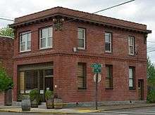
Main Street in Carlton looking west | |
| Motto: A Great Little Town | |
 Location in Oregon | |
| Coordinates: 45°17′37″N 123°10′39″W / 45.29361°N 123.17750°WCoordinates: 45°17′37″N 123°10′39″W / 45.29361°N 123.17750°W | |
| Country | United States |
| State | Oregon |
| County | Yamhill |
| Incorporated | 1899 |
| Government | |
| • Mayor | Kathie Oriet |
| Area[1] | |
| • Total | 0.88 sq mi (2.28 km2) |
| • Land | 0.88 sq mi (2.28 km2) |
| • Water | 0 sq mi (0 km2) |
| Elevation | 198 ft (60.35 m) |
| Population (2010)[2] | |
| • Total | 2,007 |
| • Estimate (2012[3]) | 2,018 |
| • Density | 2,280.7/sq mi (880.6/km2) |
| Time zone | Pacific (UTC-8) |
| • Summer (DST) | Pacific (UTC-7) |
| ZIP code | 97111 |
| Area code(s) | 503 |
| FIPS code | 41-11150[4] |
| GNIS feature ID | 1162876[5] |
| Website | www.ci.carlton.or.us |

Carlton is a city in Yamhill County, Oregon, United States. The population was 2,007 at the 2010 census.
History
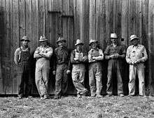
_(yamDA0137).jpg)
The origin of Carlton's name is disputed. An ex-county commissioner claims that the name was derived from Wilson Carl, whereas A. E. Bones, postmaster at Carlton, stated in a 1925 letter that it was named for John Carl, Sr., at the request of R. R. Thompson. These men may have been part of the same family.[6]
Carlton post office was established in 1874, with F. J. Fryer serving as its first postmaster.[6]
Actual history of Carlton, Oregon: Prior to the post office inside the city of Carlton, Wilson Carl, owned the original Post Office, Stagecoach stop, and Blacksmith shop, for the area, about 7 miles West of Carlton, and his home was known as Mountain House. Wilson Carl was the original postmaster. Wilson Carl traveled with Dr. Joel Knight, on the Oregon Trail, to the area, as witnessed in the diary of Amelia Stewart Knight. Wilson Carl negotiated with the railroad in Portland, Oregon, to build closer to his property. Since the original plot was over the mountain West of Carlton, it was a matter of convenience for the railroad to build where it presently is, because negotiating the mountain was not feasible. The population of Carlton expanded to become the city of Carlton, around the railroad. The city is named after Wilson Carl, and, was originally called Carl's town, and, a few other variations of his name were used before the name became Carlton. Wilson Carl began as a pioneer carpenter/builder and shoemaker who became a wealthy land owner, who built a portion of what is now Linfield College, in McMinnville, and was founder of the Republican Party in McMinnville, County Commissioner, and, at one time owned the property that the Yamhill County Courthouse presently sits on. The original post office still exists on his original homestead and plot of land, though it has since been used as a residence for his heirs and is currently unoccupied. There is further information about the name variations used for Carlton, in a former Oregon Blue Book.
Geography
According to the United States Census Bureau, the city has a total area of 0.88 square miles (2.28 km2), all of it land.[1]
Demographics
| Historical population | |||
|---|---|---|---|
| Census | Pop. | %± | |
| 1880 | 243 | — | |
| 1900 | 145 | — | |
| 1910 | 386 | 166.2% | |
| 1920 | 552 | 43.0% | |
| 1930 | 749 | 35.7% | |
| 1940 | 864 | 15.4% | |
| 1950 | 1,081 | 25.1% | |
| 1960 | 959 | −11.3% | |
| 1970 | 1,126 | 17.4% | |
| 1980 | 1,302 | 15.6% | |
| 1990 | 1,289 | −1.0% | |
| 2000 | 1,514 | 17.5% | |
| 2010 | 2,007 | 32.6% | |
| Est. 2015 | 2,067 | [7] | 3.0% |
2010 census
As of the census[2] of 2010, there were 2,007 people, 702 households, and 541 families residing in the city. The population density was 2,280.7 inhabitants per square mile (880.6/km2). There were 769 housing units at an average density of 873.9 per square mile (337.4/km2). The racial makeup of the city was 90.6% White, 0.2% African American, 0.9% Native American, 0.8% Asian, 0.4% Pacific Islander, 2.5% from other races, and 4.5% from two or more races. Hispanic or Latino of any race were 5.8% of the population.
There were 702 households of which 43.0% had children under the age of 18 living with them, 57.5% were married couples living together, 13.8% had a female householder with no husband present, 5.7% had a male householder with no wife present, and 22.9% were non-families. 17.0% of all households were made up of individuals and 6% had someone living alone who was 65 years of age or older. The average household size was 2.86 and the average family size was 3.22.
The median age in the city was 34.3 years. 30.2% of residents were under the age of 18; 7.9% were between the ages of 18 and 24; 28% were from 25 to 44; 24.6% were from 45 to 64; and 9.3% were 65 years of age or older. The gender makeup of the city was 49.9% male and 50.1% female.
2000 census
As of the census[4] of 2000, there were 1,514 people, 540 households, and 412 families residing in the city. The population density was 1,745.1 people per square mile (671.9/km²). There were 578 housing units at an average density of 666.2 per square mile (256.5/km²). The racial makeup of the city was 91.81% White, 0.13% African American, 1.59% Native American, 0.26% Asian, 0.07% Pacific Islander, 3.24% from other races, and 2.91% from two or more races. Hispanic or Latino of any race were 4.62% of the population.
There were 540 households out of which 42.6% had children under the age of 18 living with them, 60.2% were married couples living together, 10.7% had a female householder with no husband present, and 23.7% were non-families. 19.4% of all households were made up of individuals and 6.3% had someone living alone who was 65 years of age or older. The average household size was 2.80 and the average family size was 3.23.
In the town the population was spread out with 31.3% under the age of 18, 7.8% from 18 to 24, 31.0% from 25 to 44, 20.7% from 45 to 64, and 9.2% who were 65 years of age or older. The median age was 33 years. For every 100 females there were 106.5 males. For every 100 females age 18 and over, there were 103.5 males.
The median income for a household in the town was $41,827, and the median income for a family was $45,972. Males had a median income of $35,577 versus $23,661 for females. The per capita income for the city was $16,850. About 4.5% of families and 6.7% of the population were below the poverty line, including 7.2% of those under age 18 and 6.9% of those age 65 or over.
Education
Residents are zoned to the Yamhill Carlton School District, headquartered in Yamhill.[9]
Yamhill Carlton Elementary School (YCES) is located in Carlton,[10] and Yamhill Carlton Intermediate School (YCIS) and Yamhill Carlton High School (YCHS) are in Yamhill.[11][12]
Notable people
- Matt Marshall, golfer
References
- 1 2 "US Gazetteer files 2010". United States Census Bureau. Archived from the original on 2012-07-14. Retrieved 2012-12-21.
- 1 2 "American FactFinder". United States Census Bureau. Retrieved 2012-12-21.
- ↑ "Population Estimates". United States Census Bureau. Archived from the original on 2013-06-17. Retrieved 2013-06-02.
- 1 2 "American FactFinder". United States Census Bureau. Archived from the original on 2013-09-11. Retrieved 2008-01-31.
- ↑ "US Board on Geographic Names". United States Geological Survey. 2007-10-25. Retrieved 2008-01-31.
- 1 2 McArthur, Lewis A.; Lewis L. McArthur (1982) [1928]. Oregon Geographic Names (Fifth ed.). Portland, Oregon: Oregon Historical Society Press. p. 128. ISBN 0-87595-114-7.
- ↑ "Annual Estimates of the Resident Population for Incorporated Places: April 1, 2010 to July 1, 2015". Retrieved July 2, 2016.
- ↑ "Census of Population and Housing". Census.gov. Archived from the original on May 11, 2015. Retrieved June 4, 2015.
- ↑ "Welcome to Yamhill Carlton School District!." Yamhill Carlton School District. Retrieved on October 10, 2010. "120 N. Larch Place · Yamhill, OR 97148 "
- ↑ "Welcome to Yamhill Carlton Elementary School!." Yamhill Carlton School District. Retrieved on October 10, 2010. "420 S. Third St. · Carlton, Oregon 97111"
- ↑ "Welcome to Yamhill Carlton Elementary School!." Yamhill Carlton School District. Retrieved on October 10, 2010. "275 N. Maple Street · Yamhill, Oregon 97148"
- ↑ "Welcome to Yamhill Carlton Intermediate School!." Yamhill Carlton School District. Retrieved on October 10, 2010. "310 E. Main St. · Yamhill, Oregon 97148"
External links
 Media related to Carlton, Oregon at Wikimedia Commons
- Entry for Carlton in the Oregon Blue Book
Municipalities and communities of Yamhill County, Oregon, United States | ||
|---|---|---|
| Cities | 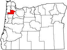 | |
| CDPs | ||
| Other unincorporated communities | ||
| Indian reservation | ||
| Footnotes | ‡This populated place also has portions in an adjacent county or counties | |