Caswell, Wisconsin
| Caswell, Wisconsin | |
|---|---|
| Town | |
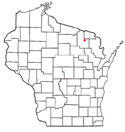 Location of Caswell, Wisconsin | |
 The Towns of Ross and Caswell | |
| Coordinates: 45°39′23″N 88°40′33″W / 45.65639°N 88.67583°WCoordinates: 45°39′23″N 88°40′33″W / 45.65639°N 88.67583°W | |
| Country | United States |
| State | Wisconsin |
| County | Forest |
| Area | |
| • Total | 47.9 sq mi (124.1 km2) |
| • Land | 47.7 sq mi (123.6 km2) |
| • Water | 0.2 sq mi (0.4 km2) |
| Elevation[1] | 1,496 ft (456 m) |
| Population (2010) | |
| • Total | 91 |
| • Density | 1.9/sq mi (0.73/km2) |
| Time zone | Central (CST) (UTC-6) |
| • Summer (DST) | CDT (UTC-5) |
| Area code(s) | 715 & 534 |
| FIPS code | 55-13125[2] |
| GNIS feature ID | 1582930[1] |
Caswell is a town in Forest County, Wisconsin, United States. The population was 91 at the 2010 census.[3] The unincorporated communities of Cavour and Laona Junction are located within the town.[4] The ghost town of Bagdad was located in the town.
History
The Town of Caswell was created from land in the Town of Cavour by an act of the Wisconsin Legislature in 1901. The remainder of the Town of Cavour, which ceased to exist at that point, went to create the Town of Wabeno.[5]
Geography
According to the United States Census Bureau, the town has a total area of 47.9 square miles (124 km2), of which 47.7 square miles (124 km2) is land and 0.2 square miles (0.52 km2), or 0.35%, is water. The Peshtigo River runs through the town. U.S. Route 8, Wisconsin Highway 139, and Forest County Roads G and O are the highway routes that run through the town.
Demographics
| Historical population | |||
|---|---|---|---|
| Census | Pop. | %± | |
| 1910 | 216 | — | |
| 1920 | 798 | 269.4% | |
| 1930 | 244 | −69.4% | |
| 1940 | 199 | −18.4% | |
| 1950 | 133 | −33.2% | |
| 1960 | 107 | −19.5% | |
| 1970 | 96 | −10.3% | |
| 1980 | 85 | −11.5% | |
| 1990 | 94 | 10.6% | |
| 2000 | 102 | 8.5% | |
| 2010 | 91 | −10.8% | |
| U.S. Decennial Census[6] 1910, 1920[7] 1930, 1940, 1950[8] 1960, 1970, 1980[9] 1980, 1990, 2000[10] 2000, 2010[2] | |||
As of the census[2] of 2000, there were 102 people, 41 households, and 28 families residing in the town. The population density was 2.1 people per square mile (0.8/km²). There were 156 housing units at an average density of 3.3 per square mile (1.3/km²). The racial makeup of the town was 89.22% White, 2.94% African American, 2.94% Native American, 2.94% from other races, and 1.96% from two or more races. Hispanic or Latino of any race were 3.92% of the population.
There were 41 households out of which 31.7% had children under the age of 18 living with them, 56.1% were married couples living together, 7.3% had a female householder with no husband present, and 31.7% were non-families. 29.3% of all households were made up of individuals and 14.6% had someone living alone who was 65 years of age or older. The average household size was 2.49 and the average family size was 2.96.
In the town the population was spread out with 29.4% under the age of 18, 2.0% from 18 to 24, 33.3% from 25 to 44, 19.6% from 45 to 64, and 15.7% who were 65 years of age or older. The median age was 40 years. For every 100 females there were 108.2 males. For every 100 females age 18 and over, there were 111.8 males.
The median income for a household in the town was $37,750, and the median income for a family was $39,375. Males had a median income of $30,417 versus $20,417 for females. The per capita income for the town was $15,560. There were 21.2% of families and 22.5% of the population living below the poverty line, including 34.8% of under eighteens and 20.0% of those over 64.
References
- 1 2 "US Board on Geographic Names". United States Geological Survey. 2007-10-25. Retrieved 2008-01-31.
- 1 2 3 "American FactFinder". United States Census Bureau. Archived from the original on 2013-09-11. Retrieved 2008-01-31.
- ↑ "Race, Hispanic or Latino, Age, and Housing Occupancy: 2010 Census Redistricting Data (Public Law 94-171) Summary File (QT-PL), Caswell town, Wisconsin". U.S. Census Bureau, American FactFinder 2. Archived from the original on September 11, 2013. Retrieved August 12, 2011.
- ↑ Wisconsin Department of Transportation-Forest County map
- ↑ "Chapter 67". Laws of Wisconsin: 85. 1901.
- ↑ "U.S. Decennial Census". United States Census Bureau. Archived from the original on April 22, 2013. Retrieved July 4, 2014.
- ↑ "Vol 1: Population, 1920. Number and distribution of inhabitants". 1920 Census of Population and Housing. US Census Bureau: 699, Wisconsin, Table 53. 1920.
- ↑ "Vol 1: Number of Inhabitants". 1950 Census of Population. US Census Bureau: 49-13, Wisconsin, Table 6. 1950.
- ↑ "Vol 1: Characteristics of the Population". 1970 Census of Population. US Census Bureau: 15-15, Wisconsin, Table 10: Population of County subdivisions 1960, 1970. 1970.
- ↑ "Census 2000" (PDF). US Census Bureau. p. 32, Wisconsin, Table 6. Population and Housing Units: 1980 to 2000. Retrieved November 8, 2014.
Municipalities and communities of Forest County, Wisconsin, United States | ||
|---|---|---|
| City | 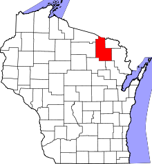 | |
| Towns | ||
| CDPs | ||
| Unincorporated communities | ||
| Indian reservations | ||
| Ghost towns | ||
| Footnotes | ‡This populated place also has portions in an adjacent county or counties | |