Newald, Wisconsin
| Newald, Wisconsin | |
|---|---|
| Census-designated place | |
 Newald, Wisconsin | |
| Coordinates: 45°44′19″N 88°42′19″W / 45.73861°N 88.70528°WCoordinates: 45°44′19″N 88°42′19″W / 45.73861°N 88.70528°W | |
| Country | United States |
| State | Wisconsin |
| County | Forest |
| Area | |
| • Total | 0.820 sq mi (2.12 km2) |
| • Land | 0.820 sq mi (2.12 km2) |
| • Water | 0 sq mi (0 km2) |
| Elevation | 1,572 ft (479 m) |
| Population (2010) | |
| • Total | 95 |
| • Density | 120/sq mi (45/km2) |
| Time zone | Central (CST) (UTC-6) |
| • Summer (DST) | CDT (UTC-5) |
| Area code(s) | 715 & 534 |
| GNIS feature ID | 1580002[1] |
Newald (also Ross) is an unincorporated census-designated place in the town of Ross, Forest County, Wisconsin, United States. Newald is located near Wisconsin Highway 139 15 miles (24 km) northeast of Crandon. As of the 2010 census, its population is 95.[2]
History
Newald was originally called Ross, for Charles Ross, a pioneer settler, and under the latter name was platted in 1905.[3][1] The community was renamed Newald in 1906 in honor of a local landowner.[3] A post office was established as Newald in 1905, and remained in operation until it was discontinued in 1985.[4]
References
- 1 2 U.S. Geological Survey Geographic Names Information System: Newald, Wisconsin
- ↑ "American FactFinder". U.S. Census Bureau. Retrieved 15 April 2011.
- 1 2 Chicago and North Western Railway Company (1908). A History of the Origin of the Place Names Connected with the Chicago & North Western and Chicago, St. Paul, Minneapolis & Omaha Railways. p. 106.
- ↑ "Forest County". Jim Forte Postal History. Retrieved 23 March 2015.
Municipalities and communities of Forest County, Wisconsin, United States | ||
|---|---|---|
| City | 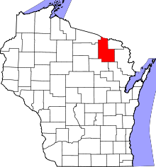 | |
| Towns | ||
| CDPs | ||
| Unincorporated communities | ||
| Indian reservations | ||
| Ghost towns | ||
| Footnotes | ‡This populated place also has portions in an adjacent county or counties | |
This article is issued from Wikipedia - version of the 10/23/2016. The text is available under the Creative Commons Attribution/Share Alike but additional terms may apply for the media files.