Champion, New York
| Champion, New York | |
|---|---|
| Town | |
 Champion, New York Location within the state of New York | |
| Coordinates: 43°58′N 75°41′W / 43.967°N 75.683°W | |
| Country | United States |
| State | New York |
| County | Jefferson |
| Government | |
| • Type | Town Council |
| • Town Supervisor | Terry L. Buckley (R) |
| • Town Council |
Members' List
|
| Area | |
| • Total | 45.1 sq mi (116.7 km2) |
| • Land | 44.3 sq mi (114.7 km2) |
| • Water | 0.8 sq mi (2.0 km2) |
| Elevation | 968 ft (295 m) |
| Population (2010) | |
| • Total | 4,494 |
| • Density | 101.7/sq mi (39.3/km2) |
| Time zone | Eastern (EST) (UTC-5) |
| • Summer (DST) | EDT (UTC-4) |
| ZIP code | 13619 |
| Area code(s) | 315 |
| FIPS code | 36-13717 |
| GNIS feature ID | 0978808 |
| Website | www.racog.org |
Champion is a town in Jefferson County, New York, USA. The population was 4,494 at the 2010 census. The town is named after General Henry Champion, early owner.
The Town of Champion is in the southern part of the county and is east of Watertown.
History
Settlement began around 1798. General Henry Champion purchased the lands and sent his surveyor, Noadiah Hubbard to the land. Hubbard settled in the area where his homestead still exist today.
Champion was the birthplace of George E. Spencer (1836-1893), a Union general in the Civil War who later served two terms as a United States Senator from Alabama.
The town was established in 1800 from part of the Town of Mexico (Now in Oswego County) before the county was created. It was named after Henry Champion, who in return for his gratitude, commissioned a bell for the town church. In 1803, part of the town was used to establish part of the Town of Harrisburg (now in Lewis County). Early settlers hoped the town would become the locale for the county seat, but were disappointed.
The community of West Carthage set itself apart from the town in 1889 by incorporating as a village.
The Hiram Hubbard House was added to the National Register of Historic Places in 2012.[1]
Geography
According to the United States Census Bureau, the town has a total area of 45.1 square miles (117 km2), of which, 44.3 square miles (115 km2) of it is land and 0.8 square miles (2.1 km2) of it (1.71%) is water.
The Black River flows along the town's east boundary. The southeast town line is the border of Lewis County.
New York State Route 126 is a major east-west highway. Another east-west highway in the northern part of Champion intersects north-south highway New York State Route 26 at Great Bend.
Demographics
| Historical population | |||
|---|---|---|---|
| Census | Pop. | %± | |
| 1820 | 2,080 | — | |
| 1830 | 2,342 | 12.6% | |
| 1840 | 2,206 | −5.8% | |
| 1850 | 2,085 | −5.5% | |
| 1860 | 2,132 | 2.3% | |
| 1870 | 2,156 | 1.1% | |
| 1880 | 2,259 | 4.8% | |
| 1890 | 2,191 | −3.0% | |
| 1900 | 2,525 | 15.2% | |
| 1910 | 2,704 | 7.1% | |
| 1920 | 2,854 | 5.5% | |
| 1930 | 3,001 | 5.2% | |
| 1940 | 3,103 | 3.4% | |
| 1950 | 3,499 | 12.8% | |
| 1960 | 3,878 | 10.8% | |
| 1970 | 4,371 | 12.7% | |
| 1980 | 4,056 | −7.2% | |
| 1990 | 4,574 | 12.8% | |
| 2000 | 4,361 | −4.7% | |
| 2010 | 4,494 | 3.0% | |
| Est. 2014 | 4,639 | [2] | 3.2% |
As of the census[4] of 2000, there were 4,361 people, 1,675 households, and 1,190 families residing in the town. The population density was 98.4 people per square mile (38.0/km²). There were 1,906 housing units at an average density of 43.0 per square mile (16.6/km²). The racial makeup of the town was 92.85% White, 2.75% African American, 0.62% Native American, 1.05% Asian, 0.14% Pacific Islander, 0.89% from other races, and 1.70% from two or more races. Hispanic or Latino of any race were 2.89% of the population.
There were 1,675 households out of which 36.5% had children under the age of 18 living with them, 59.0% were married couples living together, 8.6% had a female householder with no husband present, and 28.9% were non-families. 23.9% of all households were made up of individuals and 11.6% had someone living alone who was 65 years of age or older. The average household size was 2.60 and the average family size was 3.06.
In the town the population was spread out with 27.8% under the age of 18, 8.8% from 18 to 24, 30.2% from 25 to 44, 21.1% from 45 to 64, and 12.2% who were 65 years of age or older. The median age was 35 years. For every 100 females there were 93.1 males. For every 100 females age 18 and over, there were 93.8 males.
The median income for a household in the town was $34,875, and the median income for a family was $41,415. Males had a median income of $35,093 versus $21,386 for females. The per capita income for the town was $15,951. About 7.6% of families and 10.5% of the population were below the poverty line, including 12.0% of those under age 18 and 8.2% of those age 65 or over.
Communities and locations in Champion
- Champion – The hamlet of Champion is west of West Carthage village, located on NY-126.
- Champion Hill was the 1954 birthplace of local TV for the Kingston-Watertown market; see WWNY-TV and WPBS-TV.
- Champion Huddle – A location north of Champion village, located on the Huddle Creek and County Road 47.
- Fort Drum – A small part of the military reservation is in the town by the Black River.
- Great Bend – A hamlet on the Black River in the northern part of the town on NY-3 and NY-26.
- Huddle Creek – A stream flowing northward past Champion village and Champion Huddle.
- Pleasant Lake – A lake by the south town line.
- West Carthage – The Village of West Carthage is on the east border of the town by the Black River and NY-26.
References
- ↑ National Park Service (2010-07-09). "National Register Information System". National Register of Historic Places. National Park Service.
- ↑ "Annual Estimates of the Resident Population for Incorporated Places: April 1, 2010 to July 1, 2014". Retrieved June 4, 2015.
- ↑ "Census of Population and Housing". Census.gov. Archived from the original on May 11, 2015. Retrieved June 4, 2015.
- ↑ "American FactFinder". United States Census Bureau. Archived from the original on 2013-09-11. Retrieved 2008-01-31.
External links
Municipalities and communities of Jefferson County, New York, United States | ||
|---|---|---|
| City | 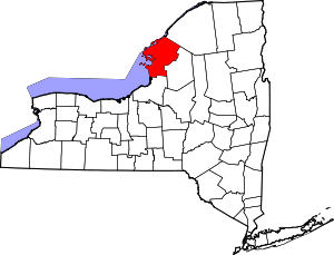 | |
| Towns | ||
| Villages | ||
| CDPs |
| |
| Hamlets | ||
Coordinates: 43°58′N 75°41′W / 43.967°N 75.683°W