Adams, New York
| Adams | |
| Town | |
| Country | United States |
|---|---|
| State | New York |
| County | Jefferson County |
| Elevation | 619 ft (188.7 m) |
| Coordinates | 43°48′36″N 76°01′26″W / 43.81000°N 76.02389°WCoordinates: 43°48′36″N 76°01′26″W / 43.81000°N 76.02389°W |
| Area | 42.5 sq mi (110.1 km2) |
| - land | 42.4 sq mi (110 km2) |
| - water | 0.04 sq mi (0 km2), 0.09% |
| Population | 5,143 (2010) |
| Density | 121/sq mi (46.7183612/km2) |
| Incorporated | 1802 |
| Town Supervisor | David W. Kellogg (R)
|
| Timezone | EST (UTC-5) |
| - summer (DST) | EDT (UTC-4) |
| ZIP code | 13605, 13606 |
| Area code | 315 |
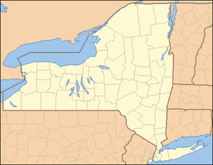 Location of Adams in New York
| |
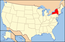 Location of New York in the United States
| |
| Website: http://www.tughill.org/Towns.htm | |
Adams is a town in Jefferson County, New York, USA. Named after President John Adams, the population was 5,143 at the 2010 census.
The Town of Adams also contains a village named Adams. Both village and town are centrally located in the county and are south of Watertown.
History
Settlement began around 1800 at Adams village. David Smith built a sawmill at the present site of Adams in 1801. Renamed for John Adams in 1802 (the year after his presidency ended), the Town of Adams was created from the survey townships of Aleppo and Orpheus. The eastern part of Adams was taken in 1804 to form the Town of Rodman. During the War of 1812, the town formed a local militia for home defense. In more recent times, the town has served as the home of the 46-unit chain restaurant Jreck Subs.
The Talcott Falls Site was listed on the National Register of Historic Places in 1974.[1]
Residents of note
- William E. Blackstone, evangelical Christian and Zionist.
- Henry Keep, (1818–1869), born in Adams, noted financier and president of several railroad firms, he left an estate of over four million dollars.[2]
- Nicholas Doxtater Yost, attorney and president of the Adams Farmer’s National Bank; relative of Henry Keep and father of U.N. Ambassador Charles W. Yost.
- J. Sterling Morton, father of Arbor Day, was born in Adams village.
- Henry Benjamin Whipple, first Episcopal bishop of Minnesota
- Charles Grandison Finney, prominent evangelist
- Philander Smith, son of mill operator and original settler David Smith, eponym of Philander Smith College and father-in-law of William E. Blackstone (above)
- Rob Krone, WWNY-TV (Channel 7) sports anchor
Geography
According to the United States Census Bureau, the town has a total area of 42.4 square miles (109.9 km²), of which, 42.4 square miles (109.8 km²) of it is land and 0.04 square miles (0.1 km²) of it (0.05%) is water.
Interstate 81 is a major north-south highway through the middle of Adams. New York State Route 177 runs eastward from U.S. Route 11, another north-south highway, at Adams Center. New York State Route 178 runs westward from Adams village.
The town is located in an area called the Tug Hill Plateau. Sandy Creek flows westward through the south part of the town, and Stony Creek flows through the northwest corner.
Demographics
| Historical population | |||
|---|---|---|---|
| Census | Pop. | %± | |
| 1820 | 2,467 | — | |
| 1830 | 2,995 | 21.4% | |
| 1840 | 2,966 | −1.0% | |
| 1850 | 3,106 | 4.7% | |
| 1860 | 3,496 | 12.6% | |
| 1870 | 3,348 | −4.2% | |
| 1880 | 3,302 | −1.4% | |
| 1890 | 3,181 | −3.7% | |
| 1900 | 3,081 | −3.1% | |
| 1910 | 3,128 | 1.5% | |
| 1920 | 3,194 | 2.1% | |
| 1930 | 3,284 | 2.8% | |
| 1940 | 3,334 | 1.5% | |
| 1950 | 3,629 | 8.8% | |
| 1960 | 3,964 | 9.2% | |
| 1970 | 4,381 | 10.5% | |
| 1980 | 4,390 | 0.2% | |
| 1990 | 4,977 | 13.4% | |
| 2000 | 4,782 | −3.9% | |
| 2010 | 5,143 | 7.5% | |
| Est. 2014 | 5,302 | [3] | 3.1% |
As of the census[5] of 2000, there were 4,782 people, 1,864 households, and 1,293 families residing in the town. The population density was 112.8 people per square mile (43.5/km²). There were 2,019 housing units at an average density of 47.6 per square mile (18.4/km²). The racial makeup of the town was 97.97% White, 0.29% Black or African American, 0.27% Native American, 0.36% Asian, 0.02% Pacific Islander, 0.21% from other races, and 0.88% from two or more races. Hispanic or Latino of any race were 0.65% of the population.
There were 1,864 households, out of which 35.4% had children under the age of 18 living with them, 56.2% were married couples living together, 9.5% had a female householder with no husband present, and 30.6% were non-families. 24.5% of all households were made up of individuals and 11.6% had someone living alone who was 65 years of age or older. The average household size was 2.56 and the average family size was 3.05.
In the town the population was spread out with 27.5% under the age of 18, 6.9% from 18 to 24, 30.0% from 25 to 44, 23.2% from 45 to 64, and 12.3% who were 65 years of age or older. The median age was 37 years. For every 100 females there were 94.9 males. For every 100 females age 18 and over, there were 89.0 males.
The median income for a household in the town was $38,012, and the median income for a family was $48,354. Males had a median income of $34,000 versus $25,610 for females. The per capita income for the town was $17,707. About 6.6% of families and 9.6% of the population were below the poverty line, including 12.7% of those under age 18 and 7.0% of those age 65 or over.
Communities and locations in the Town of Adams
- Adams – The Village of Adams, located near the south town line on US-11 at NY-178.
- Adams Center – A hamlet is located north of Adams village on U.S. Route 11 at NY-177.
- Butterville – A location at the west town line on County Road 76.
- Coopers Corners – A former location in the town.
- Green Settlement – A hamlet on County Road 76 west of Adams Center.
- Honeyville – A location on County Road 177 east of Adams Center.
- Lisk Settlement – A former location in the town.
- Lyon Corners – A location near the west town line on County Road 76.
- North Adams – A hamlet near the northern town line by North Kellog and Cady Roads.
- Sanford Corners – A location on County Road 66 in the northwest corner of the town.
- Talcott Corners – A location on US-11 in the northeast corner of the town.
- Thomas Settlement – A hamlet on NY-178 in the southwest corner of the town.
- Smithville – A hamlet on County Road 75 on the western town line.
References
- ↑ National Park Service (2010-07-09). "National Register Information System". National Register of Historic Places. National Park Service.
- ↑ Who Was Who in America, Historical Volume, 1607-1896. Chicago: Marquis Who's Who. 1963.
- ↑ "Annual Estimates of the Resident Population for Incorporated Places: April 1, 2010 to July 1, 2014". Retrieved June 4, 2015.
- ↑ "Census of Population and Housing". Census.gov. Archived from the original on May 11, 2015. Retrieved June 4, 2015.
- ↑ "American FactFinder". United States Census Bureau. Archived from the original on 2013-09-11. Retrieved 2008-01-31.
External links
- Early Adams history
- Historical/genealogical links
- Historical summary for Adams
- Towns of the Tug Hill Plateau
Municipalities and communities of Jefferson County, New York, United States | ||
|---|---|---|
| City | 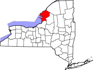 | |
| Towns | ||
| Villages | ||
| CDPs |
| |
| Hamlets | ||