West Carthage, New York
| West Carthage, New York | |
|---|---|
| Village | |
 West Carthage, New York Location within the state of New York | |
| Coordinates: 43°58′25″N 75°37′17″W / 43.97361°N 75.62139°WCoordinates: 43°58′25″N 75°37′17″W / 43.97361°N 75.62139°W | |
| Country | United States |
| State | New York |
| County | Jefferson |
| Area | |
| • Total | 1.3 sq mi (3.4 km2) |
| • Land | 1.2 sq mi (3.1 km2) |
| • Water | 0.1 sq mi (0.3 km2) |
| Elevation | 778 ft (237 m) |
| Population (2010) | |
| • Total | 2,012 |
| Time zone | Eastern (EST) (UTC-5) |
| • Summer (DST) | EDT (UTC-4) |
| ZIP code | 13619 |
| Area code(s) | 315 |
| FIPS code | 36-79499[1] |
| GNIS feature ID | 0969168[2] |
West Carthage is a village in Jefferson County, New York, United States. The population was 2,012 at the 2010 census.
The Village of West Carthage is in the Town of Champion. The village is the east town line, and is east of Watertown. West Carthage is adjacent to the Village of Carthage and is south of Fort Drum.
History
Settlement began around 1798 with a ferry service and tavern established at that location, but development was slower compared to Carthage on the other side of the river in spite of water power available to both communities.
The village was incorporated in 1889, yet the early village government encountered notable resistance to obtaining funds for development.
Geography
West Carthage is located at 43°58′25″N 75°37′17″W / 43.973678°N 75.621355°W.[3]
According to the United States Census Bureau, the village has a total area of 1.3 square miles (3.4 km2), of which, 1.2 square miles (3.1 km2) of it is land and 0.1 square miles (0.26 km2) of it (8.40%) is water.
The village is on the west side of the Black River, which separates it from the Village of Carthage.
West Carthage is at the junction of New York State Route 26 and New York State Route 126.
Demographics
| Historical population | |||
|---|---|---|---|
| Census | Pop. | %± | |
| 1880 | 807 | — | |
| 1890 | 932 | 15.5% | |
| 1900 | 1,135 | 21.8% | |
| 1910 | 1,393 | 22.7% | |
| 1920 | 1,666 | 19.6% | |
| 1930 | 1,722 | 3.4% | |
| 1940 | 1,767 | 2.6% | |
| 1950 | 2,000 | 13.2% | |
| 1960 | 2,167 | 8.4% | |
| 1970 | 2,047 | −5.5% | |
| 1980 | 1,824 | −10.9% | |
| 1990 | 2,166 | 18.8% | |
| 2000 | 2,102 | −3.0% | |
| 2010 | 2,012 | −4.3% | |
| Est. 2015 | 2,065 | [4] | 2.6% |
As of the census[1] of 2000, there were 2,102 people, 830 households, and 557 families residing in the village. The population density was 1,758.3 people per square mile (676.3/km2). There were 915 housing units at an average density of 765.4 per square mile (294.4/km2). The racial makeup of the village was 89.34% White, 4.14% African American, 0.81% Native American, 1.81% Asian, 0.29% Pacific Islander, 1.57% from other races, and 2.05% from two or more races. Hispanic or Latino of any race were 5.38% of the population.
There were 830 households out of which 38.0% had children under the age of 18 living with them, 54.6% were married couples living together, 10.1% had a female householder with no husband present, and 32.8% were non-families. 28.7% of all households were made up of individuals and 15.9% had someone living alone who was 65 years of age or older. The average household size was 2.53 and the average family size was 3.09.
In the village the population was spread out with 29.7% under the age of 18, 10.4% from 18 to 24, 28.7% from 25 to 44, 17.4% from 45 to 64, and 13.8% who were 65 years of age or older. The median age was 32 years. For every 100 females there were 85.9 males. For every 100 females age 18 and over, there were 85.0 males.
The median income for a household in the village was $30,156, and the median income for a family was $34,609. Males had a median income of $33,043 versus $18,971 for females. The per capita income for the village was $14,915. About 9.2% of families and 10.6% of the population were below the poverty line, including 11.9% of those under age 18 and 8.5% of those age 65 or over.
Notable people
- Casey Powell, lacrosse player
- Ryan Powell, lacrosse player
- Michael Powell, lacrosse player
References
- 1 2 "American FactFinder". United States Census Bureau. Retrieved 2008-01-31.
- ↑ "US Board on Geographic Names". United States Geological Survey. 2007-10-25. Retrieved 2008-01-31.
- ↑ "US Gazetteer files: 2010, 2000, and 1990". United States Census Bureau. 2011-02-12. Retrieved 2011-04-23.
- ↑ "Annual Estimates of the Resident Population for Incorporated Places: April 1, 2010 to July 1, 2015". Retrieved July 2, 2016.
- ↑ "Census of Population and Housing". Census.gov. Retrieved June 4, 2015.
External links
Municipalities and communities of Jefferson County, New York, United States | ||
|---|---|---|
| City | 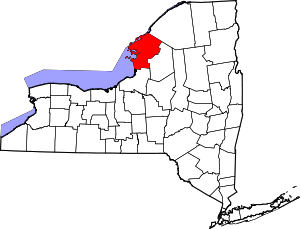 | |
| Towns | ||
| Villages | ||
| CDPs |
| |
| Hamlets | ||