Chardon Township, Geauga County, Ohio
| Chardon Township, Geauga County, Ohio | |
|---|---|
| Township | |
 Location of Chardon Township in Geauga County | |
| Coordinates: 41°37′8″N 81°15′3″W / 41.61889°N 81.25083°WCoordinates: 41°37′8″N 81°15′3″W / 41.61889°N 81.25083°W | |
| Country | United States |
| State | Ohio |
| County | Geauga |
| Area | |
| • Total | 22.9 sq mi (59.2 km2) |
| • Land | 22.8 sq mi (59.2 km2) |
| • Water | 0.0 sq mi (0.1 km2) |
| Elevation[1] | 1,289 ft (393 m) |
| Population (2000) | |
| • Total | 4,763 |
| • Density | 208.5/sq mi (80.5/km2) |
| Time zone | Eastern (EST) (UTC-5) |
| • Summer (DST) | EDT (UTC-4) |
| ZIP code | 44024 |
| Area code(s) | 440 |
| FIPS code | 39-13561[2] |
| GNIS feature ID | 1086150[1] |
Chardon Township is one of the sixteen townships of Geauga County, Ohio, United States. The 2000 census found 4,763 people in the township.[3]
Geography
Located in the northern part of the county, it borders the following townships and municipalities:
- Concord Township, Lake County - north
- Hambden Township - east
- Claridon Township - southeast corner
- Munson Township - south
- Chester Township - southwest corner
- Kirtland - west
- Kirtland Hills - northwest
Most of the city of Chardon, the county seat of Geauga County, is located in southeastern Chardon Township.
Name and history
It is the only Chardon Township statewide.[4]
Government
The township is governed by a three-member board of trustees, who are elected in November of odd-numbered years to a four-year term beginning on the following January 1. Two are elected in the year after the presidential election and one is elected in the year before it. There is also an elected township fiscal officer,[5] who serves a four-year term beginning on April 1 of the year after the election, which is held in November of the year before the presidential election. Vacancies in the fiscal officership or on the board of trustees are filled by the remaining trustees.
Notable residents
References
- 1 2 "US Board on Geographic Names". United States Geological Survey. 2007-10-25. Retrieved 2008-01-31.
- ↑ "American FactFinder". United States Census Bureau. Archived from the original on 2013-09-11. Retrieved 2008-01-31.
- ↑ Geauga County, Ohio — Population by Places Estimates Ohio State University, 2007. Accessed 15 May 2007.
- ↑ "Detailed map of Ohio" (PDF). United States Census Bureau. 2000. Retrieved 2007-02-16.
- ↑ §503.24, §505.01, and §507.01 of the Ohio Revised Code. Accessed 4/30/2009.
- ↑ Warsinskey, Tim (1992-12-16). "Ohio State Not Among Jurevicius' Final Five". The Plain Dealer. Retrieved 2009-02-10.
External links
Municipalities and communities of Geauga County, Ohio, United States | ||
|---|---|---|
| City | 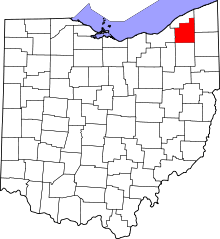 | |
| Villages | ||
| Townships | ||
| CDPs | ||
| Unincorporated communities | ||
| Footnotes | ‡This populated place also has portions in an adjacent county or counties | |