South Russell, Ohio
| South Russell, Ohio | |
|---|---|
| Village | |
|
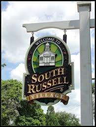
Village limits sign | |
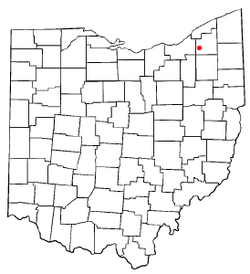 Location of South Russell, Ohio | |
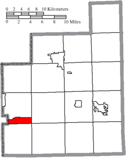 Location of South Russell in Geauga County | |
| Coordinates: 41°25′56″N 81°20′25″W / 41.43222°N 81.34028°WCoordinates: 41°25′56″N 81°20′25″W / 41.43222°N 81.34028°W | |
| Country | United States |
| State | Ohio |
| County | Geauga |
| Government | |
| • Mayor | Matthew E. Brett |
| Area[1] | |
| • Total | 3.83 sq mi (9.92 km2) |
| • Land | 3.75 sq mi (9.71 km2) |
| • Water | 0.08 sq mi (0.21 km2) |
| Elevation[2] | 1,122 ft (342 m) |
| Population (2010)[3] | |
| • Total | 3,810 |
| • Estimate (2012[4]) | 3,822 |
| • Density | 1,016.0/sq mi (392.3/km2) |
| Time zone | Eastern (EST) (UTC-5) |
| • Summer (DST) | EDT (UTC-4) |
| FIPS code | 39-73684[5] |
| GNIS feature ID | 1049194[2] |
| Website | http://www.southrussell.com/ |
South Russell is a village in Geauga County, Ohio, United States. The population was 3,810 at the 2010 census.
History
South Russell was incorporated in 1923, as of 2015 the last village in Geauga County to have done so.[6][7]
Geography
South Russell is located at 41°25′56″N 81°20′25″W / 41.43222°N 81.34028°W (41.432175, -81.340201).[8]
According to the United States Census Bureau, the village has a total area of 3.83 square miles (9.92 km2), of which 3.75 square miles (9.71 km2) is land and 0.08 square miles (0.21 km2) is water.[1]
Demographics
| Historical population | |||
|---|---|---|---|
| Census | Pop. | %± | |
| 1930 | 141 | — | |
| 1940 | 231 | 63.8% | |
| 1950 | 349 | 51.1% | |
| 1960 | 1,276 | 265.6% | |
| 1970 | 2,673 | 109.5% | |
| 1980 | 2,784 | 4.2% | |
| 1990 | 3,402 | 22.2% | |
| 2000 | 4,022 | 18.2% | |
| 2010 | 3,810 | −5.3% | |
| Est. 2015 | 3,826 | [9] | 0.4% |
98.07% spoke English and 1.93% French.[11]
2010 census
As of the census[3] of 2010, there were 3,810 people, 1,373 households, and 1,121 families residing in the village. The population density was 1,016.0 inhabitants per square mile (392.3/km2). There were 1,436 housing units at an average density of 382.9 per square mile (147.8/km2). The racial makeup of the village was 97.5% White, 0.4% African American, 0.1% Native American, 1.2% Asian, 0.1% Pacific Islander, 0.1% from other races, and 0.7% from two or more races. Hispanic or Latino of any race were 0.8% of the population.
There were 1,373 households of which 41.2% had children under the age of 18 living with them, 73.5% were married couples living together, 5.4% had a female householder with no husband present, 2.8% had a male householder with no wife present, and 18.4% were non-families. 16.5% of all households were made up of individuals and 7.7% had someone living alone who was 65 years of age or older. The average household size was 2.77 and the average family size was 3.13.
The median age in the village was 44.9 years. 29.1% of residents were under the age of 18; 4.8% were between the ages of 18 and 24; 16.4% were from 25 to 44; 35.7% were from 45 to 64; and 14.1% were 65 years of age or older. The gender makeup of the village was 49.7% male and 50.3% female.
2000 census
As of the census[5] of 2000, there were 4,022 people, 1,364 households, and 1,159 families residing in the village. The population density was 1,043.6 people per square mile (403.4/km²). There were 1,401 housing units at an average density of 363.5 per square mile (140.5/km²). The racial makeup of the village was 98.43% White, 0.35% African American, 0.80% Asian, and 0.42% from two or more races. Hispanic or Latino of any race were 0.72% of the population.
There were 1,364 households out of which 47.0% had children under the age of 18 living with them, 77.6% were married couples living together, 5.1% had a female householder with no husband present, and 15.0% were non-families. 13.4% of all households were made up of individuals and 6.6% had someone living alone who was 65 years of age or older. The average household size was 2.95 and the average family size was 3.26.
In the village the population was spread out with 32.8% under the age of 18, 3.8% from 18 to 24, 23.7% from 25 to 44, 28.8% from 45 to 64, and 10.9% who were 65 years of age or older. The median age was 40 years. For every 100 females there were 96.3 males. For every 100 females age 18 and over, there were 91.3 males.
The median income for a household in the village was $94,714, and the median income for a family was $103,174. Males had a median income of $84,783 versus $38,854 for females. The per capita income for the village was $41,091. None of the families and 0.6% of the population were living below the poverty line, including no under eighteens and none of those over 64.
Education
South Russell is served by the Chagrin Falls Exempted Village School District.
References
- 1 2 "US Gazetteer files 2010". United States Census Bureau. Retrieved 2013-01-06.
- 1 2 "US Board on Geographic Names". United States Geological Survey. 2007-10-25. Retrieved 2008-01-31.
- 1 2 "American FactFinder". United States Census Bureau. Retrieved 2013-01-06.
- ↑ "Population Estimates". United States Census Bureau. Retrieved 2013-06-17.
- 1 2 "American FactFinder". United States Census Bureau. Retrieved 2008-01-31.
- ↑ Exner, Rich (June 23, 2015). "South Russell, Ohio, demographics, other village information". cleveland.com. Plain Dealer Publishing Co. Retrieved June 23, 2015.
- ↑ Hosmer, Patricia; Hosmer, Phillip Wayne (1992). "History". http://southrussell.com/. South Russell Village. Retrieved June 23, 2015. External link in
|website=(help) - ↑ "US Gazetteer files: 2010, 2000, and 1990". United States Census Bureau. 2011-02-12. Retrieved 2011-04-23.
- ↑ "Annual Estimates of the Resident Population for Incorporated Places: April 1, 2010 to July 1, 2015". Retrieved July 2, 2016.
- ↑ "Census of Population and Housing". Census.gov. Retrieved June 4, 2015.
- ↑ http://www.mla.org/cgi-shl/docstudio/docs.pl?map_data_results
External links
Municipalities and communities of Geauga County, Ohio, United States | ||
|---|---|---|
| City | 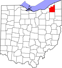 | |
| Villages | ||
| Townships | ||
| CDPs | ||
| Unincorporated communities | ||
| Footnotes | ‡This populated place also has portions in an adjacent county or counties | |