Chelsfield
| Chelsfield | |
 Chelsfield |
|
| Population | 14,507 (2011 Census. Chelsfield and Pratts Bottom Ward)[1] |
|---|---|
| OS grid reference | TQ482642 |
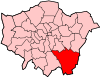
| London borough | Bromley |
| Ceremonial county | Greater London |
| Region | London |
| Country | England |
| Sovereign state | United Kingdom |
| Post town | ORPINGTON |
| Postcode district | BR6 |
| Dialling code | 01689 |
| Police | Metropolitan |
| Fire | London |
| Ambulance | London |
| EU Parliament | London |
| UK Parliament | Orpington |
| London Assembly | Bexley and Bromley |
Coordinates: 51°21′29″N 0°07′40″E / 51.358155°N 0.127800°E
Chelsfield is a large village in Greater London, England within the London Borough of Bromley. It is located south east of Orpington, near London's county border with the Kent Sevenoaks District. .
History
The name is recorded in the Domesday Book of 1086 as Cillesfelle, meaning land of a man called Cēol.[2]
It formed an ancient parish, and later civil parish of 3,378 acres (14 km2), in Kent.[3] It was part of the Bromley Rural District from 1894.[3] The parish included Green Street Green and Pratt's Bottom and stretched as far as Cudham and Orpington.[3] The parish was abolished in 1934 and its former area became part of the Orpington parish and urban district.[4] In 1965 it was transferred to Greater London, to form part of the London Borough of Bromley.[4]
Geography
In practice, Chelsfield is split into two very distinct areas; the historic Chelsfield Village sited to the East of the main Orpington bypass (the A224) and the area New Chelsfield which grew up in the first half of the 20th century after the sale of some of the Waring family estates. Although only about 1 mile (1.6 km) apart from each other, they are very different in nature.
The A224, known here as Court Road, now separates the historic village from its Anglican church which is dedicated to St Martin of Tours and which dates back, in parts, to the 12th Century.[5]
Amenities
Chelsfield Village has a primary school, a playground, a village hall and playing fields used by the local cricket club. There is a pub, the Five Bells, and the church Parish Rooms sited next to the Rectory in Skibbs Lane. There are no shops at all. The privately operated Chelsfield Park Hospital, housed in the former rectory, is situated on the outskirts of the village.
New Chelsfield, has a wide variety of shops along Windsor Drive ranging from a funeral directors and a car spares shop to hairdressers, grocery stores, a betting shop, a fish & chip takeaway and an Indian restaurant. There is also a pub, The Chelsfield (also previously known as The Heavy Horse). Windsor Drive also has the Chelsfield Community Centre, a Baptist church and GP's surgery.
Transport
Chelsfield station serves the area with rail services to London Charing Cross via Grove Park and to Sevenoaks. Chelsfield is served by two Transport for London bus services, the R1 with services to St Pauls Cray via Orpington and to Green Street Green, also the R3 with services to Locksbottom via Petts Wood and Orpington.
Notable Residents
- Brass Crosby 18th Century parliamentarian and one-time Lord Mayor of London
- Edith Nesbit Late 19th / Early 20th Century author
- Dora Jessie Saint, better known by her pseudonym of Miss Read. 20th Century author.
Nearest Places
- Pratt's Bottom
- Orpington
- Green Street Green
- St Mary Cray
- Halstead
- Farnborough
- St Pauls Cray
- Petts Wood
- Crockenhill
- Eynsford
- Knockholt
- Downe
- Locksbottom
- Swanley
- Foots Cray
- Cudham
External links
- http://www.chelsfieldhistory.org.uk/index.htm# Chelsfield Community Archive
- http://meadinkent.co.uk/chelsfieldevents/ Chelsfield Village Events
- http://www.stmartinchelsfield.org.uk/about.html St Martins of Tours Church, Chelsfield
- http://www.thefivebells-chelsfieldvillage.co.uk/ Five Bells Pub, Chelsfield Village
- http://www.gladewoodtaverns.co.uk/chelsfield_orpington.html The Chelsfield Pub
References
- ↑ "Bromley Ward population 2011". Neighbourhood Statistics. Office for National Statistics. Retrieved 10 October 2016.
- ↑ Mills, A., Oxford Dictionary of London Place Names, (2001)
- 1 2 3 Vision of Britain - Chelsfield parish (historic boundaries Archived 1 October 2007 at the Wayback Machine.)
- 1 2 Vision of Britain - Orpington parish Archived 11 March 2007 at the Wayback Machine.
- ↑ http://www.stmartinchelsfield.org.uk/about.html