Chesterland, Ohio
| Chesterland, Ohio | |
|---|---|
| CDP | |
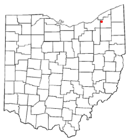 Location of Chesterland, Ohio | |
| Coordinates: 41°31′22″N 81°20′14″W / 41.52278°N 81.33722°WCoordinates: 41°31′22″N 81°20′14″W / 41.52278°N 81.33722°W | |
| Country | United States |
| State | Ohio |
| County | Geauga |
| Area | |
| • Total | 4.4 sq mi (11.4 km2) |
| • Land | 4.4 sq mi (11.4 km2) |
| • Water | 0.0 sq mi (0.0 km2) |
| Elevation[1] | 1,214 ft (370 m) |
| Population (2000) | |
| • Total | 2,646 |
| • Density | 601.7/sq mi (232.3/km2) |
| Time zone | Eastern (EST) (UTC-5) |
| • Summer (DST) | EDT (UTC-4) |
| ZIP code | 44026 |
| Area code(s) | 440 |
| FIPS code | 39-14100[2] |
| GNIS feature ID | 1060956[1] |
Chesterland is a census-designated place (CDP) in Geauga County, Ohio, United States. The population was 2,646 at the 2000 census.
Former MLB player and current baseball broadcaster Rick Manning lives in Chesterland. Not to mention a host of West Geauga graduates that work as members of the media in various cities across the United States, including: Anthony Lima, Jamie Sullivan, Michael Picha and Alicia Scicolone.
History
A post office called Chester Cross Roads was established in 1826, and the name was changed to Chesterland in 1898.[3] Chesterland derives its name from Chester, Massachusetts.[4]
Geography
Chesterland is located at 41°31′22″N 81°20′14″W / 41.52278°N 81.33722°W (41.522901, -81.337157).[5]
According to the United States Census Bureau, the CDP has a total area of 4.4 square miles (11 km2), of which 4.4 square miles (11 km2) is land and 0.23% is water.
The town center of Chesterland is located at the intersection of U.S. Route 322 and State Route 306. The commercial district of Chesterland spans out from this intersection in all directions.
Chesterland is considered part of the Chagrin Valley area, which is defined by the cities and villages along the Chagrin River.
Demographics
As of the census[2] of 2010, the population was 2,521, including 990 households, and 685 families residing in the CDP. The population density was 573.0 people per square mile (221.2/km²). There were 1,052 housing units at an average density of 239.1/sq mi (92.3/km²). The racial makeup of the CDP was 97.6% White, 0.9% African American, 0.4% Asian, and 1.0% from two or more races. Hispanic or Latino of any race were 2.4% of the population.
There were 685 households with children, out of which 25.5% had children under the age of 18 living with them, 56.5% were married couples living together, 8.8% had a female householder with no husband present, and 30.8% were non-families. 25.8% of all households were made up of individuals and 9.2% had someone living alone who was 65 years of age or older. The average household size was 2.50 and the average family size was 3.03.
In the CDP the population was spread out with 27.8% under the age of 18, and 19.8% who were 65 years of age or older. The median age was 46.7 years. For every 100 females there were 93.5 males.
The median income for a household in the CDP was $55,781, and the median income for a family was $62,917. Males had a median income of $46,490 versus $33,079 for females. The per capita income for the CDP was $26,168. About 3.2% of families and 3.2% of the population were below the poverty line, including 1.8% of those under age 18 and 2.5% of those age 65 or over.
Schools
Chesterland lies entirely in the West Geauga school district, and shares this district with neighboring Russell Township. There are two elementary schools, one middle school, and one high school, West Geauga High School. A third elementary school, Chester Elementary, served the community for many years but closed in the 1980s.
References
- 1 2 "US Board on Geographic Names". United States Geological Survey. 2007-10-25. Retrieved 2008-01-31.
- 1 2 "American FactFinder". United States Census Bureau. Archived from the original on 2013-09-11. Retrieved 2008-01-31.
- ↑ "Geauga County". Jim Forte Postal History. Archived from the original on 12 September 2005. Retrieved 26 January 2016.
- ↑ "CHESTER TOWNSHIP HISTORY". Chester Township, OH. Retrieved 26 January 2016.
- ↑ "US Gazetteer files: 2010, 2000, and 1990". United States Census Bureau. 2011-02-12. Retrieved 2011-04-23.
Municipalities and communities of Geauga County, Ohio, United States | ||
|---|---|---|
| City | 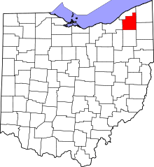 | |
| Villages | ||
| Townships | ||
| CDPs | ||
| Unincorporated communities | ||
| Footnotes | ‡This populated place also has portions in an adjacent county or counties | |