Chiloquin, Oregon
| Chiloquin | ||
|---|---|---|
| City | ||
| Chiloquin, Oregon | ||
|
Our Lady of Mt. Carmel Catholic Church | ||
| ||
 Location in Oregon | ||
| Coordinates: 42°34′30″N 121°51′51″W / 42.57500°N 121.86417°WCoordinates: 42°34′30″N 121°51′51″W / 42.57500°N 121.86417°W | ||
| Country | United States | |
| State | Oregon | |
| County | Klamath | |
| Incorporated | 1926 | |
| Government | ||
| • Mayor | Joe Hobbs[1] | |
| Area[2] | ||
| • Total | 0.82 sq mi (2.12 km2) | |
| • Land | 0.82 sq mi (2.12 km2) | |
| • Water | 0 sq mi (0 km2) | |
| Elevation | 4,180 ft (1,270 m) | |
| Population (2010)[3] | ||
| • Total | 734 | |
| • Estimate (2013)[4] | 724 | |
| • Density | 895.1/sq mi (345.6/km2) | |
| Time zone | Pacific (UTC-8) | |
| • Summer (DST) | Pacific (UTC-7) | |
| ZIP codes | 97604, 97624 | |
| Area code(s) | 541 | |
| FIPS code | 41-13050 | |
| GNIS feature ID | 1139648[5] | |
| Website | City of Chiloquin | |
_(klaDA0070).jpg)

Chiloquin (/ˈtʃɪləkwɪn/ CHIL-ə-kwin) (Klamath: mbosaksawaas, "flint place" [6]) is a city in Klamath County, Oregon, United States. Chiloquin was the pioneer version of a Klamath family name Chaloquin, which was the name of a Klamath chief who was alive at the time of the treaty of 1864.[7] Southern Pacific records also show that a woman named Bessie Chiloquin deeded a right-of-way through the area to the railroad on February 14, 1914.[8] The population was 734 at the 2010 census.
Geography
Chiloquin is at an elevation of 4,180 feet (1,270 m)[5] in Klamath County.[9] The city slightly east of U.S. Route 97, slightly north of its intersection with Oregon Route 62.[9] A short east–west highway, Oregon Route 422, links Route 97 at Chiloquin to Route 62 slightly south of Klamath Agency.[10] By highway, Chiloquin is about 26 miles (42 km) north of Klamath Falls and 253 miles (407 km) south of Portland.[11]
The Williamson River flows north–south through Chiloquin, where it receives the Sprague River from the east.[9] The city is near the Winema National Forest, which approaches it from the east and west.[10] Agency Lake is nearby, west of the city and slightly west of Route 62.[10] According to the United States Census Bureau, the city has a total area of 0.82 square miles (2.12 km2), all of it land.[2]
Climate
Chiloquin has a humid continental climate (Köppen Dsb).
| Climate data for Chiloquin | |||||||||||||
|---|---|---|---|---|---|---|---|---|---|---|---|---|---|
| Month | Jan | Feb | Mar | Apr | May | Jun | Jul | Aug | Sep | Oct | Nov | Dec | Year |
| Record high °F (°C) | 56 (13) |
64 (18) |
72 (22) |
84 (29) |
93 (34) |
98 (37) |
102 (39) |
104 (40) |
99 (37) |
86 (30) |
70 (21) |
57 (14) |
104 (40) |
| Average high °F (°C) | 37.9 (3.3) |
42.4 (5.8) |
49.3 (9.6) |
56.2 (13.4) |
65 (18) |
73.4 (23) |
82.3 (27.9) |
82 (28) |
75.2 (24) |
62.9 (17.2) |
46 (8) |
37.7 (3.2) |
59.2 (15.1) |
| Average low °F (°C) | 19.2 (−7.1) |
21.1 (−6.1) |
25.7 (−3.5) |
28.9 (−1.7) |
33.3 (0.7) |
38.1 (3.4) |
42.7 (5.9) |
41.8 (5.4) |
35.2 (1.8) |
28.7 (−1.8) |
24.3 (−4.3) |
19.8 (−6.8) |
29.9 (−1.2) |
| Record low °F (°C) | −11 (−24) |
−19 (−28) |
−1 (−18) |
12 (−11) |
14 (−10) |
23 (−5) |
28 (−2) |
26 (−3) |
15 (−9) |
0 (−18) |
−7 (−22) |
−18 (−28) |
−19 (−28) |
| Average precipitation inches (mm) | 3.16 (80.3) |
2.27 (57.7) |
2.03 (51.6) |
1.4 (36) |
1.34 (34) |
0.69 (17.5) |
0.48 (12.2) |
0.46 (11.7) |
0.56 (14.2) |
1.12 (28.4) |
2.81 (71.4) |
3.92 (99.6) |
20.21 (513.3) |
| Average snowfall inches (cm) | 17.5 (44.5) |
10.5 (26.7) |
7 (18) |
2.4 (6.1) |
0.2 (0.5) |
0 (0) |
0 (0) |
0 (0) |
0 (0) |
0.4 (1) |
8.1 (20.6) |
19.8 (50.3) |
66 (168) |
| Average precipitation days | 12 | 11 | 11 | 9 | 7 | 5 | 3 | 3 | 4 | 6 | 12 | 13 | 96 |
| Source: [12] | |||||||||||||
Demographics
| Historical population | |||
|---|---|---|---|
| Census | Pop. | %± | |
| 1880 | 150 | — | |
| 1920 | 160 | — | |
| 1930 | 481 | 200.6% | |
| 1940 | 741 | 54.1% | |
| 1950 | 688 | −7.2% | |
| 1960 | 945 | 37.4% | |
| 1970 | 826 | −12.6% | |
| 1980 | 778 | −5.8% | |
| 1990 | 673 | −13.5% | |
| 2000 | 716 | 6.4% | |
| 2010 | 734 | 2.5% | |
| Est. 2015 | 721 | [13] | −1.8% |
| Source:[14] 2013 Estimate[4] | |||
2010 census
As of the census of 2010, there were 734 people, 281 households, and 179 families residing in the city. The population density was 895.1 inhabitants per square mile (345.6/km2). There were 356 housing units at an average density of 434.1 per square mile (167.6/km2). The racial makeup of the city was 49.2% Native American, 40.7% White, 0.1% African American, 0.4% Asian, 0.5% from other races, and 9.0% from two or more races. Hispanic or Latino of any race were 6.5% of the population.
There were 281 households of which 31.3% had children under the age of 18 living with them, 36.3% were married couples living together, 19.9% had a female householder with no husband present, 7.5% had a male householder with no wife present, and 36.3% were non-families. 31.0% of all households were made up of individuals and 10.7% had someone living alone who was 65 years of age or older. The average household size was 2.61 and the average family size was 3.26.
The median age in the city was 41.9 years. 27% of residents were under the age of 18; 6.5% were between the ages of 18 and 24; 20.6% were from 25 to 44; 30.9% were from 45 to 64; and 15% were 65 years of age or older. The gender makeup of the city was 48.6% male and 51.4% female.
2000 census
As of the census of 2000, there were 716 people, 257 households, and 173 families residing in the city. The population density was 890.1 people per square mile (345.6/km²). There were 290 housing units at an average density of 360.5 per square mile (140.0/km²). According to responses provided by Chiloquin residents who participated in the census, the demographic makeup of the city was 51.54% Native American, 42.60% White, 5.31% Hispanic or Latino of any race, 0.14% Asian, and 1.26% from other races. About 4.5% were from two or more races.
There were 257 households out of which 40.5% had children under the age of 18 living with them, 39.3% were married couples living together, 21.4% had a female householder with no husband present, 32.3% were non-families, 24.1% were made up of individuals, and 10.1% had someone living alone who was 65 years of age or older. The average household size was 2.79 and the average family size was 3.34.
The age distribution was 34.9% under the age of 18, 7.0% from 18 to 24, 23.6% from 25 to 44, 22.8% from 45 to 64, and 11.7% who were 65 years of age or older. The median age was 34 years. For every 100 females there were 102.3 males. For every 100 females age 18 and over, there were 92.6 males.
The median income for a household in the city was $20,688, and the median income for a family was $21,250. Males had a median income of $29,167 versus $18,750 for females. The per capita income for the city was $9,604. About 33.5% of families and 31.2% of the population were below the poverty line, including 42.3% of those under age 18 and 5.7% of those age 65 or over.
Education and economy
Chiloquin High School, for students in grades 7 through 12, is in the city,[16] as is Chiloquin Elementary, for students in kindergarten through grade 6.[17] As of 2002, the four largest employers in Chiloquin were Weyerhaeuser (plywood, pressed board), Jeld-Wen (windows, door frames), Klamath Tribes (management, health services), and Klamath County Schools.[11]
Points of interest
The Train Mountain Miniature Railroad in Chiloquin is, according to the Guinness Book of World Records, the longest hobby railway system in the world.[18] It includes a railway museum, 25 miles (40 km) of total track, and trains that a person can straddle and ride.
Collier Memorial State Park is about 3 miles (5 km) north of Chiloquin along Route 97.[10] Kla-Mo-Ya Casino and Travel Center, owned and operated by the Klamath Tribes, is about 2 miles (3 km) south of Chiloquin along Route 97.[19]
Transportation
Climate
This region experiences warm (but not hot) and dry summers, with no average monthly temperatures above 71.6 °F. According to the Köppen Climate Classification system, Chiloquin has a warm-summer Mediterranean climate, abbreviated "Csb" on climate maps.[20]
References
- ↑ "Incorporated Cities: Chiloqin". Oregon Blue Book. Oregon Secretary of State. Retrieved January 10, 2015.
- 1 2 "U.S. Gazetteer: 2010, 2000, and 1990". United States Census Bureau. Retrieved August 22, 2013.
- ↑ "American FactFinder". U.S. Census Bureau. Archived from the original on December 10, 2014. Retrieved August 22, 2013.
- 1 2 "Population Estimates". United States Census Bureau. Retrieved 2014-10-02.
- 1 2 "Chiloquin". Geographic Names Information System. United States Geological Survey. November 28, 1980. Retrieved August 26, 2013.
- ↑ "Klamath Tribes Language Project". The Klamath Tribes. 2012. Retrieved August 30, 2012.
- ↑ McArthur, Lewis A.; Lewis L. McArthur (2003) [1928]. Oregon Geographic Names (7th ed.). Portland, Oregon: Oregon Historical Society Press. p. 198. ISBN 0-87595-277-1.
- ↑ Signor, John R. (2000). "Appendix: Shasta Division Stations". Southern Pacific's Shasta Division. Wilton and Berkeley, California: Signature Press. ISBN 1-930013-02-7.
- 1 2 3 The 2013 Road Atlas. Chicago, Illinois: Rand McNally. pp. 84, 85. ISBN 978-052-80062-2-7.
- 1 2 3 4 Oregon Atlas & Gazeteer (7th ed.). Yarmouth, Maine: DeLorme. 2008. p. 63. ISBN 978-0-89933-347-2.
- 1 2 "Chiloquin Community Profile". Infrastructure Finance Authority. 2009. Retrieved August 29, 2013.
- ↑ "CHILOQUIN 12 NW, OR (351574)". Western Regional Climate Center. Retrieved November 22, 2015.
- ↑ "Annual Estimates of the Resident Population for Incorporated Places: April 1, 2010 to July 1, 2015". Retrieved July 2, 2016.
- ↑ Moffatt, Riley Moore (1996). Population History of Western U.S. Cities and Towns, 1850–1990. Lanham, Maryland: Scarecrow Press. p. 207. ISBN 978-0-8108-3033-2.
- ↑ United States Census Bureau. "Census of Population and Housing". Archived from the original on May 11, 2015. Retrieved October 2, 2014.
- ↑ "Chiloquin High School". Klamath County School District. 2009. Retrieved August 29, 2013.
- ↑ "Chiloquin Elementary". Klamath County School District. 2009. Retrieved August 29, 2013.
- ↑ "Train Mountain". Oregon Field Guide. Oregon Public Broadcasting. July 26, 2007. Retrieved August 29, 2013.
- ↑ "About Our City". City of Chiloquin. Retrieved August 29, 2013.
- ↑ Climate Summary for Chiloquin, Oregon
External links
![]() Media related to Chiloquin, Oregon at Wikimedia Commons
Media related to Chiloquin, Oregon at Wikimedia Commons
Municipalities and communities of Klamath County, Oregon, United States | ||
|---|---|---|
| Cities | 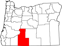 | |
| CDP | ||
| Unincorporated communities | ||