Mount Stirling
| Mount Stirling | |
|---|---|
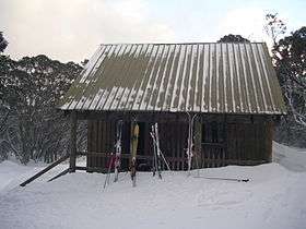 The Bluff Spur Hut at Mount Stirling | |
| Highest point | |
| Elevation | 1,747 m (5,732 ft) [1] AHD |
| Coordinates | 37°07′S 146°31′E / 37.117°S 146.517°E |
| Geography | |
| Location | Victoria, Australia |
| Parent range | Great Dividing Range |
| Climbing | |
| First ascent | Unknown |
| Easiest route | Hike/ski/4WD |
| Mt Stirling Alpine Resort | |
|---|---|
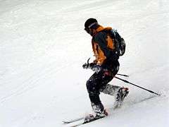 Telemark skier at Mount Stirling | |
| Location | Mount Stirling |
| Nearest city | Benalla, Victoria |
| Coordinates | 37°07′S 146°29′E / 37.117°S 146.483°E |
| Website |
www |
Mount Stirling is a mountain in the Victorian Alps of the Great Dividing Range, located in the Hume region of Victoria, Australia. The mountain has an elevation of 1,747–1,749 metres (5,732–5,738 ft) above sea level.[1][2]
Mount Stirling is also an abbreviation of the Mount Stirling Alpine Resort, a cross-country and backcountry ski resort located on the slopes of the mountain and situated approximately 230 kilometres (140 mi) from Melbourne. The Mount Stirling ski resort is a popular location for beginner backcountry skiers and snowboarders due to its distance from Melbourne and proximity to the Mount Buller Alpine Resort. The Mount Stirling Alpine Resort is contained within an 2,820-hectare (7,000-acre) Unincorporated area of Victoria; the larger surrounding locality of Mount Buller is part of the Shire of Mansfield. As at the 2011 census, the area had a population of 36.[3]
Mount Stirling was named in honour of James Stirling, a surveyor and later, the Victorian Government Geologist.[4]
Location and features
The mountain and ski resort are located at the head of the Delatite River, which flows westwards. It is surrounded by the Stirling Circuit Road, which provides access to mountains further into the Victorian Alps. In winter the road is closed at Telephone Box Junction, from which it is generally possible to ski to reach the summit (depending on conditions it is sometimes necessary to walk the lower section).
The mountain has fantastic views across to nearby Mount Buller as well as the high range that runs from Mount Cobbler through Mount Speculation and the Cross cut Saw and Mount Howitt. From there the range swings westwards, finishing in The Bluff, an impressive tilted plateau that has large clifflines on its northern side.
The lower reaches of the mountain are dominated by Alpine Ash forests, which merge into Snowgum Woodlands above approximately 1,400 metres (4,600 ft). There is a small part of the summit area which sits above treeline.
Huts
There are a number of huts in the area of Mount Stirling providing emergency refuge to visitors:
- Bluff Spur Hut is a shelter hut near the summit erected as a memorial to a pair of skiers who died of exposure on the mountain.
- Kingsaddle Shelter, an open shelter amidst towering Alpine Ash.
- Howqua Gap Hut was moved around Mount Stirling for loggers to shelter in and was left at the bottom of the Howqua Gap trail.
- Geelong Grammar School Hut on the other side of the summit from Bluff Spur Hut is owned by Geelong Grammar School and is used during cross country skiing by students from the Timbertop campus.
- Craig's Hut in the Clear Hills, built as a set for the film, The Man from Snowy River, was destroyed on 11 December 2006 by the Eastern Victoria Great Divide bushfires;[5] and has since been rebuilt.[6]
- Mount No 3 Refuge Hut, rebuilt in 2007
- Bus Hut on the Mount Number 3 Road
Seasonal activities
In winter the area is a patrolled cross country and back country ski resort. Maps of ski trails are available at the entry gate.
In summer the area is popular with four wheel drivers and bush walkers. The trail from the Circuit Road to the summit takes less than two hours to walk and is popular for day and over night trips. Also, when it is not snowing or in danger of bushfires, the area is used by numerous educational groups.
See also
References
- 1 2 "Mount Stirling: Historical Information". Vicnames. Government of Victoria. 12 August 2011. Retrieved 15 August 2014.
- ↑ "Stirling 2010: Draft Management Strategy" (PDF) (PDF). Mount Buller and Mount Stirling Alpine Resort Management Board. January 2010. Retrieved 16 August 2014.
- ↑ Australian Bureau of Statistics (31 October 2012). "2011 Community Profiles: Mount Stirling Alpine Resort (Statistical Local Area)". 2011 Census of Population and Housing. Retrieved 15 August 2014.
- ↑ "Mount Stirling Alpine Resort: Information and Resource Kit" (PDF) (PDF). Alpine Resorts Commission. c. 1992. p. 10. Retrieved 16 August 2014.
- ↑ "Bushfires ravage iconic Craig's Hut". The Sydney Morning Herald. 11 December 2006.
- ↑ "Our latest news for Summer 2007-08". High Country Horses. Merrijig Victoria. Retrieved 27 November 2007.
External links
![]() Media related to Mount Stirling at Wikimedia Commons
Media related to Mount Stirling at Wikimedia Commons
Coordinates: 37°07′S 146°30′E / 37.117°S 146.500°E