Clarence, New York
| Clarence, New York | |
| Town | |
| Country | United States |
|---|---|
| State | New York |
| County | Erie County |
| Elevation | 735 ft (224.0 m) |
| Coordinates | 42°58′36″N 78°35′31″W / 42.97667°N 78.59194°WCoordinates: 42°58′36″N 78°35′31″W / 42.97667°N 78.59194°W |
| Area | 138.9 km2 (53.6 sq mi) |
| - land | 138.6 km2 (54 sq mi) |
| - water | 0.3 km2 (0 sq mi), 0.22% |
| Population | 30,673 (2010) |
| Density | 221.4/km2 (573.4/sq mi) |
| Incorporated | 1808 |
| Town Supervisor | Patrick Casilio (R)
|
| Timezone | EST (UTC-5) |
| - summer (DST) | EDT (UTC-4) |
| ZIP code | 14031, 14221 (part of western side) |
| Area code | 716 |
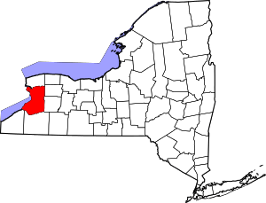
 Location in Erie County and the state of New York.
| |
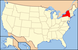 Location of New York in the United States
| |
| Website: clarence | |
Clarence is a town located in the northeastern part of Erie County, New York, United States, northeast of Buffalo. The population was 30,673 according to the 2010 census.[1] This represents an increase of 17.42% from the 2000 census figure.[2] The Clarence census-designated place occupies the southeast part of the town and roughly corresponds to a postal district with ZIP code 14031 and 14221 in the western side which it shares with nearby Williamsville . The town is named in honor of Prince William, Duke of Clarence and St Andrews (1765-1837), the third son of King George III and later king himself, as William IV.
There are no incorporated villages within the town.
History
Early history
The local Native Americans called the area Ta-Num-No-Ga-O, which means "Place of Hickory Bark".
Clarence was the first town to be established in Erie County (1808), and many other towns, villages, and cities have been formed from parts of this original town. In 1810, the town of Buffalo, from which the city of Buffalo later originated, was divided out of Clarence. Then in 1823, Newstead and Alden were formed respectively from the east and south parts of Clarence. Then finally in 1833, Lancaster was also formed from the town. The defunct town of Willink was also a source of new towns, primarily in the south part of the county, being completely partitioned for this purpose.
Western New York was part of the Holland Purchase. When Genesee County was established in 1802, all of the region was part of the town of Batavia, the single, original town of Genesee County. Clarence was, along with Willink, originally part of Genesee County. Clarence was split off from Willink in 1804, before Niagara County was created from part of Genesee County in 1808. Clarence (in the north) and Willink (in the south) then comprised the entire area of what would, in 1821, become Erie County.
One of the first settlers (1799) in the town was Asa Ransom, who has given his name to several locations. He settled in the southeast part of the town, now known as Clarence. In 1807, Asa Harris, a former colonial officer from the American Revolution, established a tavern in the town in the community of Harris Hill in the southeast part of Clarence.
Some have suggested that the town is named after a type of carriage, called a clarence. Such a carriage is pictured on a sign at the eastern edge of town. However, the name probably derives from the English Dukedom of Clarence in London, which also gave its name to the aforementioned carriage.
During the War of 1812, the press of the Buffalo Gazette was moved to Clarence, out of harm's way of the British troops.
Later history
By the end of the 19th century, industry came to the town in the form of brick kilns, potash mining and gypsum mining. National Gypsum and Atlas Gypsum operated mines in the 20th century west of Clarence Center north of Roll Road near the intersection with Harris Hill Road.
The town celebrated its bicentennial in 2008. The former Automobile Club of Buffalo clubhouse was added to the National Register of Historic Places in 2012.[3]
Colgan Air Flight 3407 crash
On February 12, 2009, Colgan Air Flight 3407 crashed in Clarence Center around 10:20 EST. The commuter flight was operating between Newark Liberty International Airport and Buffalo Niagara International Airport. The aircraft involved was a Bombardier Q400. There were 45 passengers and 4 crew members killed, as well as one victim on the ground.
Geography
According to the United States Census Bureau, the town has a total area of 53.6 square miles (138.9 km2), of which 53.5 square miles (138.6 km2) is land and 0.12 square miles (0.3 km2), or 0.25%, is water.[1]
The north border of the town is marked by Tonawanda Creek and is the border with Niagara County.
New York State Route 5, called Main Street locally, passes across the south part of the town. NY Route 78, Transit Road, marks the west town line. The eastern terminus of NY Route 324, Sheridan Drive, is located in Clarence at the intersection of NY-5 and Thompson Road. The New York State Thruway (Interstate 90) is immediately south of the town.
This town is partially a suburban community, and the remainder is light industry and agriculture. Town government offices are located in Clarence Center. Clarence, Iowa, is named after the town of Clarence.
Nearby cities and towns
Clarence is northeast of the city of Buffalo, west of the city of Batavia, and south of the city of Lockport.
The following towns border Clarence:
- Town of Amherst - west
- Town of Lockport, Niagara County - north
- Town of Royalton, Niagara County - northeast
- Town of Newstead - east
- Town of Lancaster - south
Major highways
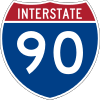
 Interstate 90 (New York State Thruway) passes through the southeasternmost corner of Clarence before entering the town of Lancaster, where it travels east-west just south of the Clarence border. A service area on the Thruway (westbound) is named for Clarence.[4]
 New York State Route 5 (Main Street) is an east-west highway that passes through the southern half of town from Amherst to Newstead.
 New York State Route 78 (Transit Road) is a north-south highway that marks the west town line.
 New York State Route 324 (Sheridan Drive) is an east-west highway through the town from the Amherst town line to its eastern terminus at Main Street (NY 5).
Demographics
| Historical population | |||
|---|---|---|---|
| Census | Pop. | %± | |
| 1820 | 3,278 | — | |
| 1830 | 3,353 | 2.3% | |
| 1840 | 2,271 | −32.3% | |
| 1850 | 2,727 | 20.1% | |
| 1860 | 3,356 | 23.1% | |
| 1870 | 3,147 | −6.2% | |
| 1880 | 3,495 | 11.1% | |
| 1890 | 3,195 | −8.6% | |
| 1900 | 2,948 | −7.7% | |
| 1910 | 2,991 | 1.5% | |
| 1920 | 2,660 | −11.1% | |
| 1930 | 3,208 | 20.6% | |
| 1940 | 4,426 | 38.0% | |
| 1950 | 6,331 | 43.0% | |
| 1960 | 13,267 | 109.6% | |
| 1970 | 18,168 | 36.9% | |
| 1980 | 18,146 | −0.1% | |
| 1990 | 20,041 | 10.4% | |
| 2000 | 26,123 | 30.3% | |
| 2010 | 30,673 | 17.4% | |
| Est. 2014 | 31,769 | [5] | 3.6% |
As of the census[7] of 2000, there were 26,123 people, 9,154 households, and 7,204 families residing in the town. The population density was 489.2 people per square mile (188.9/km²). There were 9,497 housing units at an average density of 177.8 per square mile (68.7/km²). The racial makeup of the town was 98.65% White, 1.38% Asian, 0.58% African American,0.16% Native American,0.04% Pacific Islander, 0.19% from other races, and 0.56% from two or more races. Hispanic or Latino of any race were 0.80% of the population.
There were 9,154 households out of which 38.6% had children under the age of 18 living with them, 70.3% were married couples living together, 6.1% had a female householder with no husband present, and 21.3% were non-families. 18.4% of all households were made up of individuals and 9.0% had someone living alone who was 65 years of age or older. The average household size was 2.80 and the average family size was 3.22.
In the town the population was spread out with 28.0% under the age of 18, 5.7% from 18 to 24, 26.4% from 25 to 44, 25.5% from 45 to 64, and 14.5% who were 65 years of age or older. The median age was 40 years. For every 100 females there were 94.3 males. For every 100 females age 18 and over, there were 91.3 males.
The median income for a household in the town was $68,003, and the median income for a family was $77,998. Males had a median income of $58,538 versus $31,140 for females. The per capita income for the town was $32,717. About 1.0% of families and 1.9% of the population were below the poverty line, including 1.2% of those under age 18 and 3.2% of those age 65 or over.
Communities and locations
Communities
Principal locations or settlements in the town are:
- Beeman Creek Park is an undeveloped county park in the northeast part of the town.
- Clarence (also called "Clarence Hollow", or just "The Hollow") is in the southeast and is a census-designated place. This is an extensive community of homes and businesses. The Clarence Historical Society is located on Main Street in this community. Part of the community is within a small valley which is traversed by Ransom Creek. The seat of the town government is in the Clarence postal zone, just south of the hamlet of Clarence Center. During the time of its founding, Clarence village was called "Pine Grove" and later "Ransomville".
- Clarence Aerodrome (D51) is a small, grass-strip airport in the northwest part of the town. This is a private general aviation airport. It was known earlier as "Steffan Airport".
- Clarence Center (formerly "Van Tines Corners") lies near the middle of the town. It is a small hamlet (and census-designated place) with the most densely populated neighborhood situated around the intersection of Goodrich Road and Clarence Center Road. Clarence Center is also a postal ZIP code 14032, covering most of the north part of the town.
- East Amherst (formerly "Transit Station") is an unincorporated community, or hamlet, on the west side of the town that is mostly in the town of Amherst. East Amherst is also a postal zone (ZIP code 14051).
- Escarpment Sanctuary is a small nature preserve located on Greiner Road that is losing land to the upscale Spaulding Lake development.
- Gunnville is a former railroad station in the south part of the town, now only remembered as the source of the name for Gunnville Road.
- Harris Hill is an extensive community (a census-designated place) in the southwest corner of the town, built on a low hill of the same name. This location was also called "Shimerville" after a former post office, now only remembered as the source of the name for Shimerville Road.
- Hunts Corners is a location near the eastern town line and consists of a scattered group of homes. The corners are formed by the intersection of Salt Road and Clarence Center-Akron Road.
- Mansfield Corners is a former location in the eastern part of the town, north of Hunts Corners.
- Millersport is a hamlet in the northwest corner of the town. Millersport extends into the town of Amherst and also across Tonawanda Creek into Niagara County. The primary settlement consists of residences and businesses near the intersection of Transit Road and Millersport Highway.
- Potoczek Airport (D46) is a small grass-strip airport in the northwest part of the town, located on Wolcott Road.
- Rapids is a hamlet at the northern town line. Rapids is officially in Niagara County, but partly extends into Erie County, divided by Tonawanda Creek.
- Smiths Corners is a former location in the northern part of the town near Rapids.
- Snearly Corners is now the intersection of Main Street and Transit Road. It was named after the Snearly family, which ran a hotel there.
- Spaulding Lake is an upscale housing project built around a former quarry, located north of Main Street.
- Sturnerville is an historic location east of Harris Hill.
- Swormville is on the western border of the town and extends across the border into the town of Amherst. The community has had its name spelled several different ways in the past, such as "Schwarmsville".
- Tillman Road Wildlife Management Area is a conservation area in the southeast part of Clarence.
- Wolcottsburg (once called "West Prussia") is a hamlet in the northern part of the town, centered about a cluster of businesses, homes, and a church. The community is located near the intersection of Goodrich Road and Wolcott Road.
Physiographic locations
- Beeman Creek is a small stream in the northeast part of Clarence, flowing northward to Tonawanda Creek.
- Black Creek is a stream running mostly east-west through the northern part of the town, starting near Wolcottsburg, and eventually merging into Tonawanda Creek in northern Amherst.
- The Escarpment is a ledge, part of the Onondaga Escarpment, running approximately east-west south of the middle of the town and most prominent between Goodrich Road and Kraus Road.
- Gott Creek is a stream in the southeast part of Clarence that flows west into Amherst.
- Ransom Creek is a stream in the south central part of Clarence that flows west into Amherst.
- Spaulding Lake is a former quarry north of Main Street, previously known as Quarry Lake.
Cultural institutions
- Museum of European Art – contains work by Salvador Dalí, Pablo Picasso, Arno Breher and Paul Belmondo
- Clarence Historical Society Museum
Education
Most of the town is served by the Clarence Central School District, which contains one high school (Clarence High School), one middle school (Clarence Middle School), and four elementary schools (Clarence Center, Harris Hill, Ledgeview, and Sheridan Hill).
Nativity of the Blessed Virgin Mary Church Elementary school offers K-8 Catholic education, now with a 3-4 year old pre-school program.
Notable residents
- Kevyn Adams, former assistant coach for the Buffalo Sabres
- Dave Andreychuk, NHL left winger for 24 years, formerly of the Toronto Maple Leafs, New Jersey Devils, Boston Bruins, Colorado Avalanche, Tampa Bay Lightning, and most notably the Buffalo Sabres
- Joan Baez, folk musician of the 1960s, spent some of her childhood in Clarence Center and attended Clarence Center School[8]
- Alfred F. Beiter, former US Congressman
- Bill Bernhard, born in Clarence, major league baseball player[9]
- Martin Biron, hockey goaltender, formerly of the Buffalo Sabres hockey club
- Scott Bylewski, Clarence Town Supervisor
- Archibald S. Clarke, former US Congressman
- Jane Corwin, New York State Assemblywoman
- Experience Estabrook, attorney general of the Territory of Nebraska
- Bob Froese, former goaltender for the Philadelphia Flyers and the New York Rangers hockey clubs
- Dudley Hart, professional golfer
- Neil Haskell, top-4 finalist of So You Think You Can Dance (Season 3)
- Emory William Hunt, former President of Bucknell University
- Dewitt C. Leach, former US Congressman
- Chris Lee, former US Congressman
- Katie MacFarlane, former professional women's basketball player
- Pam MacKinnon, Tony Award winning director
- Chad Michael Murray, television and movie star who attended Clarence High School. On the television show One Tree Hill, a picture is shown of Lucas Scott, Chad Michael Murray's character, wearing a Clarence football jersey as a little boy.
- John Neumann, original parish priest of St. Mary's in Swormville, first American bishop to be canonized
- Teppo Numminen, former defenseman and assistant coach of the Buffalo Sabres hockey club
- Joyce Carol Oates, author (lived in Millersport)
- Jack Phillips, former MLB first baseman and attended Lancaster High School
- Jon Powers, Congressional candidate and veteran
- Jason Rebrovich, Buffalo Bills assistant coach
- Darcy Regier, former general manager of the Buffalo Sabres[10]
- Thomas M. Reynolds, former U.S. Congressman
- Lindy Ruff, head coach of the Dallas Stars
- John Valby, musician and comedian
- Thomas Vanek, forward for the Minnesota Wild
- Ernst Volgenau, farm boy, USAF officer, engineer, founder of SRA International company, benefactor of George Mason University[11]
- Patrick Wilson, drummer for the band Weezer, attended Clarence High School
Sister city
- Tianjin, China (since November 10, 2001)
References
- 1 2 "Geographic Identifiers: 2010 Demographic Profile Data (G001): Clarence town, Erie County, New York". U.S. Census Bureau, American Factfinder. Retrieved March 28, 2013.
- ↑ 2010 Census City and Town Growth via NYPIRG
- ↑ "National Register of Historic Places Listings". Weekly List of Actions Taken on Properties: 8/06/12 through 8/10/12. National Park Service. 2012-08-17.
- ↑ "Clarence Travel Plaza". New York State Thruway Authority. Retrieved January 12, 2013.
- ↑ "Annual Estimates of the Resident Population for Incorporated Places: April 1, 2010 to July 1, 2014". Retrieved June 4, 2015.
- ↑ "Census of Population and Housing". Census.gov. Archived from the original on May 11, 2015. Retrieved June 4, 2015.
- ↑ "American FactFinder". United States Census Bureau. Archived from the original on 2013-09-11. Retrieved 2008-01-31.
- ↑ Bob Dylan's Musical Roots - Joan Baez (Page 2)
- ↑ Reichler, Joseph L., ed. (1979) [1969]. The Baseball Encyclopedia (4th ed.). New York: Macmillan Publishing. ISBN 0-02-578970-8.
- ↑ "General Manager Darcy Regier bio". Retrieved 25 February 2013.
- ↑ Lucky Bag. Annapolis, Maryland. 1955. p. 446. Retrieved 2013-08-27.
External links
| Wikivoyage has a travel guide for Clarence, New York. |
- Town of Clarence official website
- "History of Clarence, NY" (1898)
- Clarence Central School District
- ClarenceHome, community website
- Clarence Pathways (Multi-use Trails), at ClassicBuffalo.com