Hamburg (village), New York
| Hamburg, New York | |
|---|---|
| Village | |
|
Hamburg Village Hall | |
| Motto: "Come to Discover. Stay for the Charm." | |
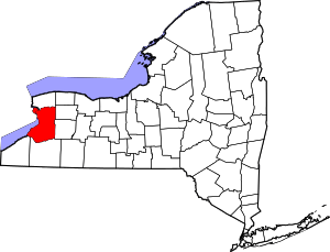
_highlighted.svg.png) Location within Erie County and New York | |
 Hamburg, New York Location within the United States | |
| Coordinates: 42°43′22″N 78°50′2″W / 42.72278°N 78.83389°WCoordinates: 42°43′22″N 78°50′2″W / 42.72278°N 78.83389°W | |
| Country | United States |
| State | New York |
| County | Erie |
| Town | Hamburg |
| Government | |
| • Mayor | Thomas Moses |
| Area | |
| • Total | 2.5 sq mi (6.5 km2) |
| • Land | 2.5 sq mi (6.5 km2) |
| • Water | 0.0 sq mi (0.0 km2) |
| Elevation | 820 ft (250 m) |
| Population (2010) | |
| • Total | 9,409 |
| • Density | 3,700/sq mi (1,400/km2) |
| Time zone | Eastern (EST) (UTC-5) |
| • Summer (DST) | EDT (UTC-4) |
| ZIP codes | 14075, 14219 |
| Area code(s) | 716 |
| FIPS code | 36-31643 |
| GNIS feature ID | 0952086 |
| Website |
www |

Hamburg is a village in Erie County, New York, United States. The population was 9,409 at the 2010 census. The village is reportedly named after Hamburg, a city in Germany. It is part of the Buffalo–Niagara Falls Metropolitan Statistical Area.
The village of Hamburg lies in the southeast part of the town of Hamburg and is south of Buffalo.
History
The Village of Hamburg was incorporated in 1874 and had a population in 1880 of 758.[1]
The Hamburg Downtown Historic District was listed on the National Register of Historic Places in 2012.[2]
Geography
Hamburg is located at 42°43′21″N 78°50′1″W / 42.72250°N 78.83361°W (42.722759, -78.833853).[3]
According to the United States Census Bureau, the village has a total area of 2.5 square miles (6.5 km²), all land.
Hamburg lies at the junction of several major trucking roads, such as Lakeview Road, Boston State Road (Route 391), Sisson Highway (Route 75), South Park Avenue/Buffalo Street (U.S. Route 62), which becomes Gowanda State Road south of the village, and McKinley Parkway. Hamburg is east of the New York State Thruway (Interstate 90).
Eighteen Mile Creek flows south of the village to Lake Erie.
Demographics
| Historical population | |||
|---|---|---|---|
| Census | Pop. | %± | |
| 1880 | 758 | — | |
| 1890 | 1,331 | 75.6% | |
| 1900 | 1,683 | 26.4% | |
| 1910 | 2,134 | 26.8% | |
| 1920 | 3,185 | 49.3% | |
| 1930 | 4,731 | 48.5% | |
| 1940 | 5,467 | 15.6% | |
| 1950 | 6,938 | 26.9% | |
| 1960 | 9,145 | 31.8% | |
| 1970 | 10,215 | 11.7% | |
| 1980 | 10,582 | 3.6% | |
| 1990 | 10,442 | −1.3% | |
| 2000 | 10,116 | −3.1% | |
| 2010 | 9,409 | −7.0% | |
| Est. 2015 | 9,576 | [4] | 1.8% |
As of the census[6] of 2000, there were 10,116 people, 4,010 households, and 2,694 families residing in the village. The population density was 4,025.2 people per square mile (1,556.1/km²). There were 4,144 housing units at an average density of 1,648.9 per square mile (637.5/km²). The racial makeup of the village was 98.64% White, 0.20% Black or African American, 0.15% Native American, 0.40% Asian, 0.15% from other races, and 0.47% from two or more races. Hispanic or Latino of any race were 0.75% of the population.
There were 4,010 households out of which 33.5% had children under the age of 18 living with them, 55.4% were married couples living together, 9.1% had a female householder with no husband present, and 32.8% were non-families. 28.7% of all households were made up of individuals and 15.3% had someone living alone who was 65 years of age or older. The average household size was 2.50 and the average family size was 3.12.
In the village the population was spread out with 26.4% under the age of 18, 6.0% from 18 to 24, 27.2% from 25 to 44, 23.9% from 45 to 64, and 16.4% who were 65 years of age or older. The median age was 38 years. For every 100 females there were 87.3 males. For every 100 females age 18 and over, there were 81.1 males.
The median income for a household in the village was $51,239, and the median income for a family was $63,180. Males had a median income of $43,395 versus $31,731 for females. The per capita income for the village was $23,371. About 2.8% of families and 3.0% of the population were below the poverty line, including 3.0% of those under age 18 and 2.7% of those age 65 or over.
Notable people
- Frank Resetarits, lacrosse player
References
- ↑ http://www.townofhamburgny.com/about_the_town.asp
- ↑ "National Register of Historic Places Listings". Weekly List of Actions Taken on Properties: 12/10/12 through 12/14/12. National Park Service. 2012-12-21.
- ↑ "US Gazetteer files: 2010, 2000, and 1990". United States Census Bureau. 2011-02-12. Retrieved 2011-04-23.
- ↑ "Annual Estimates of the Resident Population for Incorporated Places: April 1, 2010 to July 1, 2015". Retrieved July 2, 2016.
- ↑ "Census of Population and Housing". Census.gov. Retrieved June 4, 2015.
- ↑ "American FactFinder". United States Census Bureau. Retrieved 2008-01-31.