Clay Township, Morgan County, Indiana
| Clay Township | |
|---|---|
| Township | |
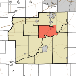 Location in Morgan County | |
| Coordinates: 39°31′44″N 86°24′12″W / 39.52889°N 86.40333°WCoordinates: 39°31′44″N 86°24′12″W / 39.52889°N 86.40333°W | |
| Country |
|
| State |
|
| County | Morgan |
| Government | |
| • Type | Indiana township |
| Area | |
| • Total | 30.66 sq mi (79.4 km2) |
| • Land | 29.99 sq mi (77.7 km2) |
| • Water | 0.67 sq mi (1.7 km2) 2.19% |
| Elevation | 676 ft (206 m) |
| Population (2010) | |
| • Total | 4,292 |
| • Density | 143.1/sq mi (55.3/km2) |
| Time zone | Eastern (EST) (UTC-5) |
| • Summer (DST) | EDT (UTC-4) |
| ZIP codes | 46111, 46151, 46158 |
| GNIS feature ID | 0453215 |
Clay Township is one of fourteen townships in Morgan County, Indiana, United States. As of the 2010 census, its population was 4,292 and it contained 1,707 housing units.[1]
The township contains the incorporated towns of Brooklyn and Bethany, and the unincorporated town of Centerton. The entire township lies within the Metropolitan School District of Martinsville, with elementary schools at both Brooklyn and Centerton.
Clay Township is also home to the Goethe Link Observatory and Bradford Woods, both affiliated to Indiana University.
Fire protection is provided to the township by the Brooklyn Volunteer Fire Department, which operates stations in Brooklyn and on Robb Hill Road.
History
The Franklin Landers-Black and Adams Farm and Bradford Estate are listed on the National Register of Historic Places.[2]
Geography
According to the 2010 census, the township has a total area of 30.66 square miles (79.4 km2), of which 29.99 square miles (77.7 km2) (or 97.81%) is land and 0.67 square miles (1.7 km2) (or 2.19%) is water.[1]
Cities, towns, villages
Unincorporated towns
- Beech Grove at 39°31′02″N 86°26′47″W / 39.51727°N 86.446384°W
- Center Valley at 39°30′49″N 86°24′32″W / 39.513659°N 86.408883°W
- Centerton at 39°30′54″N 86°23′42″W / 39.515048°N 86.394994°W
(This list is based on USGS data and may include former settlements.)
Cemeteries
The township contains these two cemeteries: Brooklyn and Butterfield.
Major highways
Airports and landing strips
- Hilhon Airport
Lakes
- Jewel Lake
- Old Swimmin Hole Lake
School districts
- Metropolitan School District of Martinsville Schools
Political districts
- Indiana's 4th congressional district
- State House District 47
- State Senate District 37
References
- "Clay Township, Morgan County, Indiana". Geographic Names Information System. United States Geological Survey. Retrieved 2009-09-26.
- United States Census Bureau 2008 TIGER/Line Shapefiles
- IndianaMap
- 1 2 "Population, Housing Units, Area, and Density: 2010 - County -- County Subdivision and Place -- 2010 Census Summary File 1". United States Census. Retrieved 2013-05-10.
- ↑ National Park Service (2010-07-09). "National Register Information System". National Register of Historic Places. National Park Service.
External links
- Indiana Township Association
- United Township Association of Indiana
- City-Data.com page for Clay Township
 |
Monroe Township | Brown Township | Madison Township | |
| Gregg Township | |
Harrison Township | ||
| ||||
| | ||||
| Jefferson Township | Washington Township | Green Township |
Municipalities and communities of Morgan County, Indiana, United States | ||
|---|---|---|
| City | ||
| Towns | ||
| Townships | ||
| CDP | ||
| Other unincorporated communities |
| |
| Footnotes | ‡This populated place also has portions in an adjacent county or counties | |