Clear Creek Township, Marion County, Kansas
| Clear Creek Township Marion County, Kansas | |
|---|---|
| Township | |
|
Location within Marion County | |
 Clear Creek Township | |
| Coordinates: 38°28′1″N 096°57′35″W / 38.46694°N 96.95972°WCoordinates: 38°28′1″N 096°57′35″W / 38.46694°N 96.95972°W | |
| Country | United States |
| State | Kansas |
| County | Marion |
| Area | |
| • Total | 76 sq mi (200 km2) |
| Dimensions | |
| • Length | 8.0 mi (12.9 km) |
| • Width | 12.0 mi (19.3 km) |
| Elevation | 1,421 ft (433 m) |
| Population (2010)[1] | |
| • Total | 548 |
| • Density | 7.2/sq mi (2.8/km2) |
| Time zone | CST (UTC-06:00) |
| • Summer (DST) | CDT (UTC-05:00) |
| Area code(s) | 620 |
| FIPS code | 20-13750 [2] |
| GNIS feature ID | 477143 [3] |
| Website | County Website |
|
| |
Clear Creek Township is a township in Marion County, Kansas, United States. As of the 2010 census, the township population was 548, including the city of Lincolnville, and unincorporated communities of Antelope and east side of Pilsen.[1]
Geography
Clear Creek Township covers an area of 76 square miles (196.8 km2).
Communities
The township contains the following settlements:
- City of Lincolnville.
- Unincorporated community of Antelope.
- Unincorporated community of Pilsen (east of Remington Road). The west part is located in Clark Township.
Cemeteries
The township contains the following cemeteries:[4]
- Evangelical Lutheran Cemetery (aka Lincolnville Cemetery), located in Section 1 T18S R4E.
- Lincolnville Cemetery (aka Evangelical Luther Church Cemetery), located in Section 11 T18S R4E.
- Pilsen Cemetery (aka St. John Nepomocene Catholic Church Cemetery), located in Section 19 T18S R4E.
Transportation
U.S. Route 77 pass through the township.[5]
Further reading
References
- 1 2 "2010 Total Population - Township of Clear Creek". U.S. Census Bureau. Retrieved June 25, 2013.
- ↑ "American FactFinder". United States Census Bureau. Archived from the original on 2013-09-11. Retrieved 2011-05-14.
- ↑ U.S. Geological Survey Geographic Names Information System: Township of Clear Creek
- ↑ Marion County Cemetery List; KsGenWeb. (archived on archive.org)
- ↑ Marion County Highway Map; KSDOT.
External links
- Marion County Website
- City-Data.com
- Marion County Maps: Current, Historic, KDOT
 |
Colfax Township | Lost Springs Township | Burdick Township (Morris County) | |
| Clark Township | |
Diamond Creek Township (Chase County) | ||
| ||||
| | ||||
| Gale Township | Grant Township Centre Township |
Diamond Creek Township (Chase County) |
Municipalities and communities of Marion County, Kansas, United States | ||
|---|---|---|
| Cities | 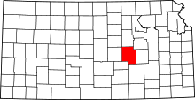 | |
| Unincorporated communities | ||
| Ghost towns | ||
| Townships | ||
| Footnotes | ‡This populated place also has portions in an adjacent county or counties | |
This article is issued from Wikipedia - version of the 11/26/2016. The text is available under the Creative Commons Attribution/Share Alike but additional terms may apply for the media files.