Cliff, New Mexico
| Cliff, New Mexico | |
|---|---|
| Census-designated place | |
 Cliff, New Mexico | |
| Coordinates: 32°57′43″N 108°36′40″W / 32.96194°N 108.61111°W | |
| Country | United States |
| State | New Mexico |
| County | Grant |
| Area[1] | |
| • Total | 10.253 sq mi (26.56 km2) |
| • Land | 10.253 sq mi (26.56 km2) |
| • Water | 0.0 sq mi (0.0 km2) |
| Elevation | 4,498 ft (1,371 m) |
| Population (2010)[2] | |
| • Total | 293 |
| • Density | 29/sq mi (11/km2) |
| Time zone | MST (UTC-7) |
| • Summer (DST) | MDT (UTC-6) |
| ZIP code | 88028 |
| Area code(s) | 575 |
| FIPS code | 35-17-15860 |
| GNIS feature ID | 898744 |
Cliff is a census-designated place in Grant County, New Mexico, United States. Its population was 293 as of the 2010 census.[2]
History
Cliff and the nearby town of Gila were settled in 1884, in the Gila River Valley. The area was and is primarily a ranching and farming community.[3] The local Cliff Post Office was established on Aug 4, 1894.
Culture
The annual Grant County Fair is held annually at the adjoining fairgrounds next to Cliff High School.
Education
Cliff schools are part of the Silver Consolidated School District. The District's main office is located in Silver City.
- Cliff Elementary School (K-6)
- Students: 124
- Teachers: 7.7
- Cliff High School (7-12)
- Students 155
- Teachers 12.1
Transportation
U.S. Route 180 connects Cliff to Silver City, and NM 211 connects Cliff to Gila.
Points of interest
- Bill Evan's Lake
- Gila Riparian Preserve
References
- ↑ "US Gazetteer files: 2010, 2000, and 1990". United States Census Bureau. 2011-02-12. Retrieved 2011-04-23.
- 1 2 "American FactFinder". United States Census Bureau. Archived from the original on 2013-09-11. Retrieved 2011-05-14.
- ↑ SouthWest New Mexico, Historic Silver City Area Scenic Tours, page 19, 2008.
Municipalities and communities of Grant County, New Mexico, United States | ||
|---|---|---|
| City | 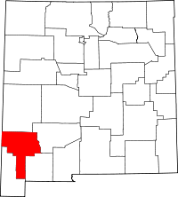 | |
| Towns | ||
| Village | ||
| CDPs | ||
| Other unincorporated communities | ||
| Ghost towns | ||
Coordinates: 32°57′43″N 108°36′40″W / 32.96194°N 108.61111°W
This article is issued from Wikipedia - version of the 11/26/2016. The text is available under the Creative Commons Attribution/Share Alike but additional terms may apply for the media files.