Gila, New Mexico
| Gila, New Mexico | |
|---|---|
| Census-designated place | |
 Gila, New Mexico | |
| Coordinates: 32°57′58″N 108°34′37″W / 32.96611°N 108.57694°W | |
| Country | United States |
| State | New Mexico |
| County | Grant |
| Area[1] | |
| • Total | 9.394 sq mi (24.33 km2) |
| • Land | 9.362 sq mi (24.25 km2) |
| • Water | 0.032 sq mi (0.08 km2) |
| Elevation | 4,557 ft (1,389 m) |
| Population (2010) | |
| • Total | 314 |
| • Density | 33/sq mi (13/km2) |
| Time zone | MST (UTC-7) |
| • Summer (DST) | MDT (UTC-6) |
| ZIP code | 88038 |
| Area code(s) | 575 |
| FIPS code | 35-17-29160 |
| GNIS feature ID | 898782 |
Gila is a census-designated place in Grant County, New Mexico, United States. It is 30 miles northwest of Silver City, New Mexico. Its population was 314 as of the 2010 census.[2]
History
Gila and the nearby town of Cliff were settled in 1884. The area was and is primarily a ranching and farming community. The local Gila Post Office was established on Apr 5, 1875.
Economics and culture
Services in Gila include: hardware store, post office, library, EMT and medical clinic, community center, senior center, library, and several churches. The library collection contains 3025 volumes. The library circulates 1539 items per year.[3]
Transportation
Major highways
Gila can be accessed via NM 211 from US 180 north of Silver City. Also, NM 153 provides access to Turkey Creek.
Points of interest
- The Double E Ranch is four miles from Gila, and is one of the largest working cattle ranches in Grant County.
- The Lyons & Campbell Ranch Headquarters is a Registered New Mexico Cultural Property and on the National Registry of Historic Places. The National Park Service in their publication The Cattleman's Empire wrote "The L.C. completely overshadowed all other ranching operations in the Southwest, at its height controlling over one million acres" and “The L.C. remains as one of the last surviving Great Ranch Houses of the Old West”. Today the L.C. Ranch Headquarters is a 60 room adobe complex including an old west Saloon, Jail, theater, chapel, and 27 room Main Ranch House. There are Saturday afternoon guided tours and overnight accommodations.
References in popular culture
- Gila is the town where Michael Scofield has Sara Tancredi meet him on the television series Prison Break.
References
- ↑ "US Gazetteer files: 2010, 2000, and 1990". United States Census Bureau. 2011-02-12. Retrieved 2011-04-23.
- ↑ "American FactFinder". United States Census Bureau. Retrieved 2011-05-14.
- ↑ http://www.librarytechnology.org/lwc-displaylibrary.pl?RC=37795, retrieved on 17 December 2008.
Municipalities and communities of Grant County, New Mexico, United States | ||
|---|---|---|
| City | 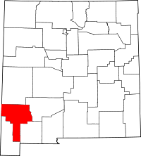 | |
| Towns | ||
| Village | ||
| CDPs | ||
| Other unincorporated communities | ||
| Ghost towns | ||
Coordinates: 32°57′58″N 108°34′37″W / 32.96611°N 108.57694°W