Closplint, Kentucky
| Closplint | |
|---|---|
| Unincorporated community | |
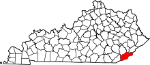
 Closplint  Closplint Location within the state of Kentucky | |
| Coordinates: 36°54′14″N 83°4′10″W / 36.90389°N 83.06944°WCoordinates: 36°54′14″N 83°4′10″W / 36.90389°N 83.06944°W | |
| Country | United States |
| State | Kentucky |
| County | Harlan |
| Elevation | 1,539 ft (469 m) |
| Time zone | Central (CST) (UTC-6) |
| • Summer (DST) | CST (UTC-5) |
| ZIP codes | 40927 |
| GNIS feature ID | 511416[1] |
Closplint is an unincorporated community in Harlan County, Kentucky, United States. The settlement was named Cloversplint after the seam of coal and the mining company that operated there. When the U.S. Postal Service established a post office (ZIP Code 40927), the name was shortened to Closplint.
References
This article is issued from Wikipedia - version of the 7/27/2016. The text is available under the Creative Commons Attribution/Share Alike but additional terms may apply for the media files.