Wallins Creek, Kentucky
| Wallins Creek, Kentucky | |
|---|---|
| City | |
|
| |
| Coordinates: 36°49′41″N 83°24′52″W / 36.82806°N 83.41444°WCoordinates: 36°49′41″N 83°24′52″W / 36.82806°N 83.41444°W | |
| Country | United States |
| State | Kentucky |
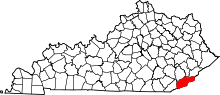
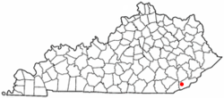
| County | Harlan |
| Incorporated | 1925 |
| Government | |
| • Type | City Commission |
| • Mayor | Kimberly Ellison (resigned in 2008) |
| Area | |
| • Total | 0.4 sq mi (1.0 km2) |
| • Land | 0.4 sq mi (1.0 km2) |
| • Water | 0.0 sq mi (0.0 km2) |
| Elevation | 1,135 ft (346 m) |
| Population (2000) | |
| • Total | 257 |
| • Density | 657.8/sq mi (254.0/km2) |
| Time zone | Eastern (EST) (UTC-5) |
| • Summer (DST) | EDT (UTC-4) |
| ZIP code | 40873 |
| Area code(s) | 606 |
| FIPS code | 21-80310 |
| GNIS feature ID | 0506153 |
| Website | WallinsCreek.com |
Wallins Creek is a city in Harlan County, Kentucky, United States. The population was 257 at the 2000 census and was estimated at 235 in 2007.
History
Wallins Creek began life as a coalmining town in 1925; the mine was owned by the Wallins Creek Coal Corporation. The Wallins Creek Baptist church was established in 1855 with 30 members.
Wallins Creek is said to be haunted by an old coal miner who died in an explosion and who walks alongside the roadside to his former home. Wallins Creek is home to the Wallins Elementary School, which has been in use since the 1940s and has won several awards in sports and academia. As of now, Wallins has no mayor. This has remained since 2008, but the townspeople do not seem to mind. At one point it was a bustling town, but now it is a shadow of its former self.
Geography
Wallins Creek is located at 36°49′41″N 83°24′52″W / 36.82806°N 83.41444°W (36.828036, -83.414449).[1]
According to the United States Census Bureau, the city has a total area of 0.4 square miles (1.0 km2), all of it land.
Demographics
| Historical population | |||
|---|---|---|---|
| Census | Pop. | %± | |
| 1930 | 900 | — | |
| 1940 | 903 | 0.3% | |
| 1950 | 525 | −41.9% | |
| 1960 | 468 | −10.9% | |
| 1970 | 369 | −21.2% | |
| 1980 | 459 | 24.4% | |
| 1990 | 261 | −43.1% | |
| 2000 | 257 | −1.5% | |
| 2010 | 156 | −39.3% | |
| Est. 2015 | 149 | [2] | −4.5% |
As of the census[4] of 2000, there were 257 people, 112 households, and 73 families residing in the city. The population density was 657.8 people per square mile (254.4/km²). There were 126 housing units at an average density of 322.5 per square mile (124.7/km²). The racial makeup of the city was 97.28% White, 0.39% Native American, and 2.33% from two or more races.
There were 112 households out of which 25.0% had children under the age of 18 living with them, 47.3% were married couples living together, 16.1% had a female householder with no husband present, and 34.8% were non-families. 29.5% of all households were made up of individuals and 14.3% had someone living alone who was 65 years of age or older. The average household size was 2.29 and the average family size was 2.86.
In the city the population was spread out with 23.7% under the age of 18, 3.5% from 18 to 24, 26.8% from 25 to 44, 28.8% from 45 to 64, and 17.1% who were 65 years of age or older. The median age was 42 years. For every 100 females there were 94.7 males. For every 100 females age 18 and over, there were 90.3 males.
The median income for a household in the city was $11,083, and the median income for a family was $16,563. Males had a median income of $17,500 versus $20,625 for females. The per capita income for the city was $8,151. About 47.6% of families and 44.2% of the population were below the poverty line, including 46.9% of those under the age of eighteen and 14.6% of those sixty five or over.
References
- ↑ "US Gazetteer files: 2010, 2000, and 1990". United States Census Bureau. 2011-02-12. Retrieved 2011-04-23.
- ↑ "Annual Estimates of the Resident Population for Incorporated Places: April 1, 2010 to July 1, 2015". Retrieved July 2, 2016.
- ↑ "Census of Population and Housing". Census.gov. Retrieved June 4, 2015.
- ↑ "American FactFinder". United States Census Bureau. Retrieved 2008-01-31.