Col de Port
| Col de Port | |
|---|---|
|
Cows grazing at Col de Port | |
| Elevation | 1,250 m (4,101 ft)[1] |
| Traversed by | D618 |
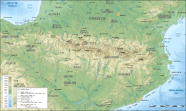
| Location | Ariège, France |
| Range | Pyrenees |
| Coordinates | 42°53′56″N 1°27′10″E / 42.89889°N 1.45278°ECoordinates: 42°53′56″N 1°27′10″E / 42.89889°N 1.45278°E |
 Col de Port Location of Col de Port | |

Col de Port (elevation 1,250 m (4,100 ft)) is a mountain pass in the French Pyrenees between Massat and Tarascon-sur-Ariège in the "massif de l'Arize". It links the Couserans and Ariège valleys.
The pass is used occasionally in the Tour de France and is popular with touring cyclists.
The name of the pass is tautological as Col means pass in French and Port means pass in Occitan.
Details of the climb
Starting from the D8/D618 junction, (Tarascon-sur-Ariège) (east) the Col de Port is 17.0 km (10.6 mi) long. Over this distance, the climb is 777 m (2,549 ft) (an average gradient of 4.6%). The steepest section is 9.2%.[2]
Starting from Massat, (west) the Col de Port is 12.8 km (8.0 mi) long. Over this distance, the climb is 601 m (1,972 ft) (an average gradient of 4.7%).[3]
From Massat, the D18 to the south links with the route from Aulus-les-Bains and Vicdessos between the Col d'Agnes (1,570 m (5,150 ft)) and the Port de Lers (1,517 m (4,977 ft)).
Tour de France
The Col de Port was first used in the Tour de France in 1910. The first cyclist over the summit was Octave Lapize.[4]
Appearances in the Tour de France (since 1947)
The Tour de France has crossed the summit 10 times since 1947, including on stage 15 of the 2007 tour.[5] The 15th stage was selected for the 2007 L'Étape du Tour, in which amateur and club riders ride over a full stage of the tour.
| Year | Stage | Category | Start | Finish | Leader at the summit |
|---|---|---|---|---|---|
| 2009 | 8 | 2 | Andorra la Vella | Saint-Girons | |
| 2007 | 15 | 2 | Foix | Loudenvielle | |
| 2002 | 12 | 2 | Lannemezan | Plateau de Beille | |
| 1998 | 11 | 2 | Bagnères-de-Luchon | Plateau de Beille | |
| 1997 | 10 | 2 | Bagnères-de-Luchon | Andorra–Arcalis | |
| 1976 | 13 | 2 | Font-Romeu | Saint-Gaudens | |
| 1968 | 13 | 3 | Saint-Gaudens | La Seu d'Urgell | |
| 1965 | 10 | 3 | Bagnères-de-Bigorre | Ax-les-Thermes | |
| 1957 | 17 | Uncategorized | Ax-les-Thermes | Saint-Gaudens | |
| 1947 | 14 | 2 | Carcassonne | Bagnères-de-Luchon |
References
- ↑ IGN map
- ↑ "Col de Port - D 8 - D 618". climbbybike. Retrieved 4 September 2014.
- ↑ "Col de Port - Massat". climbbybike. Retrieved 4 September 2014.
- ↑ Woodland, Les (2003). The Yellow Jersey companion to the Tour de France. Random House. p. 264. ISBN 0-224-06318-9.
- ↑ "Le col de Port dans le Tour de France depuis 1947" (in French). ledicodutour. Retrieved 4 September 2014.