Colo, Iowa
| Colo, Iowa | |
|---|---|
| City | |
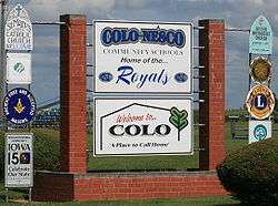 | |
| Motto: "A place to call home"[1] | |
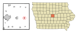 Location of Colo, Iowa | |
| Coordinates: 42°1′1″N 93°19′3″W / 42.01694°N 93.31750°WCoordinates: 42°1′1″N 93°19′3″W / 42.01694°N 93.31750°W | |
| Country |
|
| State |
|
| County | Story |
| Area[2] | |
| • Total | 1.06 sq mi (2.75 km2) |
| • Land | 1.06 sq mi (2.75 km2) |
| • Water | 0 sq mi (0 km2) |
| Elevation | 1,040 ft (317 m) |
| Population (2010)[3] | |
| • Total | 876 |
| • Estimate (2012[4]) | 870 |
| • Density | 826.4/sq mi (319.1/km2) |
| Time zone | Central (CST) (UTC-6) |
| • Summer (DST) | CDT (UTC-5) |
| ZIP code | 50056 |
| Area code(s) | 641 |
| FIPS code | 19-15240 |
| GNIS feature ID | 0455538 |
| Website | City of Colo, Iowa Website |
Colo is a city in Story County, Iowa, United States. The population was 876 at the 2010 census. It is part of the Ames, Iowa Metropolitan Statistical Area, which is a part of the larger Ames-Boone, Iowa Combined Statistical Area.
History
Colo was incorporated on April 26, 1876.[5] Railroad official John Blair named the community after his dog.[6][7]
Geography
Colo's longitude and latitude coordinates in decimal form are 42.016945, -93.317377.[8]
According to the United States Census Bureau, the city has a total area of 1.06 square miles (2.75 km2), all of it land.[2]
Demographics
| Historical populations | ||
|---|---|---|
| Year | Pop. | ±% |
| 1870 | 226 | — |
| 1880 | 296 | +31.0% |
| 1890 | 261 | −11.8% |
| 1900 | 391 | +49.8% |
| 1910 | 463 | +18.4% |
| 1920 | 507 | +9.5% |
| 1930 | 532 | +4.9% |
| 1940 | 539 | +1.3% |
| 1950 | 538 | −0.2% |
| 1960 | 574 | +6.7% |
| 1970 | 606 | +5.6% |
| 1980 | 808 | +33.3% |
| 1990 | 771 | −4.6% |
| 2000 | 868 | +12.6% |
| 2010 | 876 | +0.9% |
| 2014 | 863 | −1.5% |
| 2015 | 861 | −0.2% |
| Source:"American FactFinder". United States Census Bureau. and Iowa Data Center Source: | ||
2010 census
As of the census[3] of 2010, there were 876 people, 348 households, and 252 families residing in the city. The population density was 826.4 inhabitants per square mile (319.1/km2). There were 370 housing units at an average density of 349.1 per square mile (134.8/km2). The racial makeup of the city was 98.6% White, 0.3% African American, 0.2% Native American, 0.3% from other races, and 0.5% from two or more races. Hispanic or Latino of any race were 0.9% of the population.
There were 348 households of which 33.3% had children under the age of 18 living with them, 56.6% were married couples living together, 10.9% had a female householder with no husband present, 4.9% had a male householder with no wife present, and 27.6% were non-families. 23.6% of all households were made up of individuals and 10% had someone living alone who was 65 years of age or older. The average household size was 2.52 and the average family size was 2.94.
The median age in the city was 40.9 years. 26.3% of residents were under the age of 18; 6.4% were between the ages of 18 and 24; 23.3% were from 25 to 44; 29.2% were from 45 to 64; and 14.8% were 65 years of age or older. The gender makeup of the city was 49.8% male and 50.2% female.
2000 census
As of the census[10] of 2000, there were 868 people, 339 households, and 248 families residing in the city. The population density was 1,121.9 people per square mile (435.2/km2). There were 354 housing units at an average density of 457.6 per square mile (177.5/km2). The racial makeup of the city was 97.70% White, 0.92% African American, 0.46% Asian, 0.23% from other races, and 0.69% from two or more races. Hispanic or Latino of any race were 0.23% of the population.
There were 339 households out of which 33.6% had children under the age of 18 living with them, 64.3% were married couples living together, 5.9% had a female householder with no husband present, and 26.8% were non-families. 22.1% of all households were made up of individuals and 11.5% had someone living alone who was 65 years of age or older. The average household size was 2.56 and the average family size was 3.02.
27.6% are under the age of 18, 7.8% from 18 to 24, 30.5% from 25 to 44, 17.5% from 45 to 64, and 16.5% who were 65 years of age or older. The median age was 36 years. For every 100 females there were 98.2 males. For every 100 females age 18 and over, there were 96.9 males.
The median income for a household in the city was $41,711, and the median income for a family was $48,438. Males had a median income of $33,500 versus $24,091 for females. The per capita income for the city was $19,173. About 2.8% of families and 5.6% of the population were below the poverty line, including 3.1% of those under age 18 and 8.2% of those age 65 or over.
Parks and recreation
Located near Colo is Hickory Grove Park, Story County's largest recreational, fishing, and swimming area with 445 acres, including a 98-acre (400,000 m2) lake.[11]
East of Colo, along the Lincoln Highway, lies Colo Marsh, which drains into the Iowa River just east of Marshalltown. In Southern Colo, there is Colo-NESCO Elementary and Colo-NESCO Junior Senior High School.
Infrastructure
Transportation
Colo is located at the intersection of the historic Lincoln Highway and the Jefferson Highway. The intersection is marked by the historic complex of Reed/Niland Corner, which includes a museum/diner, vintage gas station, and small park.
For modern-day travelers, Colo lies at the intersection of U.S. Highway 30 (halfway between Ames and Marshalltown) and U.S. Highway 65 (halfway between Des Moines and Iowa Falls).
Colo lies also along the cross country line of the Union Pacific railroad.
References
- ↑ "City of Colo, Iowa". City of Colo, Iowa. Retrieved September 2, 2012.
- 1 2 "US Gazetteer files 2010". United States Census Bureau. Archived from the original on 2012-06-26. Retrieved 2012-05-11.
- 1 2 "American FactFinder". United States Census Bureau. Retrieved 2012-05-11.
- ↑ "Population Estimates". United States Census Bureau. Archived from the original on 2013-06-17. Retrieved 2013-05-23.
- ↑ "Colo, Iowa". City-Data.com. Retrieved September 2, 2012.
- ↑ "Profile for Dallastown, Pennsylvania, PA". ePodunk. Retrieved September 2, 2012.
- ↑ Chicago and North Western Railway Company (1908). A History of the Origin of the Place Names Connected with the Chicago & North Western and Chicago, St. Paul, Minneapolis & Omaha Railways. p. 58.
- ↑ "US Gazetteer files: 2010, 2000, and 1990". United States Census Bureau. 2011-02-12. Retrieved 2011-04-23.
- ↑ "Census of Population and Housing". Census.gov. Archived from the original on May 11, 2015. Retrieved June 4, 2015.
- ↑ "American FactFinder". United States Census Bureau. Archived from the original on 2013-09-11. Retrieved 2008-01-31.
- ↑ "Story County Conservation". Story County, Iowa. Retrieved April 22, 2011.
External links
| Wikimedia Commons has media related to Colo, Iowa. |
- City of Colo, Iowa Website Portal style website, Government, Schools, Businesses and more
- City-Data Comprehensive Statistical Data and more about Colo
Municipalities and communities of Story County, Iowa, United States | ||
|---|---|---|
| Cities | ||
| Townships | ||
| Unincorporated communities | ||
| Footnotes | ‡This populated place also has portions in an adjacent county or counties | |