Coobowie
| Coobowie South Australia | |||||||||||||
|---|---|---|---|---|---|---|---|---|---|---|---|---|---|
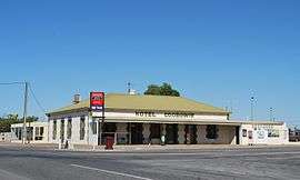 Hotel Coobowie | |||||||||||||
 Coobowie | |||||||||||||
| Coordinates | 35°02′0″S 137°43′0″E / 35.03333°S 137.71667°ECoordinates: 35°02′0″S 137°43′0″E / 35.03333°S 137.71667°E | ||||||||||||
| Population | 220 (shared with other localities in the "State Suburb of Coobowie") (2011 census)[1] | ||||||||||||
| Established | 1875[2] | ||||||||||||
| Postcode(s) | 5583[3] | ||||||||||||
| Location | |||||||||||||
| LGA(s) | Yorke Peninsula Council | ||||||||||||
| State electorate(s) | Goyder[4] | ||||||||||||
| Federal Division(s) | Grey[5] | ||||||||||||
| |||||||||||||
| |||||||||||||
| Footnotes |
Locations[3][2] Adjoining localities[7] | ||||||||||||
Coobowie is a town in the Australian state of South Australia near the south-eastern tip of Yorke Peninsula. Coobowie was proclaimed in 1875. Coobowie comes from an Aboriginal word meaning "wild fowl water".[2] At the 2011 census, Coobowie shared a population of 220 with other localities. Coobowie's current outlook is to create many new features, including a new visitor information pull in being built. The cafe also has a florist. Coobowie is an aging community, and because of this, there is a large real estate market currently, with very low prices.
The protected area known as the Coobowie Aquatic Reserve is partly located within Coobowie with the remainder being located in the adjoining bay, Salt Creek Bay.[8]
See also
References
- ↑ Australian Bureau of Statistics (31 October 2012). "Coobowie". 2011 Census QuickStats. Retrieved 8 April 2016.
- 1 2 3 "Search result for "Coobowie (Locality bounded)" (Record no. SA0015219) with the following layers selected - "Suburbs and Localities" and " Place names (gazetteer)"". Property Location Browser. Government of South Australia. Retrieved 24 June 2016.
- 1 2 "Coobowie, South Australia (Postcode)". postcodes-australia.com. Retrieved 24 June 2016.
- ↑ "Goyder electorate boundaries as of 2014". ELECTORAL COMMISSION SA. Retrieved 23 July 2015.
- ↑ "Federal electoral division of Grey" (PDF). Australian Electoral Commission. Retrieved 24 July 2015.
- 1 2 3 "Monthly climate statistics: Summary statistics Edithburgh (nearest station)". Commonwealth of Australia , Bureau of Meteorology. Retrieved 24 June 2016.
- ↑ "New Ward Structure 2014". Yorke Peninsula Council. Retrieved 21 October 2015.
- ↑ Primary Industries and Regions South Australia (PIRSA) (2007), Aquatic Reserve: Coobowie (PDF), Primary Industries and Regions South Australia
External links
| Major Townships | |||||||||||
|---|---|---|---|---|---|---|---|---|---|---|---|
| Minor Townships | |||||||||||
| Governance |
| ||||||||||
| Coastal features | |||||||||||
| Protected areas |
| ||||||||||
| Islands adjoining the Yorke Peninsula coast | |||||||||||
| Related and uncategorised | |||||||||||
| |||||||||||
This article is issued from Wikipedia - version of the 11/30/2016. The text is available under the Creative Commons Attribution/Share Alike but additional terms may apply for the media files.