District Council of Barunga West
| District Council of Barunga West South Australia | |||||||||||||
|---|---|---|---|---|---|---|---|---|---|---|---|---|---|
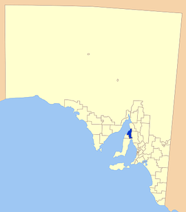
 Location of the District Council of Barunga West | |||||||||||||
| Population | 2,434 (2015 est)[1] | ||||||||||||
| • Density | 1.5929/km2 (4.1257/sq mi) | ||||||||||||
| Area | 1,528 km2 (590.0 sq mi) | ||||||||||||
| Mayor | Cynthia Axford [2] | ||||||||||||
| Council seat | Port Broughton | ||||||||||||
| Region | Yorke and Mid North[3] | ||||||||||||
| State electorate(s) |
Frome[4] Goyder[5] | ||||||||||||
| Federal Division(s) | Grey | ||||||||||||
| Website | District Council of Barunga West | ||||||||||||
| |||||||||||||
The District Council of Barunga West is a local government area in the Yorke and Mid North region of South Australia.[3] The council seat is at Port Broughton, with a sub-office at Bute.[6]
The council covers an area at the top of the Yorke Peninsula which includes the towns and localities of Alford, Bute, Clements Gap, Fisherman Bay, Kulpara, Melton, Ninnes, Port Broughton, Thomas Plain and Ward Hill, and parts of Mundoora, Paskeville, South Hummocks, Tickera and Willamulka.[7]
It was formed in 1997 from the amalgamation of the District Council of Bute and the District Council of Port Broughton.[8] The council takes its name from the Barunga Range in the eastern part of the council area.[9]
The main industries are tourism and growing grain.
Councillors
| Ward | Councillor | Notes | |
|---|---|---|---|
| Unsubdivided [2] | |||
| Cynthia Axford | Mayor | ||
| Michelaine Barker | |||
| James Bettess | |||
| Dean Dolling | Deputy Mayor | ||
| Leonie Kerley | |||
| Malcolm McDonald | |||
| Margaret McDonald | |||
| Georgie Simmons | |||
| Gregory Winen | |||
References
- ↑ "3218.0 – Regional Population Growth, Australia, 2014–15". Australian Bureau of Statistics. Retrieved 29 September 2016.
- 1 2 "Elected Members". Retrieved 31 March 2016.
- 1 2 "Yorke and Mid North SA Government region" (PDF). The Government of South Australia. Retrieved 10 October 2014.
- ↑ "District of Frome Background Profile". ELECTORAL COMMISSION SA. Retrieved 3 November 2014.
- ↑ "District of Goyder Background Profile". ELECTORAL COMMISSION SA. Retrieved 3 November 2014.
- ↑ "Council". District Council of Barunga West. Retrieved 31 March 2016.
- ↑ "Location SA Map Viewer". Government of South Australia. Retrieved 31 March 2016.
- ↑ "Mid North locals honoured". The Flinders News. 26 January 2016. Retrieved 31 March 2016.
- ↑ "Explanatory Statement and Analysis" (PDF). District Council of Barunga West. Retrieved 31 March 2016.
External links
Coordinates: 33°36′00″S 137°56′00″E / 33.6°S 137.933333°E