Hardwicke Bay
| Hardwicke Bay | |
|---|---|
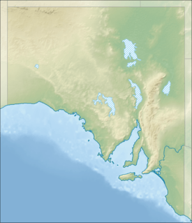 Hardwicke Bay Location in South Australia | |
| Location | Spencer Gulf, South Australia |
| Coordinates | 34°44′21.24″S 137°20′17.48″E / 34.7392333°S 137.3381889°ECoordinates: 34°44′21.24″S 137°20′17.48″E / 34.7392333°S 137.3381889°E[1] |
| Type | Bay |
| Etymology | Earl of Hardwicke[2] |
| Part of | Spencer Gulf |
| Basin countries | Australia |
| Designation |
Marine Parks: Eastern Spencer Gulf[3] Southern Spencer Gulf[4] |
| Max. length |
about 45 kilometres (28 mi) (north-south)[5] |
| Max. width |
about 33 kilometres (21 mi) (NE-SE)[5] |
| Max. depth | 29 metres (95 ft)[5] |
| Islands | Wardang |
| Settlements |
Corny Point, The Pines, Point Turton, Hardwicke Bay, Bluff Beach, Port Rickaby, Port Victoria (settlements listed from south-west to north east) |
Hardwicke Bay is a bay in the Australian state of South Australia located on the west coast of Yorke Peninsula in Spencer Gulf.
Extent & description
Hardwicke Bay is located on the west coast of the Yorke Peninsula within Spencer Gulf in South Australia. It lies between the headland of Corny Point at its southern extremity and the southern end of Wardang Island at its northern extremity.[6][7] The depth of water within the bay is reported as generally in the range of 14.6 metres (48 ft) to 20.1 metres (66 ft) with the exception of the waters within 5–10 nautical miles (9.3–18.5 km; 5.8–11.5 mi) of the south coast of Wardang Island where the depths are reported as being “very irregular”.[6] The bay is reported as being suitable as an anchorage where there is a need to shelter from southerly winds, particularly as most parts of the bay has rocky bottom suitable for anchoring on.[6] The bay’s coastline consists generally of sandy beaches that rise into low sandhills with a woodland cover with occasional rocky headlands.[8] As of 2005, navigation aids within Hardwicke Bay include the Corny Point Lighthouse at the Corny Point headland and a light on Wardang Island.[7]
History
The bay was named after the Earl of Hardwicke by the British navigator, Matthew Flinders on 19 March 1802.[2]
Settlements and port infrastructure
Settlements located on the coast of Hardwicke Bay (from south west to north east) within localities include the following - Corny Point, The Pines, Point Turton, Hardwicke Bay, Bluff Beach, Port Rickaby and Port Victoria.[7] Port infrastructure within the bay consists of jetties and boat ramps. Jetties are located at Point Turton, Port Rickaby and Port Victoria.[7][9] Boat ramps are located (from the south west to north east) at The Pines, Point Souttar, Point Turton, the settlement of Hardwicke Bay, Port Minlacowie, Bluff Beach, Port Rickaby and Port Victoria.[7][10]
Economic use
As of 2013, three areas within the southern end of the bay have been zoned under state planning legislation for aquaculture.[11] As of 2011, part of the north end of the bay was proposed for aquaculture under the name of the “Point Pearce prospective aquaculture zone.”[12]
Protected area status
Protected areas located within and adjoining the bay’s extent include the following. The Eastern Spencer Gulf Marine Park occupies the northern end of the bay as far south as Wauraltee Beach.[3] The Southern Spencer Gulf Marine Park occupies the southern end of the bay.[4] The Leven Beach Conservation Park adjoins part of the south coast of the bay to the immediate west of the settlement at Point Turton.[4]
See also
Citations and references
Citations
- ↑ "Search result for "Hardwicke Bay" (BAY) (Record Number SA0029355)". Land Services, Department of Planning, Transport and Infrastructure Resources. Retrieved 1 December 2015.
- 1 2 Manning, Geoffrey. "Place Names of South Australia - Hardwicke Bay". State Library of South Australia. Retrieved 7 January 2016.
- 1 2 DEWNR (Eastern Spencer Gulf Marine Park), 2012, pages 22 & 24
- 1 2 3 DEWNR (Southern Spencer Gulf Marine Park), 2012, pages 24 & 27
- 1 2 3 DMH, 1985, chart 24
- 1 2 3 NGA, 2012, page 184
- 1 2 3 4 5 BIA, 2005, page 201
- ↑ NGA, 2012, pages 184-185
- ↑ RDA-Y&MN, 2011, page 10 of 21
- ↑ RDA-Y&MN, 2011, page 9 of 21
- ↑ "Development Plan - Land Not Within a Council Area (Coastal Waters)" (PDF). Department of Planning, Transport and Infrastructure (DPTI). 2013. pp. 55 & 57. Retrieved 7 January 2016.
- ↑ RDA-Y&MN, 2011, page 5 of 21
References
- Boating Industry Association of South Australia (BIA); South Australia. Department for Environment and Heritage (2005), South Australia's waters an atlas & guide, Boating Industry Association of South Australia, ISBN 978-1-86254-680-6
- "Eastern Spencer Gulf Marine Park Management Plan 2012" (PDF). Department of Environment, Water and Natural Resources (DEWNR). 2012. Retrieved 8 January 2016.
- "Southern Spencer Gulf Marine Park Management Plan 2012" (PDF). Department of Environment, Water and Natural Resources (DEWNR). 2012. Retrieved 8 January 2016.
- South Australia. Department of Marine and Harbors (DMH) (1985), The Waters of South Australia a series of charts, sailing notes and coastal photographs, Dept. of Marine and Harbors, South Australia, ISBN 978-0-7243-7603-2
- National Geospatial-Intelligence Agency (NGA) (2010). Pub175, Sailing directions (enroute) north, west, and south coast of Australia (PDF) (10th ed.). National Geospatial-Intelligence Agency. Retrieved 16 May 2014.
- "Map set for the The DC of Yorke Peninsula" (PDF). Regional Development Australia Yorke and Mid North (RDA-Y&MN). 2011. Retrieved 8 January 2016.
| Major Townships | |||||||||||
|---|---|---|---|---|---|---|---|---|---|---|---|
| Minor Townships | |||||||||||
| Governance |
| ||||||||||
| Coastal features | |||||||||||
| Protected areas |
| ||||||||||
| Islands adjoining the Yorke Peninsula coast | |||||||||||
| Related and uncategorised | |||||||||||
| |||||||||||