Cook, Ohio
| Cook, Ohio | |
|---|---|
| Unincorporated community | |
|
Looking east on Cook-Yankeetown Road towards US Highway 62 in Cook, Ohio | |
 Cook  Cook Location of Cook, Ohio | |
| Coordinates: 39°40′59″N 83°18′26″W / 39.68306°N 83.30722°W | |
| Country | United States |
| State | Ohio |
| Counties | Fayette |
| Township | Madison |
| Elevation[1] | 909 ft (277 m) |
| Time zone | Eastern (EST) (UTC-5) |
| • Summer (DST) | EDT (UTC-4) |
| ZIP code | 43143 |
| Area code(s) | 740 |
| GNIS feature ID | 1070722[1] |
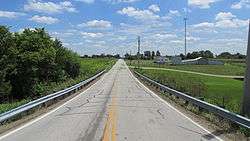
Cook is an unincorporated community in Madison Township, Fayette County, Ohio, United States. It is located at 39°40′59″N 83°18′26″W / 39.68306°N 83.30722°WCoordinates: 39°40′59″N 83°18′26″W / 39.68306°N 83.30722°W,[2] along Cook-Yankeetown Road (Fayette County Highway 34), just west of its intersection with U.S. Route 62/State Route 3.[3]
The community has the name of Matthew S. Cook, an original owner of the town site.[4] The Cook Post Office was established on January 20, 1885, but was discontinued on March 31, 1933. The mail service is now sent through the Mount Sterling branch.[5]
References
- 1 2 "US Board on Geographic Names". United States Geological Survey. 2007-10-25. Retrieved 2008-01-31.
- ↑ U.S. Geological Survey Geographic Names Information System: Cook, Ohio
- ↑ Rand McNally. The Road Atlas '06. Chicago: Rand McNally, 2006, 80.
- ↑ Overman, William Daniel (1958). Ohio Town Names. Akron, OH: Atlantic Press. p. 34.
- ↑ U.S. Geological Survey Geographic Names Information System: Cook Post Office
Municipalities and communities of Fayette County, Ohio, United States | ||
|---|---|---|
| City | 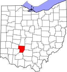 | |
| Villages | ||
| Townships | ||
| CDPs | ||
| Unincorporated communities | ||
| Footnotes | ‡This populated place also has portions in an adjacent county or counties | |
This article is issued from Wikipedia - version of the 7/5/2016. The text is available under the Creative Commons Attribution/Share Alike but additional terms may apply for the media files.