Corn, Oklahoma
| Corn, Oklahoma | |
|---|---|
| Town | |
.jpg) | |
 Location of Corn, Oklahoma | |
| Coordinates: 35°22′43″N 98°46′55″W / 35.3787092°N 98.7820174°WCoordinates: 35°22′43″N 98°46′55″W / 35.3787092°N 98.7820174°W | |
| Country | United States |
| State | Oklahoma |
| County | Washita |
| Area[1] | |
| • Total | 0.357000 sq mi (0.924627 km2) |
| • Land | 0.357000 sq mi (0.924627 km2) |
| • Water | 0.0 sq mi (0.0 km2) |
| Elevation[2] | 1,578 ft (481 m) |
| Population (2010)[3] | |
| • Total | 503 |
| • Estimate (2015)[4] | 506 |
| • Density | 1,400/sq mi (540/km2) |
| Time zone | Central (CST) (UTC-6) |
| • Summer (DST) | CDT (UTC-5) |
| ZIP code | 73024 |
| Area code(s) | 580 |
| FIPS code | 40-17300[5] |
| GNIS feature ID | 1091690[6] |
Corn is a town in Washita County, Oklahoma, United States. The population was 503 at the 2010 census.[3]
Geography
Corn, Oklahoma is located 13 miles northeast of Cordell in west-central Oklahoma.[7] According to the U.S. Geological Survey, its geographic coordinates are 35°22′41″N 98°46′55″W / 35.37806°N 98.78194°W (35.3787092, -98.7820174).[2]
The U.S. Census Bureau, reports that the town has a total area of 0.357 square miles (0.92 km2), all land.[1]
History
Origins of the town name
The word "Korn" itself is a German word translated in English as "grain".[8] Several sources confirm that the town settled by German immigrants received its name because its first post office was located in (or near) a corn field.[9][10] Due to anti-German sentiment during World War I, the name of the town was permanently changed from "Korn" to "Corn".[11]
Founding and early years
The town of Corn, or Korn - as it was spelled at that time - was originally settled by German-speaking Russian Mennonites.[11] Around the time of the Cheyenne-Arapaho Land Run of 1892, Mennonite missionary John J. Kliewer, who was stationed at nearby Shelly Indian Mission, invited fellow Mennonites from Kansas to homestead lands left unclaimed by Cheyennes and Arapahos. Sixteen Mennonite families staked homestead claims in 1892. By 1893, forty families had settled in the area.[12][13]
These Mennonite homesteaders brought with them a particular variety of winter wheat known as "Turkey Red", which grew particularly well in the western Oklahoma soil.[14][15] In 1894, Peter Bergman donated part of his land to establish a place of worship. A rough Mennonite church was then built; a dugout with a low sloping roof and sides made of sod. Church benches were made from local Cottonwood trees.[10] Between the years 1893 and 1920, a total of eight Mennonite churches within an 8-mile radius of the town were established.[12] To mark its centennial year, Corn received a historical marker from the state honoring both its agricultural and Mennonite heritage.[13]
On April 27, 1896, the Korn post office was established in a rural home, two and one-fourth miles north of the present-day town. Shortly thereafter, the post office was moved three miles north of the original site to a store owned by James Kendall. When Kendall's planned townsite failed to develop at the location, the post office was once again moved in 1903 to the present day site of the town of Corn, finding its new home in the merchandise store of George B. Flaming.[11]
World War I brought down harassment both from vigilantes and the Washita county Council of Defense upon many of the Germans and Mennonites that lived in and around Corn. This was due to the combination of their German heritage and their particular Mennonite/Anabaptist theological convictions, which dictated their conscientious objection to participation in warfare.[16] Not only did the town Americanize its name from "Korn" to "Corn" during this time, but the nearby Cordell Christian College closed and a German-language newspaper, the Oklahoma Vorwärts, ceased its operation.[16]
Education
A private Christian academy, under the name "Washita Gemeinde Schule", was established by the Mennonite Brethren Church as a Bible and language school in 1902.[17] Now known as Corn Bible Academy, it has continuously educated students into the twenty-first century[11] and is the oldest Christian school west of the Mississippi.[18] As of 2016, it was serving grades 7-12.[18]
In 1968, the public school of nearby Colony merged with the Corn public schools, forming the Washita Heights School District. On April 23, 2010, a referendum was held asking for voter approval to disband the increasingly small school district of Washita Heights, along with its school in Corn, due to the lack of students within the district and insufficient funding.[19] The dissolution was approved and the nearby Cordell schools annexed the Washita Heights district.
Interesting facts
According to the National Weather Service, the town is credited for having the first-ever U.S. tornado to be captured in movie form. Jon Gossen of rural Corn, filmed a tornado that struck the south side of the town with his home movie camera on June 8, 1951. The tornado itself would later be featured in an edition of The Saturday Evening Post.[20]
Corn was also home to the grandmother of Henry John Deutschendorf Jr., who found fame as a popular singer and songwriter and changed his name to John Denver.[21]
Demographics
| Historical population | |||
|---|---|---|---|
| Census | Pop. | %± | |
| 1960 | 317 | — | |
| 1970 | 409 | 29.0% | |
| 1980 | 542 | 32.5% | |
| 1990 | 548 | 1.1% | |
| 2000 | 591 | 7.8% | |
| 2010 | 503 | −14.9% | |
| Est. 2015 | 506 | [4] | 0.6% |
2000
As of the census[5] of 2000, there were 591 people, 198 households, and 136 families residing in the town. The population density was 1,630.2 people per square mile (633.9/km²). There were 226 housing units at an average density of 623.4 per square mile (242.4/km²). The racial makeup of the town was 91.71% White, 0.34% African American, 1.86% Native American, 2.88% from other races, and 3.21% from two or more races. Hispanic or Latino of any race were 4.57% of the population.
There were 198 households out of which 32.3% had children under the age of 18 living with them, 61.1% were married couples living together, 6.1% had a female householder with no husband present, and 31.3% were non-families. 30.3% of all households were made up of individuals and 19.2% had someone living alone who was 65 years of age or older. The average household size was 2.52 and the average family size was 3.17.
In the town the population was spread out with 24.9% under the age of 18, 4.6% from 18 to 24, 21.8% from 25 to 44, 15.2% from 45 to 64, and 33.5% who were 65 years of age or older. The median age was 44 years. For every 100 females there were 78.5 males. For every 100 females age 18 and over, there were 72.1 males.
The median income for a household in the town was $31,154, and the median income for a family was $33,281. Males had a median income of $23,750 versus $18,750 for females. The per capita income for the town was $15,632. About 14.4% of families and 14.9% of the population were below the poverty line, including 21.1% of those under age 18 and 2.4% of those age 65 or over.
2010
As of 2010, the Census Bureau reported 503 people, 188 households and 118 family households in the town. 93.6% of its population was white. 42.7% were male and 57.3% were female. The average household size was 2.22 and the average family size was 2.86 persons. The percent of the population 18 years and older was 84.9%, or 427 persons, while 37.8%, or 190 persons, were 65 years and older. The median age was 53.6 years.[3]
Economy
Agriculture has been a primary base for Corn and the surrounding county.[16] Crops include wheat, cotton, sorghum, barley, rye, and peanuts.[16]
References
- 1 2 "US Gazetteer files: 2010, 2000, and 1990 (Oklahoma)". United States Census Bureau. February 12, 2011. Retrieved May 11, 2016.
- 1 2 "Feature Detail Report for: Corn". Geographic Names Information System(GNIS). United States Geological Survey. December 18, 1979. Retrieved May 6, 2016.
- 1 2 3 "Profile of General Population and Housing Characteristics: 2010 (DP-1): Corn town, Oklahoma". U.S. Census Bureau, American Factfinder. Retrieved May 11, 2016.
- 1 2 "Annual Estimates of the Resident Population for Incorporated Places: April 1, 2010 to July 1, 2015". Retrieved July 2, 2016.
- 1 2 "American FactFinder". United States Census Bureau. Archived from the original on 2013-09-11. Retrieved 2008-01-31.
- ↑ "US Board on Geographic Names". United States Geological Survey. 2007-10-25. Retrieved 2008-01-31.
- ↑ Official State Map (Map) (2008 ed.). Oklahoma Department of Transportation.
- ↑ "Linguee Dictionary - grain". Linguee Dictionary. Linguee GmbH. Retrieved January 25, 2016.
- ↑ "Profile for Corn, Oklahoma, OK". ePodunk. Retrieved January 26, 2016.
- 1 2 Hege, Henry (1953). "Corn (Oklahoma, USA)". Global Anabaptist Mennonite Encyclopedia Online. GAMEO. Retrieved May 10, 2016.
- 1 2 3 4 Heinrichs, Don. "Encyclopedia of Oklahoma History and Culture - Corn". The Encyclopedia of Oklahoma History and Culture. Oklahoma Historical Society. Retrieved January 23, 2016.
- 1 2 Kroeker, Marvin E. (June 2006). "Natives and Settlers: The Mennonite Invasion of Indian Territory". Mennonite Life. Vol. 61 No. 2: [email protected]. Retrieved May 17, 2016.
- 1 2 "Korn to Corn - Corn, Oklahoma". waymarking.com. Groundspeak, Inc. Retrieved May 10, 2016.
- ↑ Fretz, J Winfield (1956). "Farming Among Mennonites in North America". Global Anabaptist Mennonite Encyclopedia Online. GAMEO. Retrieved January 26, 2016.
- ↑ "Turkey Hard Red Winter Wheat". Heritage Seed Co. Heritage Seed Co. Retrieved January 26, 2016.
- 1 2 3 4 O'Dell, Larry. "Encyclopedia of Oklahoma History and Culture - Washita County". The Encyclopedia of Oklahoma History and Culture. Oklahoma Historical Society. Retrieved January 23, 2016.
- ↑ Vogt, JW; Steiner, Sam (July 2008). "Corn Bible Academy (Corn, Oklahoma, USA)". Global Anabaptist Mennonite Encyclopedia Online. GAMEO. Retrieved January 26, 2016.
- 1 2 "Corn Bible Academy home page". Corn Bible Academy. Corn Bible Academy. Retrieved January 25, 2016.
- ↑ Rolland, Megan (March 14, 2010). "Washita Heights community faces loss of schools". News OK. newsok.com. Retrieved May 11, 2016.
- ↑ Matthews, Gan (June 8, 2010). "Corn Resident One of First to Capture Tornado on Motion Pictures 59 Years Ago". News9.com. Frankly Media. Retrieved May 9, 2016.
- ↑ Reilly, Debra"," (accessed September 23, 2011).
- ↑ "Census of Population and Housing". United States Census Bureau. Retrieved June 4, 2015.
External links
Municipalities and communities of Washita County, Oklahoma, United States | ||
|---|---|---|
| Cities | 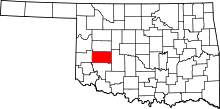 | |
| Towns | ||
| Unincorporated communities |
| |
| Footnotes | ‡This populated place also has portions in an adjacent county or counties | |