Clinton, Oklahoma
| Clinton, Oklahoma | |
|---|---|
| City | |
| Motto: "Hub City of Western Oklahoma" | |
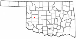 Location of Clinton, Oklahoma | |
| Coordinates: 35°30′34″N 98°58′27″W / 35.50944°N 98.97417°WCoordinates: 35°30′34″N 98°58′27″W / 35.50944°N 98.97417°W | |
| Country | United States |
| State | Oklahoma |
| Counties | Custer, Washita |
| Government | |
| • Type | Council / Manager |
| Area | |
| • Total | 9.395951 sq mi (24.335402 km2) |
| • Land | 9.377394 sq mi (24.287340 km2) |
| • Water | 0.018557 sq mi (0.048062 km2) |
| Elevation | 1,565 ft (477 m) |
| Population (2010) | |
| • Total | 9,033 |
| • Density | 960/sq mi (370/km2) |
| Time zone | Central (CST) (UTC-6) |
| • Summer (DST) | CDT (UTC-5) |
| ZIP code | 73601 |
| Area code(s) | 580 |
| FIPS code | 40-15400[1] |
| GNIS feature ID | 1091467[2] |
| Website | Clinton, Oklahoma |
Clinton is a city in Custer and Washita counties in the U.S. state of Oklahoma. The population was 9,033 at the 2010 census.
History
The community began in 1899 when two men, J.L. Avant and E.E. Blake, decided to locate a town in the Washita River Valley.
Because of governmental stipulations that an Indian could sell no more than one half of a 160-acre (0.6 km2) allotment, the men made plans to purchase 320 acres (1.3 km2) from four different Indians - Hays, Shoe-Boy, Nowahy, and Night Killer - and paid them each $2,000 for 80 acres (320,000 m2) to begin the small settlement of Washita Junction.
Congressional approval for the sale was granted in 1902 and Washita Junction quickly developed.[3] The first businesses were the office of the Custer County Chronicle newspaper and the First National Bank building. When a post office was started, the postal department would not accept the name of Washita Junction; so the town was named for the late Judge Clinton Irwin.
Clinton was served by the Frisco Railroad. It was also the eastern terminus of the Clinton, Oklahoma, and Western Railroad Company, which lay track westward to Hemphill County, Texas. Once in Hemphill County, a second similarly-named railroad, the Clinton-Oklahoma-Western Railroad Company of Texas, joined with Pampa in Gray County, Texas. Both of these companies were soon leased and purchased by the Panhandle and Santa Fe Railway, which held them until disestablishment in 1965.[4]
Clinton particularly benefited from the presence of U.S. Highway 66. Like most other cities and towns on Route 66, Clinton was home of tourist businesses including several restaurants, cafés, motels and filling stations. The Pop Hicks Restaurant, which opened in 1936 and burned in 1999, was once the longest running restaurant on Route 66. The U.S. Highway 66 Association, founded 1927 in Tulsa, curtailed its activity when World War II rationing of rubber and fuel disrupted leisure travel. After the war, Jack and Gladys Cutberth revived the organization in Clinton, where it promoted the "Main Street of America" from 1947 until it disbanded in the 1980s.[5] The late Dr. Walter S. Mason Jr. operated a Best Western from 1964-2003 which welcomed Elvis Presley as an occasional guest in the 1960s.[6]
Today, cross-country traffic passes Clinton to the south on Interstate 40, which bypassed the city in 1970.[5] Clinton remains a popular tourist stop as one of the largest Route 66 cities between Oklahoma City and Amarillo, Texas. Much of the old U.S. 66 route that passed through the city is now designated as an I-40 business loop; the town became home to the first state sponsored Route 66 Museum in the nation.[7]
In 1942, the federal government built a naval airfield at nearby Burns Flat and named it Naval Air Station Clinton. During the World War II period, the population of Clinton grew to nearly 7,000 residents. In 1949, Naval Air Station Clinton was deactivated and the airfield was deeded to the City of Clinton, specifying that the land could be recaptured in case of national emergencies. Later, the government leased the site back and used it as Clinton-Sherman Air Force Base a bomber base supporting 4123rd Strategic Wing, then the 70th Bombardment Wing, Heavy of the Strategic Air Command (SAC), operating B-52 Stratofortress and KC-135 Stratotanker aircraft. Purchasing more land, the site soon expanded to more than 3,500 acres (14 km2), where both the U.S. Air Force and the U.S. Navy utilized the airfield for both operational and training purposes. When military operations were de-emphasized, the Clinton-Sherman base was designated for closure in 1969. The entire complex was deeded to the City of Clinton in 1971 and three years later became the Clinton-Sherman Industrial Airpark.
Clinton is also home to the Clinton Daily News, a six-day daily newspaper edited by Rod Serfoss which has a circulation of 4,500.[8] The newspaper has been published continuously from its inception in 1927 to the current day.[9]
Geography
Clinton is located at 35°30′34″N 98°58′27″W / 35.50944°N 98.97417°W (35.509369, −98.974063),[10] sitting at an elevation of 1,592 feet (485 m). The town is located on historic U.S. Route 66, which is now Interstate 40.
According to the United States Census Bureau, the city has a total area of 8.9 square miles (23.2 km²), of which 8.9 square miles (23.1 km²) is land and 0.04 square mile (0.1 km²) (0.22%) is water.
Climate
| Climate data for Clinton, Oklahoma | |||||||||||||
|---|---|---|---|---|---|---|---|---|---|---|---|---|---|
| Month | Jan | Feb | Mar | Apr | May | Jun | Jul | Aug | Sep | Oct | Nov | Dec | Year |
| Record high °F (°C) | 85 (29) |
84 (29) |
95 (35) |
98 (37) |
106 (41) |
112 (44) |
112 (44) |
115 (46) |
111 (44) |
98 (37) |
89 (32) |
89 (32) |
115 (46) |
| Average high °F (°C) | 50 (10) |
55 (13) |
63 (17) |
73 (23) |
81 (27) |
91 (33) |
95 (35) |
96 (36) |
88 (31) |
77 (25) |
62 (17) |
53 (12) |
74 (23) |
| Average low °F (°C) | 25 (−4) |
29 (−2) |
35 (2) |
47 (8) |
56 (13) |
66 (19) |
69 (21) |
68 (20) |
60 (16) |
48 (9) |
34 (1) |
28 (−2) |
47 (8) |
| Record low °F (°C) | −14 (−26) |
−4 (−20) |
−2 (−19) |
20 (−7) |
31 (−1) |
44 (7) |
53 (12) |
49 (9) |
34 (1) |
22 (−6) |
8 (−13) |
−1 (−18) |
−14 (−26) |
| Average precipitation inches (mm) | 1.0 (25) |
1.0 (25) |
1.6 (41) |
2.8 (71) |
5.1 (130) |
3.5 (89) |
2.6 (66) |
2.3 (58) |
2.1 (53) |
2.6 (66) |
1.0 (25) |
1.1 (28) |
26.5 (673) |
| Average snowfall inches (cm) | 3.3 (8.4) |
2.3 (5.8) |
2.2 (5.6) |
0.5 (1.3) |
0 (0) |
0 (0) |
0 (0) |
0 (0) |
0 (0) |
0 (0) |
0.2 (0.5) |
1.5 (3.8) |
10 (25) |
| Average rainy days | 2.8 | 2.8 | 4 | 5.9 | 7.2 | 6.2 | 5.1 | 4.6 | 3.7 | 4.4 | 2.3 | 2.9 | 51.9 |
| Average relative humidity (%) | 63 | 60 | 56 | 55 | 61 | 64 | 57 | 56 | 65 | 62 | 63 | 67 | 61 |
| Source #1: weather.com | |||||||||||||
| Source #2: Weatherbase.com[11] | |||||||||||||
Demographics
| Historical population | |||
|---|---|---|---|
| Census | Pop. | %± | |
| 1910 | 2,781 | — | |
| 1920 | 2,596 | −6.7% | |
| 1930 | 7,512 | 189.4% | |
| 1940 | 6,736 | −10.3% | |
| 1950 | 7,555 | 12.2% | |
| 1960 | 9,617 | 27.3% | |
| 1970 | 10,359 | 7.7% | |
| 1980 | 9,730 | −6.1% | |
| 1990 | 9,248 | −5.0% | |
| 2000 | 8,833 | −4.5% | |
| 2010 | 9,033 | 2.3% | |
| Est. 2015 | 9,565 | [12] | 5.9% |
As of the census[1] of 2000, there were 8,833 people, 3,331 households, and 2,265 families residing in the city. The population density was 989.1 people per square mile (381.9/km²). There were 3,818 housing units at an average density of 427.5 per square mile (165.1/km²). The racial makeup of the city was 68.92% White, 5.82% African American, 6.39% Native American, 0.78% Asian, 0.02% Pacific Islander, 13.62% from other races, and 4.45% from two or more races. Hispanic or Latino of any race were 18.99% of the population.
There were 3,331 households out of which 32.6% had children under the age of 18 living with them, 51.7% were married couples living together, 11.7% had a female householder with no husband present, and 32.0% were non-families. 28.5% of all households were made up of individuals and 14.1% had someone living alone who was 65 years of age or older. The average household size was 2.55 and the average family size was 3.14.
In the city the population was spread out with 27.6% under the age of 18, 8.9% from 18 to 24, 25.7% from 25 to 44, 20.5% from 45 to 64, and 17.4% who were 65 years of age or older. The median age was 36 years. For every 100 females there were 93.0 males. For every 100 females age 18 and over, there were 88.3 males.
The median income for a household in the city was $27,051, and the median income for a family was $32,242. Males had a median income of $24,588 versus $18,596 for females. The per capita income for the city was $14,606. About 14.6% of families and 18.9% of the population were below the poverty line, including 23.9% of those under age 18 and 11.1% of those age 65 or over.
Economy
Automotive manufacturer, SportChassis was founded and has its global headquarters in Clinton.
Events
The municipal airport in Clinton was the site of the first crash of a C-5 Galaxy (68-0227) on September 27, 1974.
Notable people
- Gordon Gore, NFL player
- Captain Frederick F. Henry, United States Army (deceased), Korean War Medal of Honor recipient
- Scott Hendricks, music producer
- Toby Keith, singer
- Meg Randall, actress
- James R. Winchester, judge
Schools
Clinton has three elementary schools, one middle school and one high school within the public school system. There is also an alternative school that is part of the public school system.
Sports
Clinton is known for its high school football team, the "Red Tornadoes". The Red Tornadoes have won 16 state championships (1965, 1967, 1968, 1969, 1978, 1982, 1984, 1996, 1997, 2000, 2001, 2003, 2004, 2005, 2007, 2012)[14] which ranks currently second in the state of Oklahoma behind Ada. The Red Tornado football program currently ranks first in the state in all-time wins. Along with football, Clinton excels at a number of other sports. Other school sports include boys' and girls' basketball (the "Lady Red Tornadoes" or "Lady Reds"), baseball, girls' softball, wrestling, tennis, soccer, girls' volleyball, and track and field. Team colors are maroon and gold and the School mascot is an anthropomorphic tornado named "Tony".
Sights
Museums
- Route 66 museum, located on historic U.S. Route 66
- Cheyenne Cultural Center
National Register of Historic Places
- Clinton Armory
- Crawford House
- McLain Rogers Park
- Y Service Station & Café
References
- 1 2 "American FactFinder". United States Census Bureau. Archived from the original on 2013-09-11. Retrieved 2008-01-31.
- ↑ "US Board on Geographic Names". United States Geological Survey. 2007-10-25. Retrieved 2008-01-31.
- ↑ Clinton at Encyclopedia of Oklahoma History and Culture Archived May 31, 2010, at the Wayback Machine. (accessed April 27)
- ↑ "Clinton-Oklahoma-Western Railroad". tshaonline.org. Retrieved April 27, 2013.
- 1 2 Jon Sonderman; Jim Ross (2011-12-05). Route 66 in Oklahoma. p. 8. ISBN 9780738590516. Retrieved 2012-08-20.
- ↑ "Old-style motels fading out". USA Today. 2003-12-03. Retrieved 2012-08-18.
- ↑ Oklahoma Route 66 Museum, Oklahoma Historical Society, Clinton OK
- ↑ "Clinton Daily News", Finder Binder: Oklahoma's Updated Media Directory, 2009 Winter Issue.
- ↑ "About this Newspaper: Clinton daily news" Library of Congress (accessed February 25, 2010).
- ↑ "US Gazetteer files: 2010, 2000, and 1990". United States Census Bureau. 2011-02-12. Retrieved 2011-04-23.
- ↑ "Historical Weather for Clinton, Oklahoma, United States".
- ↑ "Annual Estimates of the Resident Population for Incorporated Places: April 1, 2010 to July 1, 2015". Retrieved July 2, 2016.
- ↑ "Census of Population and Housing". Census.gov. Archived from the original on May 11, 2015. Retrieved June 4, 2015.
- ↑ Godfrey, Ed (19 October 2012). "High school football: Clinton honors 1967 team that was proclaimed high school national champions". NewsOK. Retrieved 28 August 2014.
External links
- City website
- Clinton Chamber of Commerce
- Community profile
- Legends of America
- Encyclopedia of Oklahoma History and Culture - Clinton
- Route 66 Museum
- Cheyenne Cultural Center
Municipalities and communities of Custer County, Oklahoma, United States | ||
|---|---|---|
| Cities | 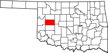 | |
| Towns | ||
| Unincorporated communities | ||
| Ghost town | ||
| Footnotes | ‡This populated place also has portions in an adjacent county or counties | |
Municipalities and communities of Washita County, Oklahoma, United States | ||
|---|---|---|
| Cities | 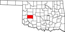 | |
| Towns | ||
| Unincorporated communities |
| |
| Footnotes | ‡This populated place also has portions in an adjacent county or counties | |