Düziçi
| Düziçi | |
|---|---|
 Düziçi | |
| Coordinates: 37°14′35″N 36°27′24″E / 37.24306°N 36.45667°ECoordinates: 37°14′35″N 36°27′24″E / 37.24306°N 36.45667°E | |
| Country |
|
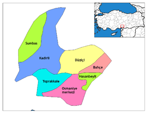
| Province | Osmaniye |
| Government | |
| • Mayor | Ökkeş Namlı (MHP) |
| • Kaymakam | Nevzat Şengök |
| Area[1] | |
| • District | 538.20 km2 (207.80 sq mi) |
| Elevation | 390 m (1,280 ft) |
| Population (2012)[2] | |
| • Urban | 43,048 |
| • District | 78,189 |
| • District density | 150/km2 (380/sq mi) |
| Post code | 80600 |
| Website |
www |
Düziçi is a town and district of Osmaniye Province in the Mediterranean region of Turkey. It is located in a small plain in the foothills of the Nur Mountains and 440 m above the sea level.
Düziçi is on a route from the Middle East to Anatolia and has seen numerous armies and campaigns throughout the centuries. The historical names for this site are minor variations of Haruniye (Arabic: al-Hārūniyya(h); Armenian: Harun or Harunia; Crusader: Haronia or Aronia). Its small castle is on an outcrop about 3 kilometers northeast of the town.
History and Monuments
The fortress was built in A.D. 785/86 during the Abbasid Caliphate by Hārūn ar-Rašīd as a link in a chain of Arab defenses along the Nur Dağları. The Byzantine Emperor Nicephorus Phocas captured the 1,500 residents of Haruniye in 959. When it was recaptured by the Sayf ad-Dawlah in 967, the fort was repaired. Following the Battle of Manzikert in 1071 nomadic Turks began to move into Anatolia and the nearby hills were temporarily settled by the Avşar tribe of the Turkmen. At some point between the mid-12th century and 1198/99 it became the possession of the Armenian Kingdom of Cilicia. On January 22, 1236 the Armenian King Het‛um I and his wife Zapēl bestowed the castle and village of Haruniye to the Knights of the Teutonic Order.[3]
The plan of Haruniye Kalesi reveals a compact keep-like structure with a massive tower at the east, which protects a postern gate. There are continuous galleries with pointed vaults in the north and west walls which are opened by embrasured arrow slits. The main entrance is at the south. Repairs to the castle may belong to the Teutonic Knights or the Mamluks. The lower level of the large tower at the east may have functioned as a cistern.[3]
In the late 13th century it was captured by the Egyptian Mamluks, who made Haruniye the administrative center for eastern Cilicia in the mid-14th century. The Ottomans took control in 1516 during the campaign against Egypt of Sultan Selim I. In the Ottoman period the town was still known as Haruniye.
Düziçi is one of many places in the Çukurova area that claims association with the legendary 17th century folk-poet Karacaoğlan.
The town was occupied by the French forces after the First World War until the Turkish War of Independence.
Population
The population of the county in 2014 is 80 430 according to the census. In this 45.987's the town center, while 34 443 are living in towns and villages. As of 2014 the city center population is 45 987.
Depending on the district, including the district depends; 4 waist , 25 villages and 20 from neighborhood consists.
Düziçi today
This is a farming district, growing peanuts, corn and wheat, irrigated by Berke reservoir.
Education
1 High School of Science in Our Town center, 2 Anatolian High School, 1 Public High School, 1 Vocational and Technical High School, 1 Health Professions High School, 1 Commercial High School, 1 Multi-Program High School a total of 8 schools, including, in the hands District 1 General high school for a total of 9 high school, also one kindergarten, one 8 years 22 and 29 at 5 There is a total of 51 years, including elementary school. We have a total of 61 schools across the county.
Places of interest
- The castle of Harun al-Rahshid.
- The Haruniye hot springs.
- Mount Düldül, a peak in the Nur Mountains
References
- ↑ "Area of regions (including lakes), km²". Regional Statistics Database. Turkish Statistical Institute. 2002. Retrieved 2013-03-05.
- ↑ "Population of province/district centers and towns/villages by districts - 2012". Address Based Population Registration System (ABPRS) Database. Turkish Statistical Institute. Retrieved 2013-02-27.
- 1 2 Edwards, Robert W. (1987). The Fortifications of Armenian Cilicia: Dumbarton Oaks Studies XXIII. Washington, D.C.: Dumbarton Oaks, Trustees for Harvard University. pp. 143–147, esp. notes 2–4, 283, pls.96a–100b. ISBN 0-88402-163-7.
External links
- District governor's official website (Turkish)
- District municipality's official website (Turkish)