South Wollo Zone
Debub Wollo, or South Wollo, is one of 10 Zones in the Amhara Region of Ethiopia. It acquired its name from the former province of Wollo.
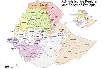
Debub Wollo is bordered on the south by Semien Shewa and the Oromia Region, on the west by Mirab Gojjam, on the northwest by Debub Gondar, on the north by Semien Wollo, on the northeast by Afar Region, and on the east by the Oromia Zone and Argobba special woreda. Its highest point is Mount Amba Ferit. Towns and cities in Debub Wello include Amba Mariam, Hayq, Dessie, and Wuchale.
On 24 August 2009 Zonal authorities announced that approximately 540 safe water units were constructed during the past Ethiopian budget year at a cost of over 23 million birr, while another 878 units were repaired. This has improved the access to safe water from 51% to 61% of the Zone's inhabitants.[1]
Demographics
Based on the 2007 Census conducted by the Central Statistical Agency of Ethiopia (CSA), this Zone has a total population of 2,518,862, an increase of 18.60% over the 1994 census, of whom 1,248,698 are men and 1,270,164 women; with an area of 17,067.45 square kilometers, Debub Wollo has a population density of 147.58. While 301,638 or 11.98% are urban inhabitants, a further 3 individuals were reported to be pastoralists. A total of 598,447 households were counted in this Zone, which results in an average of 4.21 persons to a household, and 574,378 housing units. The largest ethnic group reported in Debub Wollo was the Amhara (99.33%); all other ethnic groups made up 0.67% of the population. Amharic is spoken as a first language by 98.65%; the remaining 1.35% spoke all other primary languages reported. 70.89% were Muslim, and 28.8% of the population said they practiced Ethiopian Orthodox Christianity.[2]
The 1994 national census reported a total population for this Zone of 2,123,803 in 498,480 households, of whom 1,047,512 were men and 1,076,291 women; 210,291 or 9.9% of its population were urban dwellers at the time. The two largest ethnic groups reported in Debub Wollo were the Amhara (97.68%), and the Oromo (1.78%); all other ethnic groups made up 0.54% of the population. Amharic was spoken as a first language by 98.45%, and 1.13% spoke Oromiffa; the remaining 0.42% spoke all other primary languages reported. 70.27% were Muslim, and 29.5% of the population said they practiced Ethiopian Orthodox Christianity.[3]
According to a May 24, 2004 World Bank memorandum, 13% of the inhabitants of Debub Wollo have access to electricity, this zone has a road density of 76.1 kilometers per 1000 square kilometers (compared to the national average of 30 kilometers),[4] the average rural household has 0.7 hectare of land (compared to the national average of 1.01 hectare of land and an average of 0.75 for the Amhara Region)[5] and the equivalent of 0.6 heads of livestock. 10.6% of the population is in non-farm related jobs, compared to the national average of 25% and a regional average of 21%. 63% of all eligible children are enrolled in primary school, and 12% in secondary schools. 45% of the zone is exposed to malaria, and none to tsetse fly. The memorandum gave this zone a drought risk rating of 557.[6]
Notes
- ↑ "Zone gets 540 safe water units", Ethiopian News Agency (accessed 2 November 2009)
- ↑ Census 2007 Tables: Amhara Region, Tables 2.1, 2.4, 2.5, 3.1, 3.2 and 3.4.
- ↑ 1994 Population and Housing Census of Ethiopia: Results for Amhara Region, Vol. 1, part 1, Tables 2.1, 2.11, 2.14, 2.17 (accessed 6 April 2009).
- ↑ "Ethiopia - Second Road Sector Development Program Project", p.3 (World Bank Project Appraisal Document, published 19 May 2003)
- ↑ Comparative national and regional figures comes from another World Bank publication, Klaus Deininger et al. "Tenure Security and Land Related Investment", WP-2991 (accessed 23 March 2006).
- ↑ World Bank, Four Ethiopias: A Regional Characterization (accessed 23 March 2006).
External links
Coordinates: 11°00′N 39°15′E / 11.000°N 39.250°E
Zones of the Amhara Region | ||
|---|---|---|
| Current zones | ||
| Special woredas | ||