Decatur, Arkansas
| Decatur, Arkansas | |
|---|---|
| City | |
|
Downtown Decatur | |
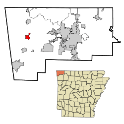 Location in Benton County and the state of Arkansas | |
| Coordinates: 36°20′15″N 94°27′24″W / 36.33750°N 94.45667°WCoordinates: 36°20′15″N 94°27′24″W / 36.33750°N 94.45667°W | |
| Country | United States |
| State | Arkansas |
| County | Benton |
| Area | |
| • Total | 4.5 sq mi (11.7 km2) |
| • Land | 4.4 sq mi (11.5 km2) |
| • Water | 0.04 sq mi (0.1 km2) |
| Elevation | 1,237 ft (377 m) |
| Population (2010) | |
| • Total | 1,699 |
| • Density | 382/sq mi (147.5/km2) |
| Time zone | Central (CST) (UTC-6) |
| • Summer (DST) | CDT (UTC-5) |
| ZIP code | 72722 |
| Area code(s) | 479 |
| FIPS code | 05-17740 |
| GNIS feature ID | 0076769 |

Decatur is a city, in Benton County, Arkansas, United States. The population was 1,699 at the 2010 census.[1] It is part of the Fayetteville–Springdale–Rogers, AR-MO Metropolitan Statistical Area. This town is named after war hero Stephen Decatur, Jr.
Geography
Decatur is located in western Benton County at 36°20′15″N 94°27′24″W / 36.33750°N 94.45667°W (36.337541, -94.456721).[2] Arkansas Highway 59 passes through the city, leading north 6 miles (10 km) to Gravette and 13 miles (21 km) to the Missouri border, and south 13 miles (21 km) to Siloam Springs. Arkansas Highway 102 leads east 16 miles (26 km) to Bentonville and west 10 miles (16 km) to the Oklahoma border.
According to the United States Census Bureau, Decatur has a total area of 4.5 square miles (11.7 km2), of which 4.4 square miles (11.5 km2) is land and 0.039 square miles (0.1 km2), or 1.21%, is water.[1]
Demographics
| Historical population | |||
|---|---|---|---|
| Census | Pop. | %± | |
| 1910 | 246 | — | |
| 1920 | 424 | 72.4% | |
| 1930 | 413 | −2.6% | |
| 1940 | 358 | −13.3% | |
| 1950 | 350 | −2.2% | |
| 1960 | 415 | 18.6% | |
| 1970 | 847 | 104.1% | |
| 1980 | 1,013 | 19.6% | |
| 1990 | 918 | −9.4% | |
| 2000 | 1,314 | 43.1% | |
| 2010 | 1,699 | 29.3% | |
| Est. 2015 | 1,773 | [3] | 4.4% |
2015 Estimate[5] | |||
As of the 2010 census Decatur had a population of 1,699. The racial and ethnic makeup of the population was 62.4% non-Hispanic white, 0.5% non-Hispanic black, 4.3% Native American, 0.9% Asian, 5.2% from two or more races and 28.4% Hispanic or Latino.[7]
As of the census[8] of 2000, there were 1,314 people, 465 households, and 346 families residing in the city. The population density was 573.0 people per square mile (221.5/km²). There were 535 housing units at an average density of 233.3 per square mile (90.2/km²). The racial makeup of the city was 80.97% White, 5.48% Native American, 0.46% Asian, 10.12% from other races, and 2.97% from two or more races. 16.51% of the population were Hispanic or Latino of any race.
There were 465 households out of which 44.7% had children under the age of 18 living with them, 52.3% were married couples living together, 15.7% had a female householder with no husband present, and 25.4% were non-families. 21.9% of all households were made up of individuals and 9.5% had someone living alone who was 65 years of age or older. The average household size was 2.83 and the average family size was 3.23.
In the city the population was spread out with 32.0% under the age of 18, 9.8% from 18 to 24, 33.3% from 25 to 44, 16.1% from 45 to 64, and 8.8% who were 65 years of age or older. The median age was 29 years. For every 100 females there were 111.6 males. For every 100 females age 18 and over, there were 103.0 males.
The median income for a household in the city was $29,844, and the median income for a family was $33,333. Males had a median income of $22,115 versus $19,125 for females. The per capita income for the city was $11,618. About 16.3% of families and 18.3% of the population were below the poverty line, including 23.2% of those under age 18 and 22.1% of those age 65 or over.
Education
Public education for elementary and secondary school students is primarily provided by the Decatur School District leading to graduation from Decatur High School. Some students may attend the Gentry School District and graduate from the Gentry High School.
References
- 1 2 "Geographic Identifiers: 2010 Demographic Profile Data (G001): Decatur city, Arkansas". U.S. Census Bureau, American Factfinder. Retrieved September 23, 2013.
- ↑ "US Gazetteer files: 2010, 2000, and 1990". United States Census Bureau. 2011-02-12. Retrieved 2011-04-23.
- ↑ "Annual Estimates of the Resident Population for Incorporated Places: April 1, 2010 to July 1, 2015". Retrieved July 2, 2016.
- ↑ "Census of Population and Housing". Census.gov. Retrieved June 4, 2015.
- ↑ "Annual Estimates of the Resident Population for Incorporated Places: April 1, 2010 to July 1, 2015". Retrieved June 26, 2016.
- ↑ National Park Service (2010-07-09). "National Register Information System". National Register of Historic Places. National Park Service.
- ↑ 2010 general profile of population and housing characteristics of Decatur from the US census
- ↑ "American FactFinder". United States Census Bureau. Retrieved 2008-01-31.
External links
Municipalities and communities of Benton County, Arkansas, United States | ||
|---|---|---|
| Cities |  | |
| Towns | ||
| Townships | ||
| CDPs | ||
| Other communities |
| |
| Ghost town | ||
| Footnotes | ‡This populated place also has portions in an adjacent county or counties | |