Decatur Township, Marion County, Indiana
| Decatur Township Marion County | |
|---|---|
| Township | |
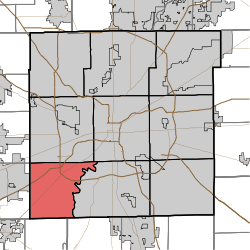 Map of Marion County with Decatur Township highlighted | |
| Coordinates: 39°41′44″N 86°15′42″W / 39.69556°N 86.26167°WCoordinates: 39°41′44″N 86°15′42″W / 39.69556°N 86.26167°W | |
| Country | United States |
| State | Indiana |
| County | Marion |
| Named for | Stephen Decatur |
| Government | |
| • Type | Indiana township |
| Area | |
| • Total | 32.4 sq mi (83.9 km2) |
| • Land | 32.3 sq mi (83.7 km2) |
| • Water | 0.1 sq mi (0.2 km2) |
| Elevation | 768 ft (234 m) |
| Population (2010) | |
| • Total | 32,388 |
| • Density | 1,000/sq mi (390/km2) |
| Time zone | Eastern (EST) (UTC-5) |
| • Summer (DST) | EDT (UTC-4) |
| FIPS code | 18-17092[1] |
| GNIS feature ID | 0453255[2] |
Decatur Township is the smallest in geographic size and in population of the nine townships in Marion County, Indiana, United States. As of the 2010 census, it had a population of 32,388.[3] Located on the southwest corner of the county, the township is home to the new Indianapolis International Airport main terminal. The city of Indianapolis and Marion County are a merged unit. Long one of the most rural sections of the county, Decatur Township has seen many new residential and commercial developments. AmeriPlex, one of the largest industrial parks in Indiana, is in Decatur Township. Through the White River, Decatur and Perry townships share the only water boundary among Marion County's townships.
Population
Decatur Township was home to 27,881 residents in 2008 and has seen tremendous growth in recent years. As of the 2010 census, it had a population of 32,388.
History
The township was settled in the 1820s by mostly Quakers from South Carolina. They settled along the banks of the White River. West Newton is a small Quaker-settled town inside the township. Many of today's residents can trace their lineages back to these early settlers.
Decatur Township was named for Stephen Decatur.[4]
Key information
The township is the home of the Decatur Township Civic Council and the Metropolitan School District of Decatur Township. The Indianapolis Challenger Center calls Decatur Township home.
Camby (also sometimes called "West Union Station") is a neighborhood in western Decatur Township that also extends into neighboring Hendricks and Morgan counties, centered along Camby Road near State Road 67.[5] Its elevation is 764 feet (233 m) above sea level, and it is located at 39°39′45″N 86°19′00″W / 39.66250°N 86.31667°W (39.6625457, −86.3166582).[6] Camby has a post office with the ZIP code of 46113.[7]
Township elected officials
- U.S. Congress, District 7: André Carson (D)
- Indiana House, District 91: Robert Behning (R)
- Indiana Senate, District 35: R. Michael Young (R)
- Mayor: Joe Hogsett (D)
- City-County Council, District 22: Jason Holliday (R)
- City-County Council, At-Large: Zach Adamson (D), John Barth (D), Pamela Hickman (D), Leroy Robinson (D)
- Trustee: Stephen Rink (R)
- Small Claims Court Judge: Myron Hockman (R)
- Constable: Darrell McGaha (R)
- Township Board: District 1, Stephanie McGaha (R); District 2, Pat Rigsby (D); District 3, Sandra Filipovich (R); District 4, Joe Griffith (R); District 5, Larry Kugelman (R); District 6, Martha Fisher-Vaughn (R); District 7, David Knight (R)
- School Board: Judy Collins, Larry Taylor, Dale Henson, Timothy Huber, Cathy Wiseman
References
- ↑ "American FactFinder". United States Census Bureau. Retrieved 2008-01-31.
- ↑ "US Board on Geographic Names". United States Geological Survey. 2007-10-25. Retrieved 2008-01-31.
- ↑ "Profile of General Population and Housing Characteristics: 2010 Demographic Profile Data (DP-1): Decatur township, Marion County, Indiana". U.S. Census Bureau, American Factfinder. Retrieved February 13, 2012.
- ↑ Bodenhamer, David J.; Barrows, Robert G. (22 November 1994). The Encyclopedia of Indianapolis. Indiana University Press. p. 495. ISBN 0-253-11249-4.
- ↑ DeLorme. Indiana Atlas & Gazetteer. 3rd ed. Yarmouth: DeLorme, 2004, p. 44. ISBN 0-89933-319-2.
- ↑ Geographic Names Information System Feature Detail Report, Geographic Names Information System, 1979-02-14. Accessed 2008-06-01.
- ↑ Zip Code Lookup
External links
- Indiana Township Association
- United Township Association of Indiana
- Decatur Township Fire Department
Municipalities and communities of Marion County, Indiana, United States | ||
|---|---|---|
| Cities | ||
| Town | ||
| Townships | ||
| Included towns (see Unigov) | ||
| Footnotes | ‡This populated place also has portions in an adjacent county or counties | |