Deer River, Minnesota
| Deer River, Minnesota | |
|---|---|
| City | |
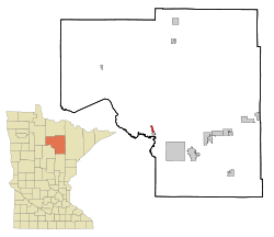 Location of the city of Deer River within Itasca County, Minnesota | |
| Coordinates: 47°20′6″N 93°47′39″W / 47.33500°N 93.79417°W | |
| Country | United States |
| State | Minnesota |
| County | Itasca |
| Area[1] | |
| • Total | 1.29 sq mi (3.34 km2) |
| • Land | 1.29 sq mi (3.34 km2) |
| • Water | 0 sq mi (0 km2) |
| Elevation | 1,293 ft (394 m) |
| Population (2010)[2] | |
| • Total | 930 |
| • Estimate (2012[3]) | 929 |
| • Density | 720.9/sq mi (278.3/km2) |
| Time zone | Central (CST) (UTC-6) |
| • Summer (DST) | CDT (UTC-5) |
| ZIP code | 56636 |
| Area code(s) | 218 |
| FIPS code | 27-15310[4] |
| GNIS feature ID | 0655967[5] |
| Website | http://www.deerrivercity.com/ |
Deer River is a city in Itasca County, Minnesota, United States. The population was 930 at the 2010 census.[6]
U.S. Highway 2 and Minnesota State Highways 6 and 46 are three of the main routes in the community.
Deer River is home to the world's largest Wild Rice Festival. Possibly its greatest attribute is its proximity to several beautiful lakes, including Deer Lake, Bowstring Lake, Leech Lake, and Lake Winnibigoshish.
History
Deer River has a site on the National Register of Historic Places, the Itasca Lumber Company Superintendent's House, built in 1904 by the leading lumber company in the area.[7]
Late in World War II, a logging camp manned by prisoners of war was located at the site of an old CCC camp near Deer River.[8]
Geography
According to the United States Census Bureau, the city has a total area of 1.29 square miles (3.34 km2), all of it land.[1]
Demographics
| Historical population | |||
|---|---|---|---|
| Census | Pop. | %± | |
| 1900 | 251 | — | |
| 1910 | 900 | 258.6% | |
| 1920 | 1,044 | 16.0% | |
| 1930 | 832 | −20.3% | |
| 1940 | 987 | 18.6% | |
| 1950 | 1,033 | 4.7% | |
| 1960 | 992 | −4.0% | |
| 1970 | 815 | −17.8% | |
| 1980 | 907 | 11.3% | |
| 1990 | 838 | −7.6% | |
| 2000 | 903 | 7.8% | |
| 2010 | 930 | 3.0% | |
| Est. 2015 | 933 | [9] | 0.3% |
| U.S. Decennial Census | |||
2010 census
As of the census[2] of 2010, there were 930 people, 397 households, and 212 families residing in the city. The population density was 720.9 inhabitants per square mile (278.3/km2). There were 434 housing units at an average density of 336.4 per square mile (129.9/km2). The racial makeup of the city was 83.8% White, 0.1% African American, 11.5% Native American, 0.1% from other races, and 4.5% from two or more races. Hispanic or Latino of any race were 0.3% of the population.
There were 397 households of which 28.2% had children under the age of 18 living with them, 37.5% were married couples living together, 10.8% had a female householder with no husband present, 5.0% had a male householder with no wife present, and 46.6% were non-families. 39.8% of all households were made up of individuals and 19.4% had someone living alone who was 65 years of age or older. The average household size was 2.25 and the average family size was 3.05.
The median age in the city was 39.8 years. 24.6% of residents were under the age of 18; 9% were between the ages of 18 and 24; 20.8% were from 25 to 44; 24% were from 45 to 64; and 21.6% were 65 years of age or older. The gender makeup of the city was 44.9% male and 55.1% female.
2000 census
As of the census[4] of 2000, there were 903 people, 389 households, and 220 families residing in the city. The population density was 850.9 people per square mile (328.9/km²). There were 415 housing units at an average density of 391.1 per square mile (151.2/km²). The racial makeup of the city was 84.05% White, 12.07% Native American, 0.22% Asian, and 3.65% from two or more races. Hispanic or Latino of any race were 0.66% of the population. 21.6% were of German, 14.8% Norwegian, 11.7% Finnish and 7.1% Swedish ancestry according to Census 2000.
There were 389 households out of which 27.2% had children under the age of 18 living with them, 41.9% were married couples living together, 10.3% had a female householder with no husband present, and 43.2% were non-families. 39.3% of all households were made up of individuals and 24.7% had someone living alone who was 65 years of age or older. The average household size was 2.19 and the average family size was 2.94.
In the city the population was spread out with 24.4% under the age of 18, 8.3% from 18 to 24, 23.3% from 25 to 44, 17.7% from 45 to 64, and 26.4% who were 65 years of age or older. The median age was 41 years. For every 100 females there were 80.6 males. For every 100 females age 18 and over, there were 77.9 males.
The median income for a household in the city was $21,900, and the median income for a family was $32,273. Males had a median income of $29,063 versus $15,156 for females. The per capita income for the city was $13,078. About 10.3% of families and 17.3% of the population were below the poverty line, including 19.6% of those under age 18 and 21.7% of those age 65 or over.
References
- 1 2 "US Gazetteer files 2010". United States Census Bureau. Retrieved 2012-11-13.
- 1 2 "American FactFinder". United States Census Bureau. Retrieved 2012-11-13.
- ↑ "Population Estimates". United States Census Bureau. Retrieved 2013-05-28.
- 1 2 "American FactFinder". United States Census Bureau. Retrieved 2008-01-31.
- ↑ "US Board on Geographic Names". United States Geological Survey. 2007-10-25. Retrieved 2008-01-31.
- ↑ "2010 Census Redistricting Data (Public Law 94-171) Summary File". American FactFinder. U.S. Census Bureau, 2010 Census. Retrieved 23 April 2011.
- ↑ Nord, Mary Ann (2003). The National Register of Historic Places in Minnesota. Minnesota Historical Society. ISBN 0-87351-448-3.
- ↑ Pluth, Edward J. (Winter 1975). "Prisoner of War Employment in Minnesota During World War II" (PDF). Minnesota History. Minnesota Historical Society. p. 295. Retrieved June 20, 2014.
- ↑ "Annual Estimates of the Resident Population for Incorporated Places: April 1, 2010 to July 1, 2015". Retrieved July 2, 2016.
External links
- Official City of Deer River website
- Independent School District 317 - Deer River
- Deer River Community Internet website
- Deer River Photo Gallery
Municipalities and communities of Itasca County, Minnesota, United States | ||
|---|---|---|
| Cities | 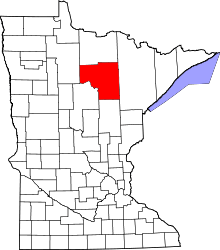 | |
| Townships |
| |
| Unorganized territories | ||
| CDPs | ||
| Unincorporated communities | ||
| Indian reservations | ||
| Footnotes | ‡This populated place also has portions in an adjacent county or counties | |
Coordinates: 47°19′59″N 93°47′34″W / 47.33306°N 93.79278°W