Delaplaine, Arkansas
| Delaplaine, Arkansas | |
|---|---|
| Town | |
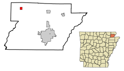 Location in Greene County in the state of Arkansas | |
| Coordinates: 36°13′58″N 90°43′33″W / 36.23278°N 90.72583°WCoordinates: 36°13′58″N 90°43′33″W / 36.23278°N 90.72583°W | |
| Country | United States |
| State | Arkansas |
| County | Greene |
| Area | |
| • Total | 1.1 sq mi (2.9 km2) |
| • Land | 1.1 sq mi (2.9 km2) |
| • Water | 0 sq mi (0 km2) |
| Elevation | 276 ft (84 m) |
| Population (2010) | |
| • Total | 116 |
| • Density | 105/sq mi (40.4/km2) |
| Time zone | Central (CST) (UTC-6) |
| • Summer (DST) | CDT (UTC-5) |
| ZIP code | 72425 |
| Area code(s) | 870 |
| FIPS code | 05-18010 |
| GNIS feature ID | 0076777 |
Delaplaine is a town in Greene County, Arkansas, United States. The population was 116 at the 2010 census. [1]
History
Delaplaine was incorporated as a town in April 1912 but has a history that dates back to the time of the French explorations. Early settlers found remains of a French-Indian trading post at the site. When the St. Louis-Iron Mountain Railroad pushed lines into northern Arkansas in 1873 a station was established called Grey's Station. The name was later changed to the French "De La Plaine" (of the plain) in recognition of the earlier French trading post. The rail line provided the entire county with passenger and freight services, especially for the local timber industry. The county's first newspaper was published at Delaplaine in 1873 by James W. Wray.
Noteworthy natives
- Jimmie Lou Fisher, former Arkansas State Treasurer and 2002 Democratic nominee for Governor
Geography
Delaplaine is located in northwestern Greene County at 36°13′58″N 90°43′33″W / 36.23278°N 90.72583°W (36.232701, -90.725807).[2] Arkansas Highway 90 passes through the town, leading northeast, then east, 31 miles (50 km) to Rector, and southwest, then northwest, 21 miles (34 km) to Pocahontas. Arkansas Highway 34 leads southeast from the center of town 16 miles (26 km) to Oak Grove Heights. Paragould, the Greene County seat, is 23 miles (37 km) to the southeast via Highways 34 and 135. Highway 34 joins Highway 90 to the southwest from Delaplaine and leads 17 miles (27 km) to Walnut Ridge. Arkansas Highway 304 leads west from Delaplaine on a more direct route of 16 miles (26 km) to Pocahontas.
According to the United States Census Bureau, the town of Delaplaine has a total area of 1.1 square miles (2.9 km2), all land.[1] It is 4 miles (6 km) south of the Black River.
Demographics
| Historical population | |||
|---|---|---|---|
| Census | Pop. | %± | |
| 1920 | 152 | — | |
| 1930 | 161 | 5.9% | |
| 1940 | 180 | 11.8% | |
| 1950 | 208 | 15.6% | |
| 1960 | 186 | −10.6% | |
| 1970 | 145 | −22.0% | |
| 1980 | 161 | 11.0% | |
| 1990 | 146 | −9.3% | |
| 2000 | 127 | −13.0% | |
| 2010 | 116 | −8.7% | |
| Est. 2015 | 117 | [3] | 0.9% |
2014 Estimate[5] | |||
As of the census[6] of 2000, there were 127 people, 49 households, and 36 families residing in the town. The population density was 115.0 inhabitants per square mile (44.6/km²). There were 56 housing units at an average density of 50.7 per square mile (19.7/km²). The racial makeup of the town was 89.76% White, and 10.24% from two or more races.
There were 49 households out of which 28.6% had children under the age of 18 living with them, 49.0% were married couples living together, 14.3% had a female householder with no husband present, and 26.5% were non-families. 24.5% of all households were made up of individuals and 8.2% had someone living alone who was 65 years of age or older. The average household size was 2.59 and the average family size was 3.03.
In the town the population was spread out with 20.5% under the age of 18, 13.4% from 18 to 24, 26.0% from 25 to 44, 28.3% from 45 to 64, and 11.8% who were 65 years of age or older. The median age was 36 years. For every 100 females there were 111.7 males. For every 100 females age 18 and over, there were 102.0 males.
The median income for a household in the town was $31,000, and the median income for a family was $27,500. Males had a median income of $27,083 versus $15,625 for females. The per capita income for the town was $13,076. There were no families and 0.8% of the population living below the poverty line, including no under eighteens and none of those over 64.
Education
Delaplaine was for many years home of the Delaplaine School District which included Delaplaine and rural northwest Greene County, O'Kean and rural southeast Randolph County, and the town of Peach Orchard in Clay County. In 2003, the Arkansas Legislature passed Act 60 supported by then-Governor Mike Huckabee, that required every school district in the state that had a daily enrollment of less than 350 students to be consolidated with another school district. In 2004 the Delaplaine School District was consolidated with Greene County Tech School District in Paragould, Arkansas. Delaplaine High School and Delaplaine Elementary School were closed in 2007 by Greene County Tech. All of the former Delaplaine School District is now part of the Greene County Technical School District.
References
- 1 2 "Geographic Identifiers: 2010 Demographic Profile Data (G001): Delaplaine town, Arkansas". American Factfinder. U.S. Census Bureau. Retrieved November 15, 2016.
- ↑ "US Gazetteer files: 2010, 2000, and 1990". United States Census Bureau. 2011-02-12. Retrieved 2011-04-23.
- ↑ "Annual Estimates of the Resident Population for Incorporated Places: April 1, 2010 to July 1, 2015". Retrieved July 2, 2016.
- ↑ "Census of Population and Housing". Census.gov. Retrieved June 4, 2015.
- ↑ "Annual Estimates of the Resident Population for Incorporated Places: April 1, 2010 to July 1, 2014". Retrieved June 4, 2015.
- ↑ "American FactFinder". United States Census Bureau. Retrieved 2008-01-31.
Municipalities and communities of Greene County, Arkansas, United States | ||
|---|---|---|
| Cities | 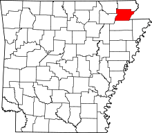 | |
| Towns | ||
| Unincorporated communities | ||