Marmaduke, Arkansas
| Marmaduke, Arkansas | |
|---|---|
| City | |
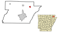 Location in Greene County and the state of Arkansas | |
| Coordinates: 36°11′22″N 90°23′8″W / 36.18944°N 90.38556°WCoordinates: 36°11′22″N 90°23′8″W / 36.18944°N 90.38556°W | |
| Country | United States |
| State | Arkansas |
| County | Greene |
| Area | |
| • Total | 1.3 sq mi (3.4 km2) |
| • Land | 1.3 sq mi (3.4 km2) |
| • Water | 0 sq mi (0 km2) |
| Elevation | 279 ft (85 m) |
| Population (2010) | |
| • Total | 1,111 |
| • Density | 852/sq mi (328.8/km2) |
| Time zone | Central (CST) (UTC-6) |
| • Summer (DST) | CDT (UTC-5) |
| ZIP codes | 72436, 72443 |
| Area code(s) | 870 |
| FIPS code | 05-44240 |
| GNIS feature ID | 0058126 |
| Website |
www |
Marmaduke is a city in Greene County, Arkansas, United States. The population was 1,111 at the 2010 census.[1]
History
The town of Marmaduke was named for Confederate Major General John Sappington Marmaduke, who later served as governor of Missouri. Marmaduke was said to have established a camp for his soldiers near the site of the present town. The Texas and St. Louis Railroad was built through the area in 1882.
Marmaduke was incorporated on August 2, 1909, and had expanded to a fair-sized town by 1914 with two drugstores, three banks, three restaurants, a Methodist and Baptist church, two barber shops, a hotel, a boarding house, and two dime stores. The primary employers at the time were a sawmill, a lumber mill, a stave mill, and large and cut timber distributors.
Current industry includes the Anchor plastics company and the American Railcar Company.
The community was severely damaged by a severe tornado on April 2, 2006. At least half of the town was reported to have been destroyed or even flattened, and nearly every structure received some degree of damage. No one was killed in Marmaduke, but at least 50 people were injured, some seriously. In 2009 a major ice storm came across the northern part of Arkansas, causing the village to lose electricity for a few weeks as well as other regions. Since then the town has almost fully recovered.
Geography
Marmaduke is located in northeastern Greene County at 36°11′22″N 90°23′8″W / 36.18944°N 90.38556°W (36.189365, -90.385661).[2] U.S. Route 49 passes through the center of town, leading northeast 20 miles (32 km) to Piggott and southwest 11 miles (18 km) to Paragould, the Greene County seat. Arkansas Highway 34 crosses US 49 in the center of town; it leads east 5 miles (8 km) to Arkansas Highway 139 at Fritz and west 8 miles (13 km) to Lafe.
According to the United States Census Bureau, the city has a total area of 1.3 square miles (3.4 km2), all of it land.[1] Marmaduke is in the northern part of the Arkansas Delta physical region and sits just east of Crowley's Ridge. The Missouri state line, following the St. Francis River, is 9 miles (14 km) to the east.
Demographics
| Historical population | |||
|---|---|---|---|
| Census | Pop. | %± | |
| 1910 | 780 | — | |
| 1920 | 861 | 10.4% | |
| 1930 | 894 | 3.8% | |
| 1940 | 677 | −24.3% | |
| 1950 | 643 | −5.0% | |
| 1960 | 657 | 2.2% | |
| 1970 | 821 | 25.0% | |
| 1980 | 1,168 | 42.3% | |
| 1990 | 1,164 | −0.3% | |
| 2000 | 1,158 | −0.5% | |
| 2010 | 1,111 | −4.1% | |
| Est. 2015 | 1,216 | [3] | 9.5% |
As of the census[5] of 2000, there were 1,158 people, 487 households, and 323 families residing in the city. The population density was 871.6 people per square mile (336.2/km²). There were 528 housing units at an average density of 397.4 per square mile (153.3/km²). The racial makeup of the city was 96.80% White, 0.43% Native American, 0.09% Asian, 0.52% from other races, and 2.16% from two or more races. 0.78% of the population were Hispanic or Latino of any race.
There were 487 households out of which 32.4% had children under the age of 18 living with them, 53.2% were married couples living together, 10.5% had a female householder with no husband present, and 33.5% were non-families. 30.0% of all households were made up of individuals and 16.4% had someone living alone who was 65 years of age or older. The average household size was 2.34 and the average family size was 2.93.
In the city the population was spread out with 25.2% under the age of 18, 7.7% from 18 to 24, 28.1% from 25 to 44, 22.5% from 45 to 64, and 16.6% who were 65 years of age or older. The median age was 36 years. For every 100 females there were 85.6 males. For every 100 females age 18 and over, there were 84.3 males.
The median income for a household in the city was $23,300, and the median income for a family was $31,016. Males had a median income of $23,375 versus $19,432 for females. The per capita income for the city was $11,506. About 18.1% of families and 20.4% of the population were below the poverty line, including 24.8% of those under age 18 and 19.7% of those age 65 or over.
Education
Public education for elementary and secondary schools is provided by the Marmaduke School District, which leads to graduation from Marmaduke High School.
References
- 1 2 "Geographic Identifiers: 2010 Demographic Profile Data (G001): Marmaduke city, Arkansas". U.S. Census Bureau, American Factfinder. Retrieved November 14, 2016.
- ↑ "US Gazetteer files: 2010, 2000, and 1990". United States Census Bureau. 2011-02-12. Retrieved 2011-04-23.
- ↑ "Annual Estimates of the Resident Population for Incorporated Places: April 1, 2010 to July 1, 2015". Retrieved July 2, 2016.
- ↑ "Census of Population and Housing". Census.gov. Retrieved June 4, 2015.
- ↑ "American FactFinder". United States Census Bureau. Retrieved 2008-01-31.
External links
Municipalities and communities of Greene County, Arkansas, United States | ||
|---|---|---|
| Cities | 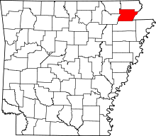 | |
| Towns | ||
| Unincorporated communities | ||